The B76 0 postcode sector stands on the Warwickshire and West Midlands border.
Did you know? According to the 2021 Census, the B76 0 postcode sector is home to a bustling 376 residents!
Given that each sector allows for 400 unique postcode combinations. Letters C, I, K, M, O and V are not allowed in the last two letters of a postcode. With 30 postcodes already in use, this leaves 370 units available.
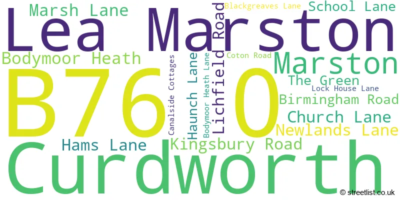
The largest settlement in the B76 0 postal code is Lea Marston followed by Marston, and Curdworth.
The B76 0 Postcode shares a border with B46 1 (Coleshill, Water Orton), B46 2 (Coleshill, Furnace End), B76 9 (Minworth, Curdworth, Wishaw) and B78 2 (Kingsbury, Middleton, Piccadilly).
The sector is within the post town of SUTTON COLDFIELD.
B76 0 is a postcode sector within the B7 postcode district which is within the B Birmingham postcode area.
The Royal Mail delivery office for the B76 0 postal sector is the unknown.
The area of the B76 0 postcode sector is 3.80 square miles which is 9.83 square kilometres or 2,429.33 square acres.
The B76 0 postcode sector is crossed by the M42 motorway.
The B76 0 postcode sector is crossed by the A446 Major A road.
The B76 0 postcode sector is crossed by the M6 motorway.
Waterways within the B76 0 postcode sector include the River Tame, Birmingham and Fazeley Canal.

Map of the B76 0 Postcode Sector
Explore the B76 0 postcode sector by using our free interactive map.
| B | 7 | 6 | - | 0 | X | X |
| B | 7 | 6 | Space | 0 | Letter | Letter |
Official List of Streets
Lea Marston (7 Streets)
Bodymoor Heath (2 Streets)
Marston (2 Streets)
Unofficial Streets or Alternative Spellings
Coleshill
BIRMINGHAM ROAD COTON ROAD FARADAY AVENUE HAMS LANE LICHFIELD ROAD BODYMOOR HEATH ROAD COTON LANE CURDWORTH BRIDGE DUNTON ISLAND HAMS HALL ROUNDABOUT HEMLINGFORD BRIDGE HOLLANDS CROFT LANE MARSTON LANE MEADOW WALK OLD BODYMOOR HEATH LANE OLD KINGSBURY ROAD OLD KINGSBURY ROAD (CLOSED) SEENEY LANE WOODLAND WALKWishaw
CUTTLE MILL LANECurdworth
COLESHILL ROADCastle Vale
KINGSBURY ROAD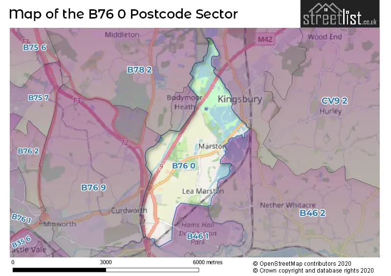
House Prices in the B76 0 Postcode Sector
| Type of Property | 2018 Average | 2018 Sales | 2017 Average | 2017 Sales | 2016 Average | 2016 Sales | 2015 Average | 2015 Sales |
|---|---|---|---|---|---|---|---|---|
| Detached | £460,000 | 3 | £444,400 | 5 | £0 | 0 | £375,500 | 5 |
| Semi-Detached | £383,370 | 1 | £0 | 0 | £570,000 | 2 | £330,000 | 1 |
| Terraced | £0 | 0 | £0 | 0 | £0 | 0 | £0 | 0 |
| Flats | £0 | 0 | £0 | 0 | £0 | 0 | £0 | 0 |
| The B76 0 Sector is within these Local Authorities |
|
|---|---|
| The B76 0 Sector is within these Counties |
|
| The B76 0 Sector is within these Water Company Areas |
|
Tourist Attractions within the B76 0 Postcode Area
We found 1 visitor attractions within the B7 postcode area
| Kingsbury Water Park & Nature Reserve |
|---|
| Country Parks |
| Country Park |
| View Kingsbury Water Park & Nature Reserve on Google Maps |