This section of the site is all about the B Postcode area, also known as the Birmingham Postal Area. Explore links to the next level to learn more about specific postcode districts such as B1.
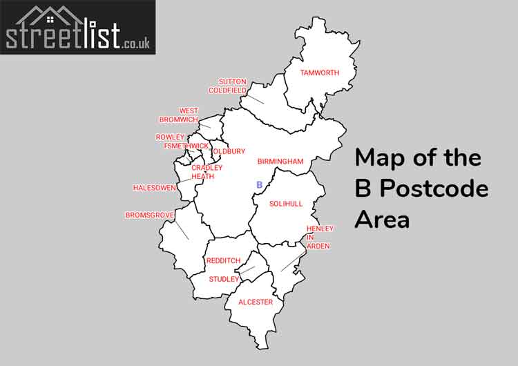
Map of the B Postcode for Birmingham
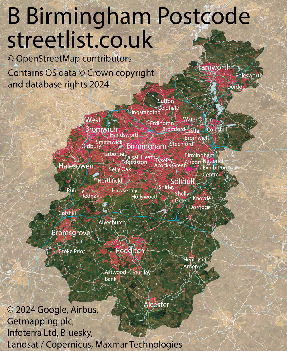

The B postcode area represents a group of postal districts in the Birmingham area of the United Kingdom. The area code B stands for the letters b in Birmingham. B has a population of 1,904,658 and covers an area of 1,299,128 hectares. Fun fact: 2.93% of the population of Great Britain lives in this area.
The postcode area falls within the following counties: West Midlands (81.34%), Worcestershire (9.26%), Warwickshire (5.09%), Staffordshire (4.30%), Leicestershire (0.00%).
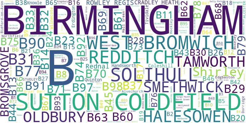
Post Towns and Postcode Districts for the B Postcode
-
B1 West MidlandsB2 West MidlandsB3 West MidlandsB4 West MidlandsB5 West MidlandsB6 West MidlandsB7 West MidlandsB8 West MidlandsB9 West MidlandsB10 West MidlandsB11 West MidlandsB12 West MidlandsB13 West MidlandsB14 West MidlandsB15 West MidlandsB16 West MidlandsB17 West MidlandsB18 West MidlandsB19 West MidlandsB20 West MidlandsB21 West MidlandsB23 West MidlandsB24 West MidlandsB25 West MidlandsB26 West MidlandsB27 West MidlandsB28 West MidlandsB29 West MidlandsB30 West MidlandsB31 West MidlandsB32 West Midlands (98%), Worcestershire (1%)B33 West MidlandsB34 West MidlandsB35 West MidlandsB36 West MidlandsB37 West MidlandsB38 West Midlands (89%), Worcestershire (10%)B40 West MidlandsB42 West MidlandsB43 West MidlandsB44 West MidlandsB45 West Midlands (54%), Worcestershire (45%)B46 WarwickshireB47 West Midlands (10%), Worcestershire (89%)B48 West Midlands (7%), Worcestershire (91%)B99
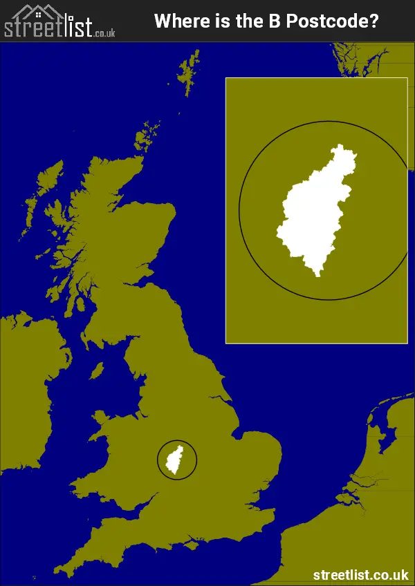
Where is the B Postcode Area?
The Birmingham B Postcode is in the West Midlands region of England. The postal area borders the following neighbouring postal areas: DE - Derby, CV - Coventry, WR - Worcester, WS - Walsall and DY - Dudley, and is located inland.
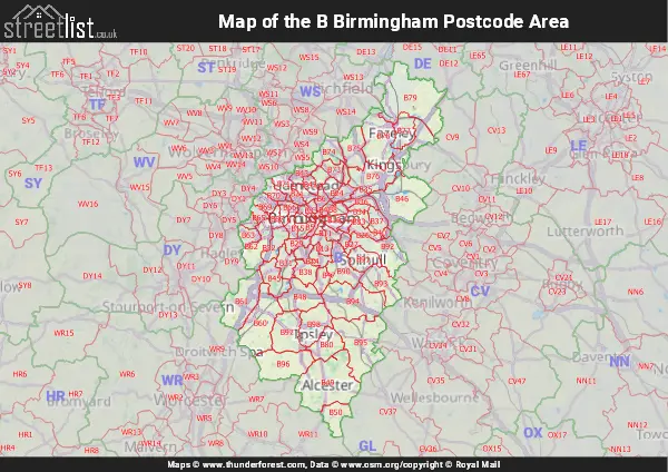
Map of the B Birmingham Postcode Area
Explore the B Birmingham postcode area by using our interactive map.
Postcode Districts within the B Birmingham Postcode Area
There are 77 postcode districts within the Birmingham postcode area
A map showing the boundary of in relation to other areas
There are 20 towns within the Birmingham postcode area.
| Unit | Area² |
|---|---|
| Hectares | 1,299,128² |
| Miles | 5,016² |
| Feet | 139,836,838,792² |
| Kilometres | 12,991² |
Postal Delivery Offices serving the B Birmingham Postcode Area
- Alcester Delivery Office
- Aston Delivery Office
- Birmingham Central Delivery Office
- Bromsgrove Delivery Office
- Camp Hill Delivery Office
- Castle Bromwich Delivery Office
- Chelmsley Wood Delivery Office
- Coleshill Delivery Office
- Coombs Wood Delivery Office
- Dor Delivery Office N Scale Payment Delivery Office
- Eastern (b) Delivery Office
- Erdington Delivery Office
- Great Barr Delivery Office
- Hall Green Delivery Office
- Handsworth Delivery Office
- Henley-in-arden Delivery Office
- Hockley Delivery Office (b)
- Kings Norton Delivery Office
- Kitts Green Delivery Office
- Knowle Delivery Office
- Moseley Delivery Office
- Northfield Delivery Office
- Oldbury Delivery Office
- Polesworth Scale Payment Delivery Office
- Quinton Delivery Office
- Redditch Delivery Office
- Redfern Park Delivery Office
- Rednal Delivery Office
- Selly Oak Delivery Office
- Shirley (b) Delivery Office
- Smethwick Delivery Office
- Solihull Delivery Office
- Sutton Coldfield Postal Delivery Office
- Tamworth Delivery Office
- West Bromwich Delivery Office
- Western (b) Delivery Office
Councils with Postcodes in B
Towns and Villages within the B Birmingham Postcode Area
- Alcester - town
- Alne End - village
- Alvechurch - village
- Alvecote - village
- Ardens Grafton - village
- Arrow - village
- Aspley Heath - village
- Aston Cantlow - village
- Astwood Bank - village
- Baddesley Clinton - village
- Barnt Green - village
- Barston - village
- Bassetts Pole - village
- Bateman's Green - village
- Bell Heath - village
- Bentley Heath - village
- Bickenhill - village
- Bidford-on-Avon - village
- Birchmoor - village
- Birmingham - city
- Bitterscote - village
- Blackheath - town
- Bodymoor Heath - otherSettlement
- Bordesley - village
- Bournheath - village
- Bradley Green - village
- Bradnock's Marsh - village
- Brierley Hill - town
- Bromsgrove - town
- Broom - village
- Burcot - village
- Catherine-de-Barnes - village
- Catshill - village
- Chadwick End - village
- Chessetts Wood - village
- Cheswick Green - village
- Cladswell - village
- Clifton Campville - village
- Coleshill - town
- Comberford - village
- Cookhill - village
- Copt Heath - village
- Coughton - village
- Cradley Heath - Settlement
- Curdworth - village
- Darley Green - village
- Dayhouse Bank - village
- Dickens Heath - village
- Dodford - village
- Dordon - village
- Dorridge - village
- Drayton Bassett - village
- Dudley - town
- Dunnington - village
- Earlswood - village
- Eastcote - village
- Edingale - village
- Elford - village
- Fazeley - town
- Feckenham - village
- Forhill - village
- Furnace End - village
- Great Alne - village
- Grendon - village
- Halesowen - town
- Ham Green - otherSettlement
- Hampton in Arden - village
- Hanbury - village
- Hardwick - village
- Harlaston - village
- Haselor - village
- Haunton - village
- Headley Heath - village
- Henley-in-Arden - town
- Heronfield - otherSettlement
- Hints - village
- Hockley Heath - village
- Hoggrill's End - village
- Holberrow Green - village
- Hollywood - village
- Holt End - village
- Hopwas - village
- Hopwood - village
- Hunnington - village
- Illey - otherSettlement
- Illshaw Heath - village
- Inkford - village
- Kendal End - village
- Kings Coughton - village
- Kingsbury - village
- Kingswood - village
- Knowle - village
- Lapworth - village
- Lea Marston - village
- Lickey - village
- Lickey End - village
- Linthurst - village
- Little Aston - village
- Lower Bentley - otherSettlement
- Lower Marlbrook - village
- Lowsonford - village
- Lydiate Ash - village
- Major's Green - village
- Mappleborough Green - village
- Marlcliff - village
- Marston - village
- Middleton - village
- Middletown - village
- Nether Whitacre - village
- New End - village
- Newton Regis - village
- No Man's Heath - village
- Old Hill - village
- Oldbury - town
- Oldwich Lane - otherSettlement
- Over Green - village
- Over Whitacre - village
- Oversley Green - village
- Packwood - village
- Pheasey - village
- Piccadilly - village
- Polesworth - village
- Portway - village
- Preston Green - otherSettlement
- Redditch - town
- Romsley - village
- Rowley Regis - town
- Rowney Green - village
- Royal Sutton Coldfield - town
- Rumbush - village
- Sambourne - village
- Shustoke - village
- Shuttington - village
- Smethwick - town
- Solihull - town
- Stock Green - village
- Stoke Pound - village
- Stoke Prior - village
- Stourbridge - town
- Streetly - Settlement
- Studley - village
- Tamworth - town
- Tanworth-in-Arden - village
- Tardebigge - village
- Temple Grafton - village
- Terry's Green - village
- Thorpe Constantine - otherSettlement
- Tidbury Green - village
- Tipton - town
- Tutnall - village
- Ullenhall - village
- Upper Bentley - village
- Upper Marlbrook - village
- Upton Warren - village
- Walsall - town
- Warton - village
- Water Orton - village
- Weatheroak Hill - village
- West Bromwich - town
- Whitacre Heath - village
- Whitlock's End - village
- Wigginton - village
- Wildmoor - village
- Wixford - village
- Wood End - village
- Woodcote Green - otherSettlement
- Woodgate - otherSettlement
- Wootton Wawen - village
- Wythall - village