The B96 postcode district is a postal district located in the B Birmingham postcode area with a population of 5,290 residents according to the 2021 England and Wales Census.
The area of the B96 postcode district is 16.74 square miles which is 43.34 square kilometres or 10,710.54 acres.
Currently, the B96 district has about 211 postcode units spread across 1 geographic postcode sectors.
Given that each sector allows for 400 unique postcode combinations, the district has a capacity of 400 postcodes. With 211 postcodes already in use, this leaves 189 units available.
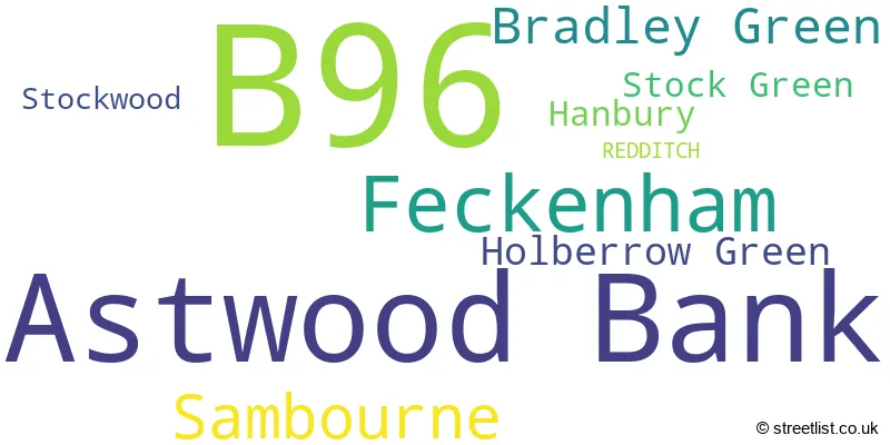
The largest settlement in the B96 postal code is Astwood Bank followed by Feckenham, and Sambourne.
The B96 Postcode shares a border with WR7 (Inkberrow, Crowle, Upton Snodsbury), B49 (ALCESTER, Great Alne, Cookhill), B60 (BROMSGROVE, Stoke Prior, Marlbrook) and B97 (REDDITCH, Callow Hill, Kingfisher Shopping Centre).
The primary settlement in the B96 postcode district is Redditch, located in the county of Worcestershire, England. The most significant postal town is Redditch. Other significant settlements within the district include Astwood Bank, Bradley Green, Feckenham, Hanbury, Holberrow Green, Sambourne, Stock Green, and Stockwood.
For the district B96, we have data on 1 postcode sectors. Here's a breakdown: The sector B96 6, covers Astwood Bank and Feckenham in Worcestershire.
B96 Postcode Sectors

Map of the B96 Postcode District
Explore the B96 postcode district by using our free interactive map.

When it comes to local government, postal geography often disregards political borders. However, for a breakdown in the B96 District: the district mostly encompasses the Redditch District (B) (118 postcodes), followed by the Wychavon District area (75 postcodes), and finally, the Stratford-on-Avon District area (19 postcodes).
Weather Forecast for B96
Press Button to Show Forecast for Redditch
| Time Period | Icon | Description | Temperature | Rain Probability | Wind |
|---|---|---|---|---|---|
| 21:00 to 00:00 | Light rain | 7.0°C (feels like 3.0°C) | 79.00% | NE 13 mph |
Press Button to Show Forecast for Redditch
| Time Period | Icon | Description | Temperature | Rain Probability | Wind |
|---|---|---|---|---|---|
| 00:00 to 03:00 | Heavy rain | 6.0°C (feels like 2.0°C) | 84.00% | NNE 13 mph | |
| 03:00 to 06:00 | Heavy rain | 6.0°C (feels like 1.0°C) | 93.00% | N 16 mph | |
| 06:00 to 09:00 | Heavy rain | 4.0°C (feels like 0.0°C) | 92.00% | NNW 16 mph | |
| 09:00 to 12:00 | Heavy rain | 4.0°C (feels like 0.0°C) | 85.00% | NW 13 mph | |
| 12:00 to 15:00 | Heavy rain | 6.0°C (feels like 3.0°C) | 79.00% | WNW 11 mph | |
| 15:00 to 18:00 | Cloudy | 9.0°C (feels like 7.0°C) | 16.00% | W 9 mph | |
| 18:00 to 21:00 | Partly cloudy (day) | 10.0°C (feels like 7.0°C) | 8.00% | WSW 9 mph | |
| 21:00 to 00:00 | Clear night | 6.0°C (feels like 4.0°C) | 0.00% | SW 7 mph |
Press Button to Show Forecast for Redditch
| Time Period | Icon | Description | Temperature | Rain Probability | Wind |
|---|---|---|---|---|---|
| 00:00 to 03:00 | Clear night | 4.0°C (feels like 2.0°C) | 0.00% | SSW 7 mph | |
| 03:00 to 06:00 | Clear night | 4.0°C (feels like 1.0°C) | 0.00% | SSW 7 mph | |
| 06:00 to 09:00 | Sunny day | 5.0°C (feels like 3.0°C) | 1.00% | S 9 mph | |
| 09:00 to 12:00 | Partly cloudy (day) | 11.0°C (feels like 8.0°C) | 2.00% | S 13 mph | |
| 12:00 to 15:00 | Cloudy | 13.0°C (feels like 10.0°C) | 7.00% | S 16 mph | |
| 15:00 to 18:00 | Cloudy | 13.0°C (feels like 10.0°C) | 8.00% | S 16 mph | |
| 18:00 to 21:00 | Partly cloudy (day) | 12.0°C (feels like 9.0°C) | 3.00% | S 13 mph | |
| 21:00 to 00:00 | Clear night | 9.0°C (feels like 7.0°C) | 1.00% | SSE 11 mph |
Press Button to Show Forecast for Redditch
| Time Period | Icon | Description | Temperature | Rain Probability | Wind |
|---|---|---|---|---|---|
| 00:00 to 03:00 | Partly cloudy (night) | 8.0°C (feels like 5.0°C) | 2.00% | SE 11 mph | |
| 03:00 to 06:00 | Clear night | 7.0°C (feels like 4.0°C) | 2.00% | SE 11 mph | |
| 06:00 to 09:00 | Sunny day | 8.0°C (feels like 5.0°C) | 2.00% | SE 9 mph | |
| 09:00 to 12:00 | Partly cloudy (day) | 12.0°C (feels like 10.0°C) | 2.00% | SE 11 mph | |
| 12:00 to 15:00 | Cloudy | 15.0°C (feels like 12.0°C) | 7.00% | SE 13 mph | |
| 15:00 to 18:00 | Partly cloudy (day) | 15.0°C (feels like 13.0°C) | 5.00% | SE 13 mph | |
| 18:00 to 21:00 | Partly cloudy (day) | 14.0°C (feels like 13.0°C) | 6.00% | SE 9 mph | |
| 21:00 to 00:00 | Cloudy | 11.0°C (feels like 9.0°C) | 7.00% | ESE 7 mph |
Press Button to Show Forecast for Redditch
| Time Period | Icon | Description | Temperature | Rain Probability | Wind |
|---|---|---|---|---|---|
| 00:00 to 03:00 | Cloudy | 10.0°C (feels like 8.0°C) | 8.00% | ESE 7 mph | |
| 03:00 to 06:00 | Cloudy | 9.0°C (feels like 8.0°C) | 13.00% | E 4 mph | |
| 06:00 to 09:00 | Cloudy | 10.0°C (feels like 8.0°C) | 14.00% | E 7 mph | |
| 09:00 to 12:00 | Cloudy | 13.0°C (feels like 12.0°C) | 13.00% | E 7 mph | |
| 12:00 to 15:00 | Partly cloudy (day) | 15.0°C (feels like 14.0°C) | 15.00% | E 7 mph | |
| 15:00 to 18:00 | Cloudy | 16.0°C (feels like 15.0°C) | 18.00% | E 7 mph | |
| 18:00 to 21:00 | Light rain shower (day) | 15.0°C (feels like 14.0°C) | 35.00% | ENE 7 mph | |
| 21:00 to 00:00 | Cloudy | 12.0°C (feels like 11.0°C) | 14.00% | NNE 7 mph |
Where is the B96 Postcode District?
The postcode district B96 is located in the town of Redditch. Redditch is surrounded by several nearby towns, including Studley to the North East (4.45 miles), Alcester to the South East (4.47 miles), Bromsgrove to the North (6.66 miles), Droitwich to the West (7.29 miles), Pershore to the South West (10.42 miles), Evesham to the South (10.87 miles), and Stourport-on-Severn to the North West (13.29 miles). Additionally, Redditch is approximately 94.39 miles away from the center of London.
The district is within the post town of REDDITCH.
The sector has postcodes within the nation of England.
The B96 Postcode District is covers the following regions.
- Worcestershire - Herefordshire, Worcestershire and Warwickshire - West Midlands (England)
- Warwickshire - Herefordshire, Worcestershire and Warwickshire - West Midlands (England)
Postcode Sectors within the B96 District
| Postcode Sector | Delivery Office |
|---|---|
| B96 6 | Redditch Delivery Office |
| B | 9 | 6 | - | X | X | X |
| B | 9 | 6 | Space | Numeric | Letter | Letter |
Current Monthly Rental Prices
| # Bedrooms | Min Price | Max Price | Avg Price |
|---|---|---|---|
| 1 | £600 | £600 | £600 |
| 2 | £915 | £915 | £915 |
| 3 | £1,200 | £1,300 | £1,250 |
Current House Prices
| # Bedrooms | Min Price | Max Price | Avg Price |
|---|---|---|---|
| 2 | £450,000 | £525,000 | £487,500 |
| 3 | £425,000 | £1,500,000 | £691,500 |
| 4 | £429,950 | £699,995 | £571,421 |
| 5 | £495,000 | £1,200,000 | £838,750 |
| 7 | £975,000 | £975,000 | £975,000 |
| 10 | £2,250,000 | £2,250,000 | £2,250,000 |
Estate Agents who Operate in the B96 District
| Logo | Name | Brand Name | Address | Contact Number | Total Properties |
|---|---|---|---|---|---|
 | Redditch | Arden Estates | 373 Evesham Road, Redditch, B97 5JA | 01527 540654 | 15 |
 | Alcester | Jeremy McGinn & Co | 49 High Street, Alcester, B49 5AF | 01789 339445 | 6 |
 | Redditch | A P Morgan | Estate House, 12 Church Green East, Redditch, B98 8BP | 01527 913195 | 4 |
 | Worcester | Fisher German | Global House Hindlip Lane Worcester WR3 8SB | 03300 581934 | 3 |
 | Birmingham | Fine & Country | 83-85 Hagley Road, Birmingham, B16 8QG | 0121 387 6323 | 2 |
| Type of Property | 2018 Average | 2018 Sales | 2017 Average | 2017 Sales | 2016 Average | 2016 Sales | 2015 Average | 2015 Sales |
|---|---|---|---|---|---|---|---|---|
| Detached | £440,659 | 44 | £460,959 | 51 | £429,580 | 54 | £416,835 | 51 |
| Semi-Detached | £297,698 | 20 | £269,229 | 24 | £217,462 | 21 | £236,443 | 27 |
| Terraced | £246,309 | 16 | £203,813 | 16 | £229,379 | 17 | £220,010 | 15 |
| Flats | £133,150 | 10 | £113,500 | 11 | £109,877 | 11 | £107,169 | 12 |