This section of the site is all about the WR Postcode area, also known as the Worcester Postal Area. Explore links to the next level to learn more about specific postcode districts such as WR1.
The WR postcode area represents a group of postal districts in the Worcester area of the United Kingdom. The area code WR stands for the letters w and r in WoRcester. WR has a population of 287,414 and covers an area of 1,265,890 hectares. Fun fact: 0.44% of the population of Great Britain lives in this area.
The postcode area falls within the following counties: Worcestershire (95.05%), Herefordshire (3.21%), Gloucestershire (0.76%), Shropshire (0.60%), Warwickshire (0.38%).
Post Towns and Postcode Districts for the WR Postcode
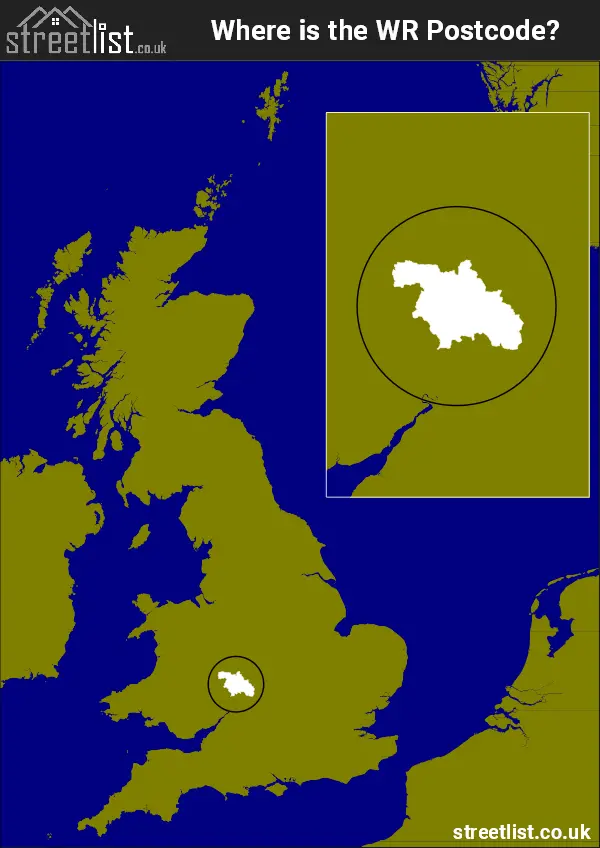
Where is the WR Postcode Area?
The Worcester WR Postcode is in the West Midlands region of England. The postal area borders the following neighbouring postal areas: CV - Coventry, SY - Shrewsbury, B - Birmingham, GL - Gloucester, DY - Dudley and HR - Hereford, and is located inland.
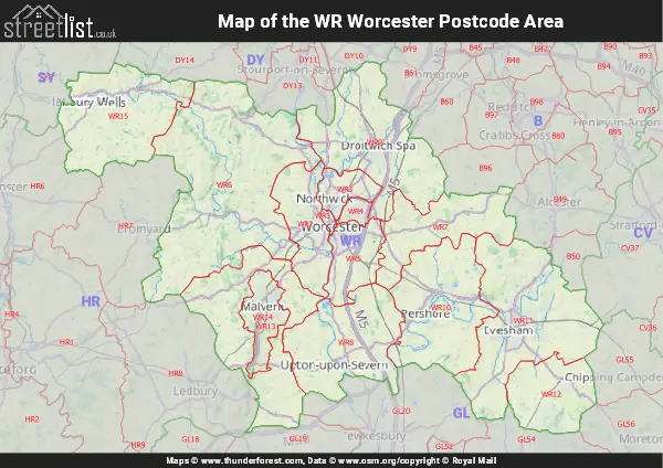
Map of the WR Worcester Postcode Area
Explore the WR Worcester postcode area by using our interactive map.
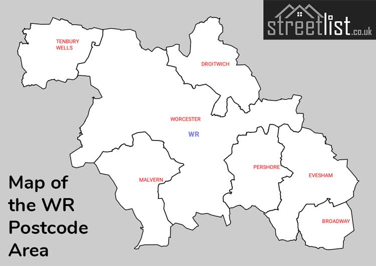
Postcode Districts within the WR Worcester Postcode Area
There are 15 postcode districts within the Worcester postcode area
A map showing the boundary of in relation to other areas
There are 5 towns within the Worcester postcode area.
| Unit | Area² |
|---|---|
| Hectares | 1,265,890² |
| Miles | 4,888² |
| Feet | 136,259,133,710² |
| Kilometres | 12,659² |
Postal Delivery Offices serving the WR Worcester Postcode Area
- Abberley Scale Payment Delivery Office
- Alfrick Scale Payment Delivery Office
- Bishampton Scale Payment Delivery Office
- Bishops Frome Scale Payment Delivery Office
- Bringsty Scale Payment Delivery Office
- Broadwas Scale Payment Delivery Office
- Callow End Scale Payment Delivery Office
- Clifton-on-teme Scale Payment Delivery Office
- Droitwich Delivery Office
- Eckington Scale Payment Delivery Office
- Evesham Delivery Office
- Flyford Flavel Scale Payment Delivery Office
- Great Witley Scale Payment Delivery Office
- Hanley Castle Scale Payment Delivery Office
- Holt Heath Scale Payment Delivery Office
- Inkberrow Scale Payment Delivery Office
- Lower Moor Scale Payment Delivery Office
- Malvern Delivery Office
- Pershore Delivery Office
- Suckley Scale Payment Delivery Office
- Tenbury Wells Scale Payment Delivery Office
- Upton-upon-severn Scale Payment Delivery Office
- Worcester Apc
- Worcester City Delivery Office
Councils with Postcodes in WR
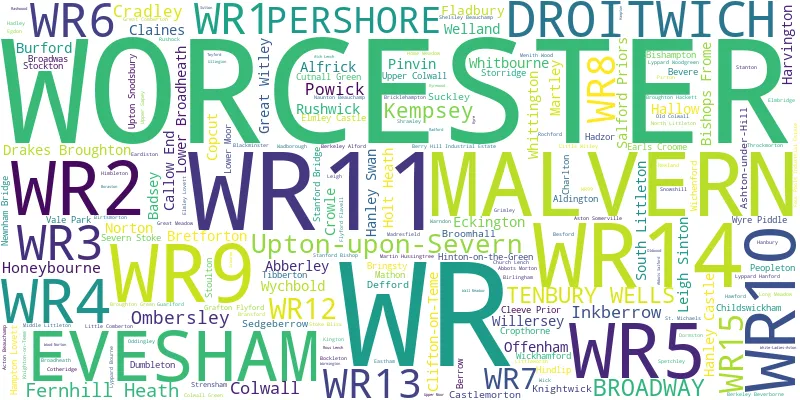
Towns and Villages within the WR Worcester Postcode Area
- Abberley - village
- Aldington - village
- Alfrick - village
- Ashton under Hill - village
- Aston Somerville - village
- Badsey - village
- Baughton - village
- Besford - village
- Birlingham - village
- Birts Street - village
- Bishampton - village
- Bishops Frome - village
- Blackminster - village
- Bransford - village
- Bricklehampton - village
- Broad Heath - village
- Broadwas - village
- Broadway - village
- Brockamin - village
- Broughton Hackett - village
- Burford - village
- Callow End - village
- Castlemorton - village
- Charlton - village
- Childswickham - village
- Church Lench - village
- Claines - village
- Cleeve Prior - village
- Clifton upon Teme - village
- Collett's Green - village
- Colwall Stone - village
- Cotheridge - village
- Cradley - village
- Cropthorne - village
- Crowle - village
- Crowle Green - village
- Cutnall Green - village
- Defford - village
- Drakes Broughton - village
- Droitwich Spa - town
- Dumbleton - village
- Eardiston - village
- Earl's Croome - village
- Eckington - village
- Elmley Castle - village
- Evesham - town
- Fernhill Heath - village
- Fladbury - village
- Flyford Flavell - village
- Frith Common - village
- Grafton Flyford - village
- Great Comberton - village
- Great Malvern - town
- Great Witley - village
- Guarlford - village
- Hadzor - village
- Hallow - village
- Hampton Lovett - village
- Hanley Castle - village
- Hanley Swan - village
- Hartlebury - village
- Harvington - village
- Hatfield - village
- Hill Side - village
- Himbleton - village
- Hindlip - village
- Hinton on the Green - village
- Holt Fleet - village
- Holt Heath - village
- Honeybourne - village
- Hook Bank - village
- Inkberrow - village
- Kempsey - village
- Kington - village
- Knightwick - village
- Ladywood - village
- Leigh Sinton - village
- Little Comberton - village
- Little Witley - village
- Littleworth - village
- Longley Green - village
- Lower Broadheath - village
- Lower Moor - village
- Madresfield - village
- Malvern Wells - village
- Martin Hussingtree - village
- Martley - village
- Meadow Green - village
- Menithwood - village
- Middle Littleton - village
- Naunton Beauchamp - village
- Newland - village
- Newnham Bridge - village
- North Littleton - village
- North Piddle - otherSettlement
- Norton - village
- Norton - village
- Noutard's Green - village
- Offenham - village
- Oldfield - village
- Oldwood - village
- Ombersley - village
- Pensax - village
- Peopleton - village
- Pershore - town
- Pinvin - village
- Powick - village
- Radford - village
- Rashwood - otherSettlement
- Ravenhills Green - village
- Rous Lench - village
- Rushwick - village
- Ryall - village
- Salford Priors - village
- Sedgeberrow - village
- Severn Stoke - village
- Shelsley Beauchamp - village
- Shrawley - village
- Sinton Green - village
- Sneachill - village
- Snowshill - village
- South Littleton - village
- Spetchley - otherSettlement
- St Michaels - village
- Stanton - village
- Stockton on Teme - village
- Storridge - village
- Stoulton - village
- Suckley - village
- Suckley Knowl - village
- Tenbury Wells - town
- The Grove - village
- Throckmorton - village
- Tibberton - village
- Uphampton - village
- Upper Rochford - village
- Upper Sapey - village
- Upper Strensham - village
- Upper Welland - village
- Upper Wick - village
- Upton Snodsbury - village
- Upton upon Severn - village
- Wadborough - village
- Welland - village
- Westfield - village
- Whitbourne - village
- White Ladies Aston - village
- Whittington - village
- Wichenford - village
- Wick - village
- Wickhamford - village
- Willersey - village
- Windmill Hill - village
- Worcester - city
- Wychbold - village
- Wyre Piddle - village