The WR13 postcode district is a postal district located in the WR Worcester postcode area with a population of 8,854 residents according to the 2021 England and Wales Census.
The area of the WR13 postcode district is 43.88 square miles which is 113.65 square kilometres or 28,084.12 acres.
Currently, the WR13 district has about 369 postcode units spread across 2 geographic postcode sectors.
Given that each sector allows for 400 unique postcode combinations, the district has a capacity of 800 postcodes. With 369 postcodes already in use, this leaves 431 units available.
The largest settlement in the WR13 postal code is Colwall followed by Cradley, and Welland.
The WR13 Postcode shares a border with WR8 (Upton-upon-Severn, Hanley Swan, Hanley Castle), HR8 (LEDBURY, Much Marcle, Bosbury), WR14 (MALVERN), WR6 (Martley, Clifton-on-Teme, Holt Heath), WR2 (WORCESTER, Hallow, Powick) and GL19 (Redmarley, Staunton, Hartpury).
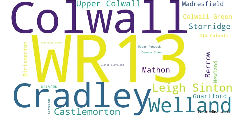
The primary settlement in the WR13 postcode district is Cradley, which is located in the county of Herefordshire. Other significant settlements in the district include Leigh Sinton, Madresfield, Mathon, Newland, Sherrards Green, Storridge, Berrow, Birtsmorton, Castlemorton, Clevelode, Colwall, Colwall Green, Coombe Green, Guarlford, Little Clevelode, Old Colwall, Upper Colwall, Upper Pendock, and Welland. The most significant Post Town in the district is Malvern.
For the district WR13, we have data on 2 postcode sectors. Here's a breakdown: The sector WR13 5, covers Cradley and Mathon in Herefordshire. The sector WR13 5, covers Leigh Sinton in Worcestershire. The sector WR13 6, covers Colwall in Herefordshire. The sector WR13 6, covers Welland and Castlemorton in Worcestershire.

Map of the WR13 Postcode District
Explore the WR13 postcode district by using our free interactive map.

When it comes to local government, postal geography often disregards political borders. However, for a breakdown in the WR13 District: the district mostly encompasses the County of Herefordshire (193 postcodes), and finally, the Malvern Hills District area (178 postcodes).
Recent House Sales in WR13
| Date | Price | Address |
|---|---|---|
| 19/09/2023 | £665,000 | Stone Drive, Colwall, Malvern, WR13 6HT |
| 31/08/2023 | £770,000 | Brockhill Road, Colwall, Malvern, WR13 6EX |
| 23/08/2023 | £795,000 | Walwyn Road, Colwall, Malvern, WR13 6QT |
| 18/08/2023 | £220,000 | Pyndar Court, Newland, Malvern, WR13 5AX |
| 18/08/2023 | £225,000 | Welland Gardens, Welland, Malvern, WR13 6LB |
| 11/08/2023 | £223,000 | Walwyn Road, Colwall, Malvern, WR13 6QG |
| 04/08/2023 | £572,500 | Kingsbrooke, Colwall, Malvern, WR13 6BB |
| 02/08/2023 | £555,000 | Limetree Gardens, Colwall, Malvern, WR13 6RL |
| 01/08/2023 | £240,000 | Drake Street, Welland, Malvern, WR13 6LP |
| 01/08/2023 | £277,500 | Pixiefields, Cradley, Malvern, WR13 5ND |
Where is the WR13 Postcode District?
The postcode district WR13 is located in the town of Malvern. It is situated in close proximity to several nearby towns. Ledbury is located to the South West of Malvern, at a distance of 6.01 miles. Worcester is situated to the North East, at a distance of 8.82 miles. Bromyard is located to the North West, at a distance of 10.24 miles. Pershore is located to the East, at a distance of 10.82 miles. Tewkesbury is situated to the South East, at a distance of 10.87 miles. Newent is located to the South, at a distance of 11.46 miles. Additionally, the postcode district WR13 is approximately 102.92 miles away from the center of London.
The district is within the post town of MALVERN.
The sector has postcodes within the nation of England.
The WR13 Postcode District is covers the following regions.
- Worcestershire - Herefordshire, Worcestershire and Warwickshire - West Midlands (England)
- Herefordshire, County of - Herefordshire, Worcestershire and Warwickshire - West Midlands (England)
- Gloucestershire - Gloucestershire, Wiltshire and Bath/Bristol area - South West (England)
Weather Forecast for WR13
Press Button to Show Forecast for Malvern Hills Youth Hostel
| Time Period | Icon | Description | Temperature | Rain Probability | Wind |
|---|---|---|---|---|---|
| 21:00 to 00:00 | Partly cloudy (night) | 15.0°C (feels like 15.0°C) | 2.00% | SW 4 mph |
Press Button to Show Forecast for Malvern Hills Youth Hostel
| Time Period | Icon | Description | Temperature | Rain Probability | Wind |
|---|---|---|---|---|---|
| 00:00 to 03:00 | Partly cloudy (night) | 13.0°C (feels like 13.0°C) | 1.00% | SSW 4 mph | |
| 03:00 to 06:00 | Partly cloudy (night) | 11.0°C (feels like 10.0°C) | 1.00% | SSW 7 mph | |
| 06:00 to 09:00 | Cloudy | 12.0°C (feels like 10.0°C) | 5.00% | S 7 mph | |
| 09:00 to 12:00 | Cloudy | 14.0°C (feels like 12.0°C) | 6.00% | S 11 mph | |
| 12:00 to 15:00 | Cloudy | 18.0°C (feels like 15.0°C) | 10.00% | SSE 13 mph | |
| 15:00 to 18:00 | Cloudy | 17.0°C (feels like 14.0°C) | 20.00% | SSE 13 mph | |
| 18:00 to 21:00 | Heavy rain | 15.0°C (feels like 13.0°C) | 81.00% | SSE 11 mph | |
| 21:00 to 00:00 | Heavy rain | 14.0°C (feels like 12.0°C) | 90.00% | SE 9 mph |
Press Button to Show Forecast for Malvern Hills Youth Hostel
| Time Period | Icon | Description | Temperature | Rain Probability | Wind |
|---|---|---|---|---|---|
| 00:00 to 03:00 | Heavy rain | 13.0°C (feels like 12.0°C) | 89.00% | SE 9 mph | |
| 03:00 to 06:00 | Light rain | 13.0°C (feels like 12.0°C) | 61.00% | SE 7 mph | |
| 06:00 to 09:00 | Heavy rain | 13.0°C (feels like 12.0°C) | 82.00% | SE 7 mph | |
| 09:00 to 12:00 | Heavy rain | 14.0°C (feels like 13.0°C) | 83.00% | SSE 7 mph | |
| 12:00 to 15:00 | Heavy rain | 15.0°C (feels like 13.0°C) | 83.00% | SSE 9 mph | |
| 15:00 to 18:00 | Light rain | 16.0°C (feels like 14.0°C) | 57.00% | SSE 11 mph | |
| 18:00 to 21:00 | Cloudy | 15.0°C (feels like 14.0°C) | 19.00% | SSE 9 mph | |
| 21:00 to 00:00 | Cloudy | 13.0°C (feels like 11.0°C) | 10.00% | SE 7 mph |
Press Button to Show Forecast for Malvern Hills Youth Hostel
| Time Period | Icon | Description | Temperature | Rain Probability | Wind |
|---|---|---|---|---|---|
| 00:00 to 03:00 | Partly cloudy (night) | 11.0°C (feels like 10.0°C) | 7.00% | ESE 7 mph | |
| 03:00 to 06:00 | Partly cloudy (night) | 11.0°C (feels like 10.0°C) | 5.00% | ESE 7 mph | |
| 06:00 to 09:00 | Partly cloudy (day) | 12.0°C (feels like 11.0°C) | 9.00% | ESE 7 mph | |
| 09:00 to 12:00 | Partly cloudy (day) | 15.0°C (feels like 13.0°C) | 15.00% | SE 9 mph | |
| 12:00 to 15:00 | Light rain shower (day) | 17.0°C (feels like 15.0°C) | 34.00% | SE 9 mph | |
| 15:00 to 18:00 | Light rain shower (day) | 17.0°C (feels like 16.0°C) | 37.00% | SE 9 mph | |
| 18:00 to 21:00 | Light rain shower (day) | 16.0°C (feels like 15.0°C) | 32.00% | SSE 7 mph | |
| 21:00 to 00:00 | Clear night | 11.0°C (feels like 10.0°C) | 2.00% | SSE 4 mph |
Press Button to Show Forecast for Malvern Hills Youth Hostel
| Time Period | Icon | Description | Temperature | Rain Probability | Wind |
|---|---|---|---|---|---|
| 00:00 to 03:00 | Clear night | 9.0°C (feels like 9.0°C) | 4.00% | SSE 4 mph | |
| 03:00 to 06:00 | Clear night | 8.0°C (feels like 7.0°C) | 3.00% | SSE 2 mph | |
| 06:00 to 09:00 | Sunny day | 11.0°C (feels like 10.0°C) | 4.00% | SSE 2 mph | |
| 09:00 to 12:00 | Partly cloudy (day) | 16.0°C (feels like 15.0°C) | 4.00% | S 4 mph | |
| 12:00 to 15:00 | Partly cloudy (day) | 18.0°C (feels like 17.0°C) | 11.00% | SSW 4 mph | |
| 15:00 to 18:00 | Partly cloudy (day) | 19.0°C (feels like 18.0°C) | 14.00% | WSW 7 mph | |
| 18:00 to 21:00 | Partly cloudy (day) | 17.0°C (feels like 17.0°C) | 10.00% | WNW 4 mph | |
| 21:00 to 00:00 | Clear night | 13.0°C (feels like 12.0°C) | 5.00% | W 4 mph |
| Postcode Sector | Delivery Office |
|---|---|
| WR13 5 | Malvern Delivery Office |
| WR13 6 | Malvern Delivery Office |
| W | R | 1 | 3 | - | X | X | X |
| W | R | 1 | 3 | Space | Numeric | Letter | Letter |
Tourist Attractions within the WR13 Postcode Area
We found 1 visitor attractions within the WR13 postcode area
| Old Court Nurseries & Picton Garden |
|---|
| Gardens |
| Garden |
| View Old Court Nurseries & Picton Garden on Google Maps |
Current Monthly Rental Prices
| # Bedrooms | Min Price | Max Price | Avg Price |
|---|---|---|---|
| 3 | £1,050 | £1,050 | £1,050 |
| 4 | £1,750 | £2,400 | £2,075 |
Current House Prices
| # Bedrooms | Min Price | Max Price | Avg Price |
|---|---|---|---|
| £125,000 | £125,000 | £125,000 | |
| 2 | £135,000 | £298,500 | £225,808 |
| 3 | £280,000 | £775,000 | £464,471 |
| 4 | £369,950 | £1,135,000 | £625,323 |
| 5 | £380,000 | £895,000 | £647,000 |
| 6 | £900,000 | £2,500,000 | £1,408,750 |
| 8 | £3,500,000 | £3,500,000 | £3,500,000 |
Estate Agents who Operate in the WR13 District
| Logo | Name | Brand Name | Address | Contact Number | Total Properties |
|---|---|---|---|---|---|
 | Malvern | John Goodwin FRICS | 13, Worcester Road, Malvern, WR14 4QY | 01684 211449 | 13 |
 | Malvern | Allan Morris | 3 Worcester Road Malvern WR14 4QY | 01684 211270 | 12 |
 | Ledbury | John Goodwin FRICS | 3 - 5, New Street, Ledbury, HR8 2DX | 01531 808756 | 7 |
 | Malvern | Nicol & Co | 61 Court Road Malvern WR14 3ED | 01684 211389 | 6 |
 | Worcester | Fisher German | Global House Hindlip Lane Worcester WR3 8SB | 03300 581934 | 4 |
- Alfrick Pound
- Alfrick
- Bastonford
- Birts Street
- Bransford
- Brockamin
- Bromesberrow
- Callow End
- Castlemorton
- Colwall Stone
- Cradley
- Crumpton Hill
- Evendine
- Great Malvern
- Guarlford
- Halfkey
- Hook Bank
- Kempsey
- Leigh Sinton
- Longley Green
- Madresfield
- Newland
- Pendock
- Ridgeway Cross
- Storridge
- Welland
- Westfield
- White End
Yearly House Price Averages for the WR13 Postcode District
| Type of Property | 2018 Average | 2018 Sales | 2017 Average | 2017 Sales | 2016 Average | 2016 Sales | 2015 Average | 2015 Sales |
|---|---|---|---|---|---|---|---|---|
| Detached | £455,246 | 109 | £426,086 | 100 | £418,137 | 104 | £374,688 | 76 |
| Semi-Detached | £266,854 | 53 | £265,369 | 39 | £295,083 | 18 | £262,638 | 28 |
| Terraced | £199,125 | 8 | £237,061 | 9 | £212,746 | 14 | £257,350 | 10 |
| Flats | £222,333 | 3 | £0 | 0 | £130,000 | 1 | £221,250 | 2 |