The WR15 postcode district is a postal district located in the WR Worcester postcode area with a population of 7,335 residents according to the 2021 England and Wales Census.
The area of the WR15 postcode district is 43.18 square miles which is 111.84 square kilometres or 27,636.90 acres.
Currently, the WR15 district has about 251 postcode units spread across 1 geographic postcode sectors.
Given that each sector allows for 400 unique postcode combinations, the district has a capacity of 400 postcodes. With 251 postcodes already in use, this leaves 149 units available.
The largest settlement in the WR15 postal code is TENBURY WELLS followed by Burford, and Newnham Bridge.
The WR15 Postcode shares a border with DY14 (Cleobury Mortimer, Rock, Far Forest), WR6 (Martley, Clifton-on-Teme, Holt Heath), HR7 (BROMYARD, Tedstone Wafre, Stoke Lacy), SY8 (LUDLOW, Clee Hill, Orleton) and HR6 (LEOMINSTER, Kingsland, Pembridge).
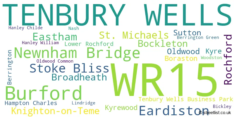
In the WR15 postcode district, the primary settlement is Tenbury Wells, located in both Shropshire and Worcestershire. Other significant settlements in this district include Berrington, Berrington Green, Bickley, Bockleton, Boraston, Broadheath, Burford, Eardiston, Eastham, Hampton Charles, Hanley Childe, Hanley William, Knighton-on-Teme, Kyre, Kyrewood, Lindridge, Lower Rochford, Nash, Newnham Bridge, Oldwood, Oldwood Common, Rochford, St. Michaels, Stoke Bliss, Sutton, Tenbury Wells Business Park, and Woodston. The most significant Postal Town in this district is Tenbury Wells.
For the district WR15, we have data on 1 postcode sectors. Here's a breakdown: The sector WR15 8, covers Tenbury Wells in Worcestershire. The sector WR15 8, covers Burford in Shropshire.
WR15 Postcode Sectors

Map of the WR15 Postcode District
Explore the WR15 postcode district by using our free interactive map.

When it comes to local government, postal geography often disregards political borders. However, for a breakdown in the WR15 District: the district mostly encompasses the Malvern Hills District (193 postcodes), followed by the Shropshire area (59 postcodes), and finally, the County of Herefordshire area (9 postcodes).
Recent House Sales in WR15
| Date | Price | Address |
|---|---|---|
| 21/09/2023 | £269,995 | Blackthorn Road, Tenbury Wells, WR15 8TN |
| 20/09/2023 | £350,000 | Boraston Drive, Burford, Tenbury Wells, WR15 8AG |
| 25/08/2023 | £172,000 | Berrington Road, Tenbury Wells, WR15 8EL |
| 04/08/2023 | £178,000 | Oak Tree Close, Burford, Tenbury Wells, WR15 8NQ |
| 04/08/2023 | £255,000 | Spring Close, Burford, Tenbury Wells, WR15 8NF |
| 02/08/2023 | £750,000 | Oldwood Road, St Michaels, Tenbury Wells, WR15 8PH |
| 28/07/2023 | £211,000 | Meadow Rise, Burford, Tenbury Wells, WR15 8DZ |
| 21/07/2023 | £345,000 | Tavern Lane, Newnham Bridge, Tenbury Wells, WR15 8LR |
| 19/07/2023 | £287,000 | White Willow Close, Tenbury Wells, WR15 8TR |
| 18/07/2023 | £490,000 | Terrills Lane, Tenbury Wells, WR15 8DD |
Where is the WR15 Postcode District?
The postcode district WR15 is located in Tenbury Wells. It is in close proximity to several nearby towns: Bromyard to the south (7.75 miles away), Leominster to the southwest (9.26 miles away), Ludlow to the northwest (9.32 miles away), Bewdley to the northeast (11.09 miles away), Stourport-on-Severn to the east (12.43 miles away), and Worcester to the southeast (15.92 miles away). Additionally, Tenbury Wells is approximately 117.02 miles away from the center of London.
The district is within the post town of TENBURY WELLS.
The sector has postcodes within the nation of England.
The WR15 Postcode District is covers the following regions.
- Worcestershire - Herefordshire, Worcestershire and Warwickshire - West Midlands (England)
- Shropshire CC - Shropshire and Staffordshire - West Midlands (England)
- Herefordshire, County of - Herefordshire, Worcestershire and Warwickshire - West Midlands (England)
Weather Forecast for WR15
Press Button to Show Forecast for Tenbury Wells
| Time Period | Icon | Description | Temperature | Rain Probability | Wind |
|---|---|---|---|---|---|
| 21:00 to 00:00 | Heavy rain | 12.0°C (feels like 10.0°C) | 97.00% | NW 7 mph |
Press Button to Show Forecast for Tenbury Wells
| Time Period | Icon | Description | Temperature | Rain Probability | Wind |
|---|---|---|---|---|---|
| 00:00 to 03:00 | Cloudy | 11.0°C (feels like 10.0°C) | 10.00% | NNW 7 mph | |
| 03:00 to 06:00 | Light rain | 11.0°C (feels like 10.0°C) | 50.00% | NNW 4 mph | |
| 06:00 to 09:00 | Overcast | 11.0°C (feels like 10.0°C) | 14.00% | N 7 mph | |
| 09:00 to 12:00 | Light rain | 12.0°C (feels like 11.0°C) | 50.00% | NNE 9 mph | |
| 12:00 to 15:00 | Light rain | 15.0°C (feels like 14.0°C) | 49.00% | NE 7 mph | |
| 15:00 to 18:00 | Cloudy | 16.0°C (feels like 15.0°C) | 50.00% | NNE 4 mph | |
| 18:00 to 21:00 | Light rain | 15.0°C (feels like 15.0°C) | 45.00% | W 4 mph | |
| 21:00 to 00:00 | Light rain | 13.0°C (feels like 12.0°C) | 47.00% | W 7 mph |
Press Button to Show Forecast for Tenbury Wells
| Time Period | Icon | Description | Temperature | Rain Probability | Wind |
|---|---|---|---|---|---|
| 00:00 to 03:00 | Light rain | 12.0°C (feels like 11.0°C) | 55.00% | N 4 mph | |
| 03:00 to 06:00 | Light rain | 10.0°C (feels like 9.0°C) | 57.00% | WNW 7 mph | |
| 06:00 to 09:00 | Overcast | 10.0°C (feels like 9.0°C) | 52.00% | W 7 mph | |
| 09:00 to 12:00 | Cloudy | 11.0°C (feels like 9.0°C) | 15.00% | W 9 mph | |
| 12:00 to 15:00 | Light rain | 12.0°C (feels like 10.0°C) | 57.00% | W 11 mph | |
| 15:00 to 18:00 | Light rain | 12.0°C (feels like 10.0°C) | 51.00% | WSW 11 mph | |
| 18:00 to 21:00 | Light rain | 12.0°C (feels like 9.0°C) | 40.00% | WSW 11 mph | |
| 21:00 to 00:00 | Cloudy | 10.0°C (feels like 8.0°C) | 11.00% | WSW 9 mph |
Press Button to Show Forecast for Tenbury Wells
| Time Period | Icon | Description | Temperature | Rain Probability | Wind |
|---|---|---|---|---|---|
| 00:00 to 03:00 | Clear night | 9.0°C (feels like 7.0°C) | 4.00% | SW 7 mph | |
| 03:00 to 06:00 | Cloudy | 8.0°C (feels like 6.0°C) | 6.00% | SW 7 mph | |
| 06:00 to 09:00 | Overcast | 9.0°C (feels like 7.0°C) | 9.00% | SSW 7 mph | |
| 09:00 to 12:00 | Overcast | 12.0°C (feels like 10.0°C) | 10.00% | SSW 9 mph | |
| 12:00 to 15:00 | Cloudy | 15.0°C (feels like 13.0°C) | 11.00% | SSW 9 mph | |
| 15:00 to 18:00 | Cloudy | 15.0°C (feels like 13.0°C) | 14.00% | S 9 mph | |
| 18:00 to 21:00 | Cloudy | 14.0°C (feels like 13.0°C) | 12.00% | SSW 7 mph | |
| 21:00 to 00:00 | Cloudy | 11.0°C (feels like 10.0°C) | 10.00% | SSW 7 mph |
Press Button to Show Forecast for Tenbury Wells
| Time Period | Icon | Description | Temperature | Rain Probability | Wind |
|---|---|---|---|---|---|
| 00:00 to 03:00 | Cloudy | 10.0°C (feels like 8.0°C) | 14.00% | SSE 4 mph | |
| 03:00 to 06:00 | Cloudy | 8.0°C (feels like 7.0°C) | 12.00% | SSE 4 mph | |
| 06:00 to 09:00 | Cloudy | 9.0°C (feels like 8.0°C) | 7.00% | S 7 mph | |
| 09:00 to 12:00 | Cloudy | 13.0°C (feels like 11.0°C) | 9.00% | S 7 mph | |
| 12:00 to 15:00 | Cloudy | 14.0°C (feels like 13.0°C) | 15.00% | SSE 9 mph | |
| 15:00 to 18:00 | Cloudy | 15.0°C (feels like 14.0°C) | 18.00% | SSW 7 mph | |
| 18:00 to 21:00 | Light rain shower (day) | 14.0°C (feels like 12.0°C) | 32.00% | WSW 7 mph | |
| 21:00 to 00:00 | Cloudy | 11.0°C (feels like 10.0°C) | 11.00% | WSW 7 mph |
Postcode Sectors within the WR15 District
| Postcode Sector | Delivery Office |
|---|---|
| WR15 8 | Tenbury Wells Scale Payment Delivery Office |
| W | R | 1 | 5 | - | X | X | X |
| W | R | 1 | 5 | Space | Numeric | Letter | Letter |
Current Monthly Rental Prices
| # Bedrooms | Min Price | Max Price | Avg Price |
|---|---|---|---|
| 1 | £600 | £600 | £600 |
Current House Prices
| # Bedrooms | Min Price | Max Price | Avg Price |
|---|---|---|---|
| £12,000 | £635,000 | £353,400 | |
| 1 | £135,000 | £135,000 | £135,000 |
| 2 | £115,000 | £300,000 | £200,500 |
| 3 | £106,000 | £865,000 | £382,363 |
| 4 | £350,000 | £825,000 | £549,231 |
| 5 | £850,000 | £850,000 | £850,000 |
| 6 | £795,000 | £1,650,000 | £1,265,000 |
| 11 | £900,000 | £900,000 | £900,000 |
Estate Agents who Operate in the WR15 District
| Logo | Name | Brand Name | Address | Contact Number | Total Properties |
|---|---|---|---|---|---|
 | Great Witley | G Herbert Banks | The Estate Office, Hill House, Stourport Road, Great Witley, WR6 6JB | 01299 667511 | 6 |
 | Ludlow | Samuel Wood | Tamberlaine House Buttercross, Ludlow, SY8 1AW | 01584 708402 | 5 |
 | Ludlow | Nock Deighton | 12 Bull Ring Ludlow SY8 1AD | 07453 531966 | 5 |
 | Ludlow | McCartneys LLP | 16-17 High Street, Ludlow, SY8 1BS | 01584 708412 | 3 |
 | Covering the West Midlands | Andrew Grant | Covering the West Midlands | 01905 673182 | 3 |
| Type of Property | 2018 Average | 2018 Sales | 2017 Average | 2017 Sales | 2016 Average | 2016 Sales | 2015 Average | 2015 Sales |
|---|---|---|---|---|---|---|---|---|
| Detached | £369,760 | 59 | £357,415 | 66 | £320,887 | 71 | £310,382 | 52 |
| Semi-Detached | £189,898 | 25 | £211,760 | 25 | £196,404 | 26 | £203,720 | 33 |
| Terraced | £177,548 | 20 | £160,088 | 17 | £202,573 | 26 | £176,329 | 21 |
| Flats | £144,800 | 5 | £160,750 | 6 | £95,738 | 4 | £74,900 | 5 |