The WR9 postcode district is a postal district located in the WR Worcester postcode area with a population of 34,418 residents according to the 2021 England and Wales Census.
The area of the WR9 postcode district is 49.51 square miles which is 128.24 square kilometres or 31,688.09 acres.
Currently, the WR9 district has about 872 postcode units spread across 4 geographic postcode sectors.
Given that each sector allows for 400 unique postcode combinations, the district has a capacity of 1,600 postcodes. With 872 postcodes already in use, this leaves 728 units available.
The largest settlement in the WR9 postal code is DROITWICH followed by Ombersley, and Wychbold.
The WR9 Postcode shares a border with WR7 (Inkberrow, Crowle, Upton Snodsbury), WR5 (WORCESTER, Kempsey, Whittington), DY10 (KIDDERMINSTER, Cookley, Blakedown), DY13 (STOURPORT-ON-SEVERN, Astley, Titton), WR6 (Martley, Clifton-on-Teme, Holt Heath), WR3 (WORCESTER, Fernhill Heath, Claines) and B61 (BROMSGROVE, Catshill, Dodford).
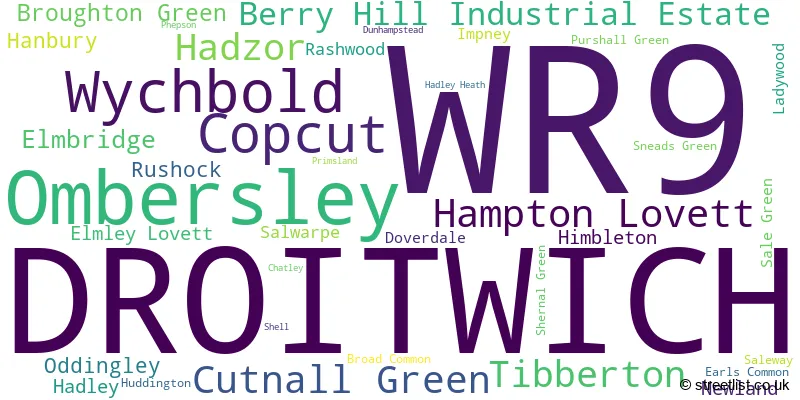
The WR9 postcode district in Worcestershire, England, primarily consists of the town of Droitwich. It also includes other significant settlements such as Broad Common, Chatley, Cutnall Green, Doverdale, Elmbridge, Elmley Lovett, Hadley, Hadley Heath, Hampton Lovett, Impney, Ladywood, Ombersley, Purshall Green, Rashwood, Rushock, Salwarpe, Sneads Green, and Wychbold. The most significant post town in this district is Droitwich.
For the district WR9, we have data on 5 postcode sectors. Here's a breakdown: The sector WR9 0, covers Ombersley and Droitwich in Worcestershire. The sector WR9 1 is non-geographic. It's often designated for PO Boxes, large organisations, or special services. The sector WR9 7, covers Droitwich and Copcut in Worcestershire. The sector WR9 8, covers Droitwich in Worcestershire. The sector WR9 9, covers Droitwich and Berry Hill Industrial Estate in Worcestershire.

Map of the WR9 Postcode District
Explore the WR9 postcode district by using our free interactive map.

When it comes to local government, postal geography often disregards political borders. However, for a breakdown in the WR9 District: the district mostly encompasses the Wychavon District (889 postcodes), and finally, the Wyre Forest District area (5 postcodes).
Recent House Sales in WR9
| Date | Price | Address |
|---|---|---|
| 06/10/2023 | £575,000 | Robin Meadow, Droitwich, WR9 7FZ |
| 06/10/2023 | £345,000 | Salters Court, Hadzor, Droitwich, WR9 7EZ |
| 03/10/2023 | £404,000 | Grosvenor Way, Droitwich, WR9 7SR |
| 29/09/2023 | £396,000 | Shernal Green, Droitwich, WR9 7JS |
| 27/09/2023 | £323,000 | Monnow Close, Droitwich, WR9 8TF |
| 22/09/2023 | £800,000 | Sneads Green, Droitwich, WR9 0PZ |
| 15/09/2023 | £230,000 | Nunnery Avenue, Droitwich, WR9 8BJ |
| 13/09/2023 | £250,000 | Miller Street, Droitwich, WR9 8HL |
| 11/09/2023 | £93,000 | Tower Hill, Droitwich, WR9 8AF |
| 04/09/2023 | £280,000 | Nunnery Avenue, Droitwich, WR9 8BH |
Weather Forecast for WR9
Press Button to Show Forecast for Droitwich Spa
| Time Period | Icon | Description | Temperature | Rain Probability | Wind |
|---|---|---|---|---|---|
| 09:00 to 12:00 | Cloudy | 7.0°C (feels like 5.0°C) | 6.00% | E 7 mph | |
| 12:00 to 15:00 | Overcast | 10.0°C (feels like 9.0°C) | 12.00% | ENE 4 mph | |
| 15:00 to 18:00 | Overcast | 10.0°C (feels like 9.0°C) | 12.00% | E 4 mph | |
| 18:00 to 21:00 | Cloudy | 10.0°C (feels like 9.0°C) | 10.00% | E 4 mph | |
| 21:00 to 00:00 | Partly cloudy (night) | 6.0°C (feels like 4.0°C) | 9.00% | ENE 7 mph |
Press Button to Show Forecast for Droitwich Spa
| Time Period | Icon | Description | Temperature | Rain Probability | Wind |
|---|---|---|---|---|---|
| 00:00 to 03:00 | Partly cloudy (night) | 5.0°C (feels like 2.0°C) | 9.00% | ENE 7 mph | |
| 03:00 to 06:00 | Cloudy | 3.0°C (feels like 1.0°C) | 15.00% | NE 7 mph | |
| 06:00 to 09:00 | Cloudy | 4.0°C (feels like 2.0°C) | 14.00% | NE 7 mph | |
| 09:00 to 12:00 | Overcast | 8.0°C (feels like 6.0°C) | 20.00% | ENE 9 mph | |
| 12:00 to 15:00 | Light rain | 10.0°C (feels like 8.0°C) | 48.00% | ENE 9 mph | |
| 15:00 to 18:00 | Overcast | 11.0°C (feels like 9.0°C) | 21.00% | ENE 9 mph | |
| 18:00 to 21:00 | Cloudy | 10.0°C (feels like 8.0°C) | 18.00% | ENE 9 mph | |
| 21:00 to 00:00 | Cloudy | 8.0°C (feels like 6.0°C) | 19.00% | NE 11 mph |
Press Button to Show Forecast for Droitwich Spa
| Time Period | Icon | Description | Temperature | Rain Probability | Wind |
|---|---|---|---|---|---|
| 00:00 to 03:00 | Light rain | 7.0°C (feels like 4.0°C) | 48.00% | NNE 11 mph | |
| 03:00 to 06:00 | Heavy rain | 7.0°C (feels like 4.0°C) | 73.00% | NNE 11 mph | |
| 06:00 to 09:00 | Heavy rain | 7.0°C (feels like 4.0°C) | 75.00% | NNE 11 mph | |
| 09:00 to 12:00 | Heavy rain | 8.0°C (feels like 5.0°C) | 75.00% | NNW 11 mph | |
| 12:00 to 15:00 | Heavy rain | 9.0°C (feels like 6.0°C) | 72.00% | NNW 13 mph | |
| 15:00 to 18:00 | Light rain shower (day) | 10.0°C (feels like 8.0°C) | 42.00% | N 13 mph | |
| 18:00 to 21:00 | Light rain shower (day) | 10.0°C (feels like 8.0°C) | 37.00% | NNW 9 mph | |
| 21:00 to 00:00 | Clear night | 7.0°C (feels like 6.0°C) | 7.00% | NW 4 mph |
Where is the WR9 Postcode District?
The postcode district WR9 is located in the town of Droitwich. It is surrounded by nearby towns such as Worcester to the South West, Stourport-on-Severn to the North West, Bromsgrove to the North East, Redditch to the East, Pershore to the South, and Stourbridge to the North. Furthermore, the distance from this postcode district to the center of London is approximately 101.47 miles.
The district is within the post town of DROITWICH.
The sector has postcodes within the nation of England.
The WR9 Postcode District is in the Worcestershire region of Herefordshire, Worcestershire and Warwickshire within the West Midlands (England).
| Postcode Sector | Delivery Office |
|---|---|
| WR9 0 | Droitwich Delivery Office |
| WR9 7 | Droitwich Delivery Office |
| WR9 8 | Droitwich Delivery Office |
| WR9 9 | Droitwich Delivery Office |
| W | R | 9 | - | X | X | X |
| W | R | 9 | Space | Numeric | Letter | Letter |
Tourist Attractions within the Postcode Area
We found 1 visitor attractions within the WR9 postcode area
| Hanbury Hall (National Trust) |
|---|
| Historic Properties |
| Historic House / House and Garden / Palace |
| View Hanbury Hall (National Trust) on Google Maps |
Current Monthly Rental Prices
| # Bedrooms | Min Price | Max Price | Avg Price |
|---|---|---|---|
| £871 | £871 | £871 | |
| 1 | £575 | £695 | £622 |
| 2 | £750 | £1,000 | £881 |
| 3 | £995 | £3,250 | £1,815 |
| 4 | £1,495 | £1,495 | £1,495 |
Current House Prices
| # Bedrooms | Min Price | Max Price | Avg Price |
|---|---|---|---|
| £30,000 | £1,800,000 | £641,000 | |
| 1 | £65,000 | £160,000 | £107,000 |
| 2 | £90,000 | £350,000 | £211,910 |
| 3 | £180,000 | £850,000 | £359,165 |
| 4 | £180,000 | £1,150,000 | £558,240 |
| 5 | £325,000 | £1,500,000 | £912,500 |
| 6 | £750,000 | £4,750,000 | £1,829,000 |
| 8 | £895,000 | £1,950,000 | £1,422,500 |
Estate Agents who Operate in the WR9 District
| Logo | Name | Brand Name | Address | Contact Number | Total Properties |
|---|---|---|---|---|---|
 | Droitwich | Nicol & Co | 226 Worcester Road Droitwich WR9 8AY | 01905 917208 | 41 |
 | Droitwich | Robert Oulsnam & Company | Orchard House, 2 Victoria Square, Droitwich, WR9 8DS | 01905 675274 | 30 |
 | Droitwich | Fine & Country | 12 Victoria Square, Droitwich, WR9 8DS | 01905 975080 | 12 |
 | Bromsgrove | A P Morgan | 4 Worcester Road, Bromsgrove, B61 7AE | 01527 913647 | 9 |
 | BROMSGROVE | Allan Morris | 18 High Street, Bromsgrove, B61 8HQ | 01527 919200 | 7 |
- Broad Alley
- Broad Common
- Bryan's Green
- Cooksey Green
- Cutnall Green
- Droitwich Spa
- Dunhampstead
- Dunhampton
- Elmbridge
- Goosehill Green
- Grafton Flyford
- Grimley
- Hadzor
- Hampton Lovett
- Hanbury
- Hartlebury
- Himbleton
- Holt Fleet
- Ladywood
- Lineholt
- Lower Town
- Newland Common
- Northampton
- Oddingley
- Oldfield
- Ombersley
- Rashwood
- Rushock
- Sale Green
- Shernal Green
- Stock Green
- Tibberton
- Uphampton
- Upton Warren
- Wychbold
| Type of Property | 2018 Average | 2018 Sales | 2017 Average | 2017 Sales | 2016 Average | 2016 Sales | 2015 Average | 2015 Sales |
|---|---|---|---|---|---|---|---|---|
| Detached | £355,488 | 311 | £352,832 | 293 | £342,791 | 243 | £330,688 | 248 |
| Semi-Detached | £233,816 | 148 | £225,685 | 177 | £220,725 | 143 | £210,367 | 133 |
| Terraced | £170,504 | 113 | £168,579 | 100 | £169,918 | 95 | £157,965 | 97 |
| Flats | £133,482 | 61 | £149,214 | 81 | £143,277 | 77 | £150,238 | 86 |