The WR3 postcode district is a postal district located in the WR Worcester postcode area with a population of 21,758 residents according to the 2021 England and Wales Census.
The area of the WR3 postcode district is 8.32 square miles which is 21.55 square kilometres or 5,325.88 acres.
Currently, the WR3 district has about 530 postcode units spread across 2 geographic postcode sectors.
Given that each sector allows for 400 unique postcode combinations, the district has a capacity of 800 postcodes. With 530 postcodes already in use, this leaves 270 units available.
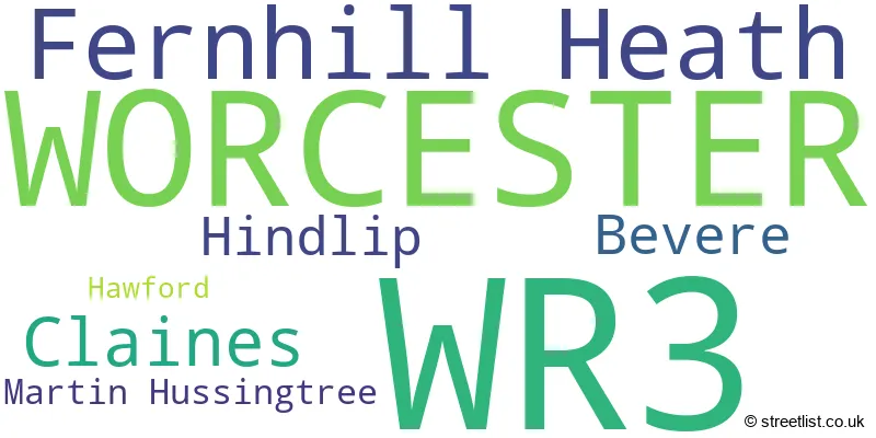
The largest settlement in the WR3 postal code is WORCESTER followed by Fernhill Heath, and Claines.
The WR3 Postcode shares a border with WR9 (DROITWICH, Ombersley, Wychbold), WR1 (WORCESTER), WR2 (WORCESTER, Hallow, Powick) and WR4 (WORCESTER, Lyppard Hanford, Long Meadow).
The primary settlement in the WR3 postcode district is Worcester, located in the county of Worcestershire in England. Other significant settlements in the district include Bevere, Claines, Fernhill Heath, Hawford, and Martin Hussingtree. The most significant post town in the district is Worcester.
For the district WR3, we have data on 2 postcode sectors. Here's a breakdown: The sector WR3 7, covers Worcester and Fernhill Heath and Claines in Worcestershire. The sector WR3 8, covers Worcester and Fernhill Heath in Worcestershire.

Map of the WR3 Postcode District
Explore the WR3 postcode district by using our free interactive map.

When it comes to local government, postal geography often disregards political borders. However, for a breakdown in the WR3 District: the district mostly encompasses the Worcester District (B) (383 postcodes), and finally, the Wychavon District area (151 postcodes).
Recent House Sales in WR3
| Date | Price | Address |
|---|---|---|
| 27/10/2023 | £135,000 | Sky Court, Worcester, WR3 7QJ |
| 03/10/2023 | £300,000 | Grange Avenue, Worcester, WR3 7QB |
| 29/09/2023 | £495,000 | Lansdowne Road, Worcester, WR3 8JJ |
| 21/09/2023 | £275,000 | St Annes Road, Worcester, WR3 7PG |
| 15/09/2023 | £255,000 | Bishops Avenue, Worcester, WR3 8XA |
| 15/09/2023 | £170,000 | Southdown Road, Worcester, WR3 8HX |
| 05/09/2023 | £145,000 | Eastbank Drive, Worcester, WR3 7EW |
| 04/09/2023 | £221,500 | Sydney Street, Worcester, WR3 8BG |
| 01/09/2023 | £300,000 | Linley Close, Worcester, WR3 7EL |
| 31/08/2023 | £450,000 | Green Lane, Bevere, Worcester, WR3 7QG |
Weather Forecast for WR3
Press Button to Show Forecast for Worcester Racecourse
| Time Period | Icon | Description | Temperature | Rain Probability | Wind |
|---|---|---|---|---|---|
| 15:00 to 18:00 | Cloudy | 11.0°C (feels like 10.0°C) | 7.00% | ENE 7 mph | |
| 18:00 to 21:00 | Cloudy | 10.0°C (feels like 8.0°C) | 10.00% | ENE 9 mph | |
| 21:00 to 00:00 | Cloudy | 8.0°C (feels like 6.0°C) | 8.00% | ENE 9 mph |
Press Button to Show Forecast for Worcester Racecourse
| Time Period | Icon | Description | Temperature | Rain Probability | Wind |
|---|---|---|---|---|---|
| 00:00 to 03:00 | Cloudy | 7.0°C (feels like 5.0°C) | 15.00% | ENE 9 mph | |
| 03:00 to 06:00 | Overcast | 6.0°C (feels like 4.0°C) | 17.00% | ENE 7 mph | |
| 06:00 to 09:00 | Cloudy | 6.0°C (feels like 4.0°C) | 21.00% | NE 9 mph | |
| 09:00 to 12:00 | Light rain | 8.0°C (feels like 5.0°C) | 48.00% | ENE 9 mph | |
| 12:00 to 15:00 | Light rain | 8.0°C (feels like 6.0°C) | 50.00% | ENE 9 mph | |
| 15:00 to 18:00 | Overcast | 9.0°C (feels like 7.0°C) | 15.00% | NE 9 mph | |
| 18:00 to 21:00 | Overcast | 9.0°C (feels like 7.0°C) | 12.00% | NE 11 mph | |
| 21:00 to 00:00 | Cloudy | 8.0°C (feels like 5.0°C) | 11.00% | NE 11 mph |
Press Button to Show Forecast for Worcester Racecourse
| Time Period | Icon | Description | Temperature | Rain Probability | Wind |
|---|---|---|---|---|---|
| 00:00 to 03:00 | Light rain | 7.0°C (feels like 4.0°C) | 51.00% | NNE 11 mph | |
| 03:00 to 06:00 | Light rain | 6.0°C (feels like 3.0°C) | 57.00% | N 11 mph | |
| 06:00 to 09:00 | Heavy rain | 6.0°C (feels like 3.0°C) | 76.00% | NNW 11 mph | |
| 09:00 to 12:00 | Heavy rain | 7.0°C (feels like 4.0°C) | 74.00% | NNW 11 mph | |
| 12:00 to 15:00 | Overcast | 9.0°C (feels like 7.0°C) | 19.00% | NW 9 mph | |
| 15:00 to 18:00 | Cloudy | 11.0°C (feels like 10.0°C) | 11.00% | NW 7 mph | |
| 18:00 to 21:00 | Partly cloudy (day) | 11.0°C (feels like 9.0°C) | 5.00% | W 7 mph | |
| 21:00 to 00:00 | Clear night | 7.0°C (feels like 6.0°C) | 1.00% | SW 7 mph |
Press Button to Show Forecast for Worcester Racecourse
| Time Period | Icon | Description | Temperature | Rain Probability | Wind |
|---|---|---|---|---|---|
| 00:00 to 03:00 | Clear night | 5.0°C (feels like 3.0°C) | 1.00% | SSW 7 mph | |
| 03:00 to 06:00 | Clear night | 4.0°C (feels like 2.0°C) | 1.00% | S 7 mph | |
| 06:00 to 09:00 | Sunny day | 6.0°C (feels like 4.0°C) | 1.00% | S 7 mph | |
| 09:00 to 12:00 | Partly cloudy (day) | 11.0°C (feels like 9.0°C) | 2.00% | S 13 mph | |
| 12:00 to 15:00 | Cloudy | 13.0°C (feels like 11.0°C) | 7.00% | S 13 mph | |
| 15:00 to 18:00 | Cloudy | 14.0°C (feels like 11.0°C) | 6.00% | S 13 mph | |
| 18:00 to 21:00 | Sunny day | 13.0°C (feels like 11.0°C) | 3.00% | S 11 mph | |
| 21:00 to 00:00 | Clear night | 10.0°C (feels like 8.0°C) | 3.00% | SSE 9 mph |
Press Button to Show Forecast for Worcester Racecourse
| Time Period | Icon | Description | Temperature | Rain Probability | Wind |
|---|---|---|---|---|---|
| 00:00 to 03:00 | Partly cloudy (night) | 9.0°C (feels like 6.0°C) | 3.00% | SE 9 mph | |
| 03:00 to 06:00 | Clear night | 8.0°C (feels like 6.0°C) | 2.00% | SE 9 mph | |
| 06:00 to 09:00 | Sunny day | 9.0°C (feels like 6.0°C) | 2.00% | ESE 9 mph | |
| 09:00 to 12:00 | Sunny day | 13.0°C (feels like 11.0°C) | 6.00% | SE 11 mph | |
| 12:00 to 15:00 | Partly cloudy (day) | 16.0°C (feels like 13.0°C) | 12.00% | SE 13 mph | |
| 15:00 to 18:00 | Partly cloudy (day) | 16.0°C (feels like 13.0°C) | 12.00% | SE 11 mph | |
| 18:00 to 21:00 | Partly cloudy (day) | 15.0°C (feels like 13.0°C) | 12.00% | SE 9 mph | |
| 21:00 to 00:00 | Partly cloudy (night) | 11.0°C (feels like 10.0°C) | 5.00% | ESE 7 mph |
Where is the WR3 Postcode District?
The postcode district WR3 is located in Worcester. Worcester is surrounded by several nearby towns. To the northeast is Droitwich, which is approximately 3.37 miles away. Stourport-on-Severn is located to the north and is approximately 7.79 miles away. Pershore is situated to the southeast and is approximately 9.45 miles away. Malvern is located to the southwest and is approximately 10.09 miles away. Bewdley can be found to the northwest and is approximately 12.16 miles away. Alcester is situated to the east and is approximately 13.21 miles away. Worcester is also approximately 101.64 miles away from the center of London.
The district is within the post town of WORCESTER.
The sector has postcodes within the nation of England.
The WR3 Postcode District is in the Worcestershire region of Herefordshire, Worcestershire and Warwickshire within the West Midlands (England).
| Postcode Sector | Delivery Office |
|---|---|
| WR3 7 | Worcester City Delivery Office |
| WR3 8 | Worcester City Delivery Office |
| WR3 7 | Worcester Apc |
| WR3 8 | Worcester Apc |
| W | R | 3 | - | X | X | X |
| W | R | 3 | Space | Numeric | Letter | Letter |
Current Monthly Rental Prices
| # Bedrooms | Min Price | Max Price | Avg Price |
|---|---|---|---|
| 2 | £795 | £850 | £823 |
| 3 | £950 | £1,300 | £1,125 |
| 5 | £3,000 | £3,000 | £3,000 |
Current House Prices
| # Bedrooms | Min Price | Max Price | Avg Price |
|---|---|---|---|
| 1 | £120,000 | £200,000 | £157,969 |
| 2 | £100,000 | £695,000 | £248,700 |
| 3 | £190,000 | £560,000 | £325,897 |
| 4 | £275,000 | £1,000,000 | £541,735 |
| 5 | £295,000 | £850,000 | £599,167 |
| 6 | £875,000 | £875,000 | £875,000 |
| 7 | £360,000 | £650,000 | £505,000 |
Estate Agents who Operate in the WR3 District
| Logo | Name | Brand Name | Address | Contact Number | Total Properties |
|---|---|---|---|---|---|
 | Worcester | Connells | 3 Foregate Street, Worcester, Worcestershire, WR1 1DB | 01905 917044 | 16 |
 | Worcester | Shelton & Lines | 37 Droitwich Road, Worcester, WR3 7LG | 01905 672222 | 15 |
 | Worcester | Nicol & Co | 46 Barbourne Road, Worcester WR1 1HU | 01905 675619 | 12 |
 | Portishead | Kingsdale Group Limited | Kings House High Street, Portishead, BS20 6PY | 01275 402920 | 12 |
 | Worcester | Allan Morris Worcester | 32 Sidbury, Worcester, WR1 2HZ | 01905 917024 | 8 |
| Type of Property | 2018 Average | 2018 Sales | 2017 Average | 2017 Sales | 2016 Average | 2016 Sales | 2015 Average | 2015 Sales |
|---|---|---|---|---|---|---|---|---|
| Detached | £367,791 | 154 | £354,510 | 138 | £350,297 | 156 | £324,694 | 111 |
| Semi-Detached | £232,214 | 149 | £223,591 | 103 | £207,139 | 148 | £216,788 | 141 |
| Terraced | £201,652 | 120 | £190,274 | 104 | £168,936 | 127 | £171,475 | 97 |
| Flats | £162,340 | 63 | £144,159 | 62 | £140,805 | 57 | £145,569 | 60 |