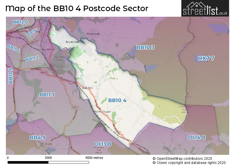
The BB10 4 postcode sector stands on the Lancashire and West Yorkshire border.
Did you know? According to the 2021 Census, the BB10 4 postcode sector is home to a bustling 10,045 residents!
Given that each sector allows for 400 unique postcode combinations. Letters C, I, K, M, O and V are not allowed in the last two letters of a postcode. With 207 postcodes already in use, this leaves 193 units available.
The largest settlements in the BB10 4 postal code are BURNLEY and Cliviger.
The BB10 4 Postcode shares a border with OL13 8 (BACUP), OL14 8 (TODMORDEN), BB10 3 (BURNLEY, Worsthorne, Briercliffe), HX7 7 (HEBDEN BRIDGE, Heptonstall, Blackshaw Head) and BB11 3 (BURNLEY, Cliviger).
The sector is within the post town of BURNLEY.
BB10 4 is a postcode sector within the BB10 postcode district which is within the BB Blackburn postcode area.
The Royal Mail delivery office for the BB10 4 postal sector is the Burnley Delivery Office.
The area of the BB10 4 postcode sector is 5.89 square miles which is 15.26 square kilometres or 3,771.05 square acres.
Waterways within the BB10 4 postcode sector include the River Calder.

Map of the BB10 4 Postcode Sector
Explore the BB10 4 postcode sector by using our free interactive map.
| B | B | 1 | 0 | - | 4 | X | X |
| B | B | 1 | 0 | Space | 4 | Letter | Letter |
Official List of Streets
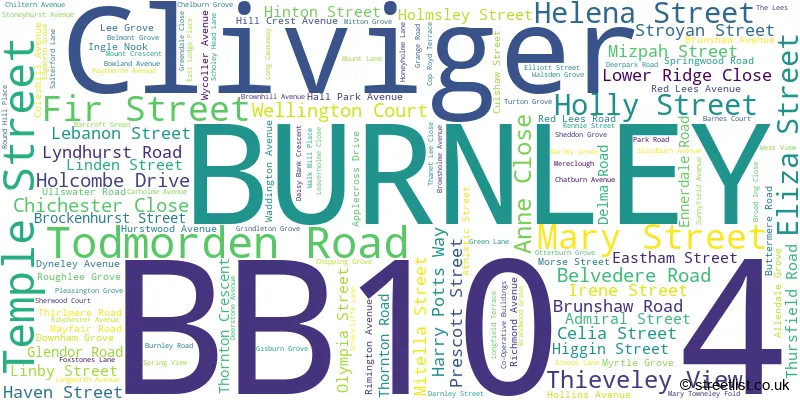
BURNLEY (103 Streets)
Cliviger (28 Streets)
Unofficial Streets or Alternative Spellings
BURNLEY
BOULDSWORTH ROAD BROWNSIDE ROAD DEERPARK ROAD DORIS STREET HARRY POTTS WAY HOBART STREET HOLMES STREET LEYLAND ROAD ORMEROD ROAD RICHARD STREET RIDGE ROAD THURSTON STREET YORKSHIRE STREETTODMORDEN
KEBS ROADSchools and Places of Education Within the BB10 4 Postcode Sector
Burnley Brunshaw Primary School
Community school
Morse Street, Burnley, Lancashire, BB10 4PB
Head: Headteacher Gina Smith
Ofsted Rating: Good
Inspection: 2022-10-12 (589 days ago)
Website: Visit Burnley Brunshaw Primary School Website
Phone: 01282423280
Number of Pupils: 382
St John's CofE Primary School, Cliviger
Voluntary aided school
Burnley Road, Burnley, Lancashire, BB10 4SU
Head: Mrs Naomi Healey
Ofsted Rating: Good
Inspection: 2023-01-26 (483 days ago)
Website: Visit St John's CofE Primary School, Cliviger Website
Phone: 01282421395
Number of Pupils: 196
House Prices in the BB10 4 Postcode Sector
| Type of Property | 2018 Average | 2018 Sales | 2017 Average | 2017 Sales | 2016 Average | 2016 Sales | 2015 Average | 2015 Sales |
|---|---|---|---|---|---|---|---|---|
| Detached | £240,536 | 14 | £229,623 | 24 | £221,714 | 14 | £265,538 | 12 |
| Semi-Detached | £139,134 | 53 | £123,011 | 59 | £128,478 | 33 | £144,320 | 43 |
| Terraced | £73,635 | 85 | £72,148 | 126 | £82,431 | 75 | £72,568 | 74 |
| Flats | £0 | 0 | £48,315 | 4 | £173,677 | 11 | £87,828 | 9 |
Important Postcodes BB10 4 in the Postcode Sector
BB10 4AB is the postcode for Burnley Registration Office, 30 Todmorden Road
BB10 4BH is the postcode for ST MARY'S RC PRIMARY SCHOOL JUNIOR BUILDING, St. Marys RC Primary School, Holcombe Drive, St Marys Junior, St Mary's RC Primary School, Holcombe Drive, St. Marys RC Primary School, Holcombe Drive, and Infant Building, St Mary's Primary School, Holcambe Drive
BB10 4BQ is the postcode for Lower Ridge Home for Elderly, Belvedere Road
BB10 4NR is the postcode for Belmont Community Centre, Belmont Grove
BB10 4PB is the postcode for Brunshaw Cp School, Morse Street, Brunshaw Foundation Centre, Morse Street, Brunshaw Foundation Centre, Brunshaw Primary, Morse Street, Brunshaw County Primary School, Morse Street, Lancashire County Council, Morse Street, and MAIN BUILDING, Brunshaw Cp School, Morse Street
BB10 4QR is the postcode for The Haven, 235 Brunshaw Road
BB10 4SU is the postcode for Cliviger Village Hall, Burnley Road, and St. Johns C E School, Burnley Road
| The BB10 4 Sector is within these Local Authorities |
|
|---|---|
| The BB10 4 Sector is within these Counties |
|
| The BB10 4 Sector is within these Water Company Areas |
|