The BD13 2 postcode sector is within the county of West Yorkshire.
Did you know? According to the 2021 Census, the BD13 2 postcode sector is home to a bustling 8,166 residents!
Given that each sector allows for 400 unique postcode combinations. Letters C, I, K, M, O and V are not allowed in the last two letters of a postcode. With 241 postcodes already in use, this leaves 159 units available.
The BD13 2 postal code covers the settlement of Queensbury.
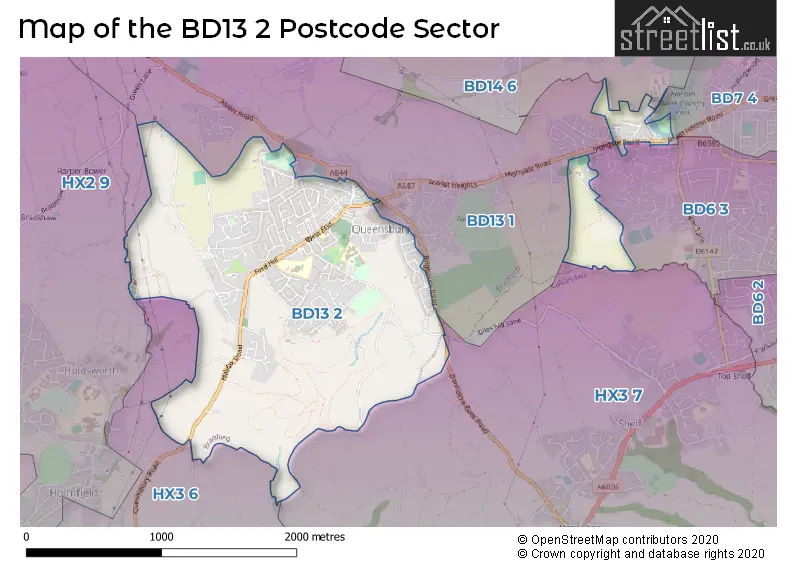
The BD13 2 Postcode shares a border with BD13 1 (Queensbury), BD14 6 (Clayton), BD6 3 (BRADFORD, Buttershaw, Wibsey), HX3 7 (HALIFAX, Northowram, Shelf), BD7 4 (BRADFORD, Great Horton), HX2 9 (HALIFAX, Illingworth, Holmfield) and HX3 6 (HALIFAX, Boothtown, Holmfield).
The sector is within the post town of BRADFORD.
BD13 2 is a postcode sector within the BD13 postcode district which is within the BD Bradford postcode area.
The Royal Mail delivery office for the BD13 2 postal sector is the West Bradford Delivery Office.
The area of the BD13 2 postcode sector is 1.66 square miles which is 4.31 square kilometres or 1,065.18 square acres.

Map of the BD13 2 Postcode Sector
Explore the BD13 2 postcode sector by using our free interactive map.
| B | D | 1 | 3 | - | 2 | X | X |
| B | D | 1 | 3 | Space | 2 | Letter | Letter |
Official List of Streets
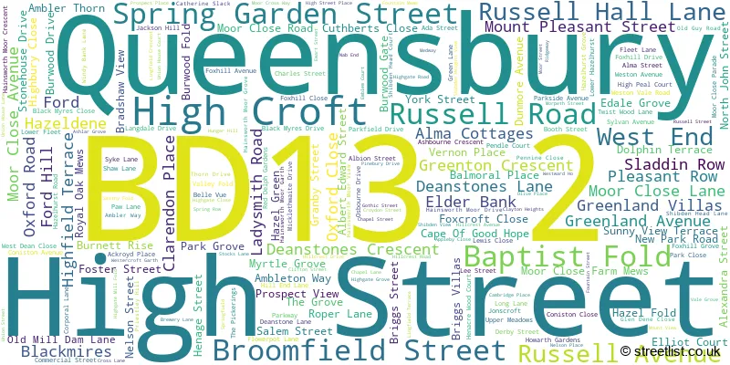
Queensbury (182 Streets)
Unofficial Streets or Alternative Spellings
Queensbury
ALBERT ROAD BACK LANE BRIGHOUSE ROAD SMALL PAGE FOLD THORNTON ROADClayton
THORNTON VIEW ROAD BRIGHOUSE & DENHOLM GATE ROAD BRIGHOUSE AND DENHOLME ROAD CROOKED LANE DENHOLME GATE ROAD EAST VIEW FALL LANE HALIFAX ROAD HAZEL HURST GROVE HAZEL HURST ROAD HENACREWOOD COURT HILL CREST ROAD JACKSON HILL LANE QUEENSBURY ROAD WARMLEIGH PARK WARMLIEGH PARKBRADFORD
BUNTING DRIVE DUNNOCK AVENUE GREAT HORTON ROAD GREBE CLOSENorthowram
GREEN LANEHALIFAX
SWALES MOOR ROADSchools and Places of Education Within the BD13 2 Postcode Sector
Russell Hall Primary School
Foundation school
West End, Bradford, West Yorkshire, BD13 2AW
Head: Mr Andrew Grant
Ofsted Rating: Good
Inspection: 2020-03-05 (1552 days ago)
Website: Visit Russell Hall Primary School Website
Phone: 01274882116
Number of Pupils: 225
Shibden Head Primary Academy
Academy converter
Hainsworth Moor Grove, Bradford, West Yorkshire, BD13 2ND
Head: Lucy Shaw
Ofsted Rating: Good
Inspection: 2023-06-14 (356 days ago)
Website: Visit Shibden Head Primary Academy Website
Phone: 01274882458
Number of Pupils: 402
Stocks Lane Primary School
Community school
Stocks Lane, Bradford, West Yorkshire, BD13 2RH
Head: Mrs Lucy Neal
Ofsted Rating: Good
Inspection: 2018-11-06 (2037 days ago)
Website: Visit Stocks Lane Primary School Website
Phone: 01274880569
Number of Pupils: 206
House Prices in the BD13 2 Postcode Sector
| Type of Property | 2018 Average | 2018 Sales | 2017 Average | 2017 Sales | 2016 Average | 2016 Sales | 2015 Average | 2015 Sales |
|---|---|---|---|---|---|---|---|---|
| Detached | £237,223 | 38 | £243,433 | 42 | £208,315 | 53 | £222,762 | 51 |
| Semi-Detached | £158,378 | 57 | £142,895 | 68 | £142,183 | 55 | £138,329 | 66 |
| Terraced | £103,589 | 65 | £97,001 | 69 | £83,800 | 76 | £89,731 | 62 |
| Flats | £67,125 | 4 | £49,000 | 1 | £52,000 | 1 | £37,500 | 2 |
Important Postcodes BD13 2 in the Postcode Sector
BD13 2AG is the postcode for Queensbury Health Centre, Russell Road
BD13 2AS is the postcode for F BLOCK, Queensbury School, Deanstones Lane, Queensbury School, Deanstones Lane, and MAIN BUILDING, TRINITY ACADEMY BRADFORD, DEANSTONES LANE
BD13 2AW is the postcode for Russell Hall Primary School, West End
BD13 2GD is the postcode for The Willows Medical Centre, 8 Osbourne Drive
BD13 2ND is the postcode for Shibden Head Primary Academy, Hainsworth Moor Grove, and Shibden Head Primary Academy, Hainsworth Moor Grove, Queensbury
BD13 2RH is the postcode for Stocks Lane Primary School, Stocks Lane
| The BD13 2 Sector is within these Local Authorities |
|
|---|---|
| The BD13 2 Sector is within these Counties |
|
| The BD13 2 Sector is within these Water Company Areas |
|