This section of the site is all about the BD Postcode area, also known as the Bradford Postal Area. Explore links to the next level to learn more about specific postcode districts such as BD1.
The BD postcode area represents a group of postal districts in the Bradford area of the United Kingdom. The area code BD stands for the letters b and d in BradforD. BD has a population of 578,336 and covers an area of 1,316,567 hectares. Fun fact: 0.89% of the population of Great Britain lives in this area.
The postcode area falls within the following counties: West Yorkshire (87.96%), North Yorkshire (11.95%), Lancashire (0.09%).
Post Towns and Postcode Districts for the BD Postcode
Where is the BD Postcode Area?
The BD Bradford,Postcode is in the Yorkshire and the Humber Region of England. The postal area borders the following neighbouring postal areas: HD - Huddersfield, LA - Lancaster, WF - Wakefield, BB - Blackburn, HX - Halifax, DL - Darlington, HG - Harrogate and LS - Leeds, and is located inland.
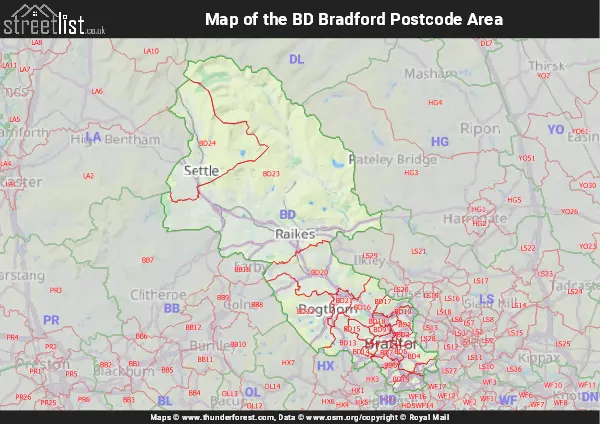
Map of the BD Bradford Postcode Area
Explore the BD Bradford postcode area by using our interactive map.

Postcode Districts within the BD Bradford Postcode Area
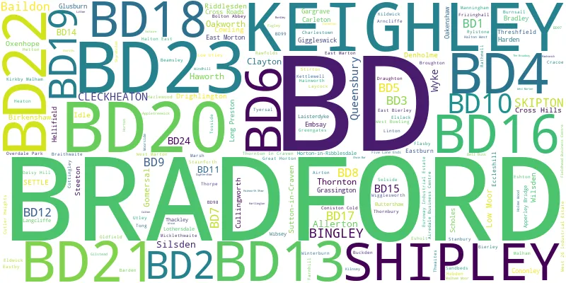
There are 24 postcode districts within the Bradford postcode area
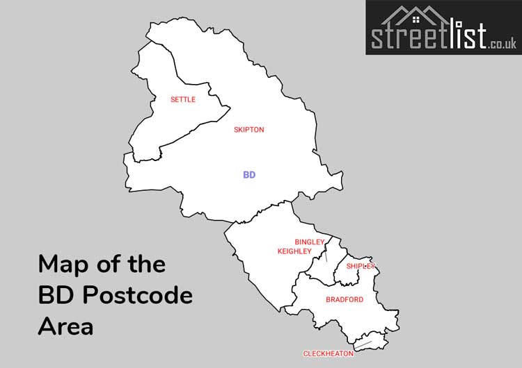
A map showing the boundary of in relation to other areas
There are 12 towns within the Bradford postcode area.
| Unit | Area² |
|---|---|
| Hectares | 1,316,567² |
| Miles | 5,083² |
| Feet | 141,713,955,313² |
| Kilometres | 13,166² |
Postal Delivery Offices serving the BD Bradford Postcode Area
- Bingley Delivery Office
- Bradford North Delivery Office
- Bradford South Delivery Office
- Cleckheaton Delivery Office
- Keighley Delivery Office
- Ribblesdale Delivery Office
- Shipley Delivery Office
- Skipton Delivery Office
- West Bradford Delivery Office
- Wharfedale Delivery Office
Councils with Postcodes in BD
Towns and Villages within the BD Bradford Postcode Area
- Airton - village
- Appletreewick - village
- Arncliffe - village
- Baildon - town
- Batley - town
- Beamsley - village
- Bingley - town
- Birkenshaw - village
- Bradford - city
- Brighouse - town
- Broughton - village
- Buckden - village
- Burnsall - village
- Carleton-in-Craven - village
- Cleckheaton - town
- Cononley - village
- Cowling - village
- Cracoe - village
- Cross Hills - village
- Cullingworth - village
- Denholme - village
- Draughton - village
- Drighlington - village
- Drub - village
- East Marton - village
- East Morton - village
- Eastburn - village
- Eastby - village
- Elslack - otherSettlement
- Embsay - village
- Esholt - village
- Farnhill - village
- Gargrave - village
- Giggleswick - village
- Gildersome - village
- Gomersal - village
- Goose Eye - village
- Grassington - village
- Hainworth - village
- Harden - village
- Harecroft - village
- Haworth - village
- Hebden - village
- Hellifield - village
- Hetton - village
- Horton in Ribblesdale - village
- Keighley - town
- Kettlewell - village
- Kildwick - village
- Kirkby Malham - village
- Laycock - village
- Lee Lane - village
- Linton - village
- Liversedge - town
- Long Ashes - village
- Long Preston - village
- Lothersdale - village
- Low Bradley - village
- Malham - village
- Micklethwaite - village
- Mountain - village
- Norr - village
- Oakenshaw - village
- Oakworth - village
- Oxenhope - village
- Pudsey - town
- Queensbury - village
- Rathmell - village
- Rylstone - village
- Scholes - village
- Settle - town
- Shipley - town
- Silsden - town
- Skipton - town
- Stainforth - village
- Stanbury - village
- Starbotton - village
- Steeton - village
- Sutton-in-Craven - village
- Thornton - village
- Thornton-in-Craven - village
- Threshfield - village
- Tong - village
- West Marton - village
- West Morton - village
- West Scholes - village
- Wigglesworth - village
- Wilsden - village