HG Postcode Area for the Harrogate Region
A wide range of spatial data has been analysed to present this overview. If you would like anything added, please contact us.
This section of the site is all about the HG Postcode area, also known as the Harrogate Postal Area. Explore links to the next level to learn more about specific postcode districts such as HG1.

Map of the HG Harrogate Postcode Area
Explore the postcode area by using our interactive map.
Quick Facts about the HG Postcode
| Width from East to West | 26.83 mi |
| Height from North to South | 26.32 mi |
| Area of HG | 365.03 mi² |
| Maximum Width | 29.43 mi |
| Perimeter of Postcode Area | 105.70 mi |
| Number of Postcode Districts | 5 |
| Number of Postcode Sectors | 25 |
| Number of Post Towns | 3 |
| Number of Postcodes | 4,453 |
The HG postcode area represents a group of 5 postal districts in the Harrogate area of the United Kingdom. The area code stands for the letters h and g in HaRrogate. The area has a population of 138,343 and covers an area of 945,431 hectares. Fun fact: 0.21% of the population of Great Britain lives in this area.
The postcode area falls within the following counties: North Yorkshire (100.00%).
Post Towns and Postcode Districts
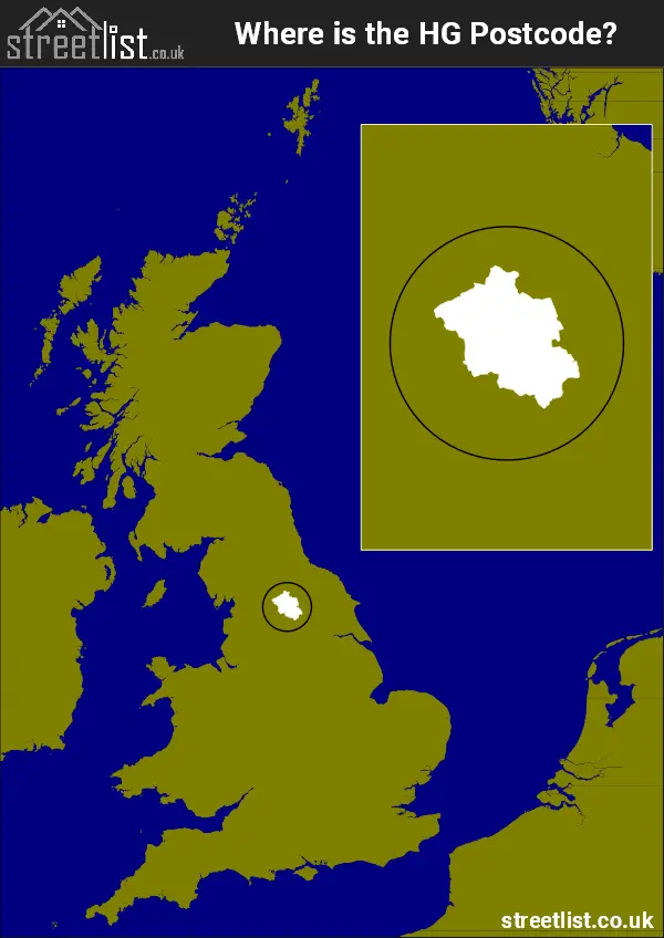
Where is the HG Postcode Area?
The HG Harrogate Postcode is in the Yorkshire and the Humber Region of England.. The postal area borders the following neighbouring postal areas: BD - Bradford, YO - York, DL - Darlington and LS - Leeds, and is located inland.

How built up is the Postcode Area?
I've calculated the total area covered by building footprints within the postcode area.
By analyzing this against the total area, I've determined the percentage of the area that's developed, this will give you an idea of how urban or rural the postcode region is.
The higher the percentage the more urban the area is. For example the least urban district is HG3 and the most urban is HG2.
| Postcode District | Total Area (m²) | Footprint Area (m²) | Built Percentage % |
|---|---|---|---|
| HG3 | 472,521,951 | 2,995,690 | 0.63% |
| HG4 | 368,983,328 | 2,582,402 | 0.70% |
| HG5 | 78,346,394 | 1,346,350 | 1.72% |
| HG1 | 12,782,427 | 1,511,092 | 11.82% |
| HG2 | 12,799,159 | 1,614,745 | 12.62% |
| Total | 945,433,259 (m²) | 10,050,279 (m²) | 1.06% |

A map showing the boundary of HG in relation to other areas
There are 4 towns within the Harrogate postcode area.

| Unit | Area² |
|---|---|
| Hectares | 945,431² |
| Miles | 3,650² |
| Feet | 101,765,247,409² |
| Kilometres | 9,454² |
Postal Delivery Offices Serving the Postcode Area
- Harrogate Delivery Office
- Knaresborough Delivery Office
- Pateley Bridge Scale Payment Delivery Office
- Ripon Delivery Office
- Summerbridge Scale Payment Delivery Office
Tourist Attractions within the Area
We found 6 visitor attractions within the Harrogate postcode area
| Washburn Heritage Centre |
|---|
| Visitor Centres |
| Heritage / Visitor Centre |
| View Washburn Heritage Centre on Google Maps |
| Fountains Abbey |
| Historic Properties |
| Other Historic Property |
| View Fountains Abbey on Google Maps |
| RHS Garden Harlow Carr |
| Gardens |
| Garden |
| View RHS Garden Harlow Carr on Google Maps |
| Markenfield Hall |
| Historic Properties |
| Historic House / House and Garden / Palace |
| View Markenfield Hall on Google Maps |
| Ripon Cathedral |
| Places of Worship |
| Place of Worship (still in use) |
| View Ripon Cathedral on Google Maps |
| Allerton Castle |
| Historic Properties |
| Historic House / House and Garden / Palace |
| View Allerton Castle on Google Maps |
Councils with Postcodes the Area
Towns and Villages within the Area
- Arkendale - village
- Beckwithshaw - village
- Bewerley - village
- Birstwith - village
- Bishop Monkton - village
- Bishop Thornton - village
- Brearton - village
- Burnt Yates - village
- Burton Leonard - village
- Clint - village
- Coneythorpe - village
- Copgrove - village
- Copt Hewick - village
- Dacre - village
- Dacre Banks - village
- Darley - village
- Farnham - village
- Fearby - village
- Ferrensby - village
- Flaxby - village
- Follifoot - village
- Forest Moor - village
- Galphay - village
- Glasshouses - village
- Goldsborough - village
- Grewelthorpe - village
- Hampsthwaite - village
- Harrogate - town
- Hopperton - otherSettlement
- Hutton Conyers - village
- Kettlesing Bottom - village
- Killinghall - village
- Kirkby Malzeard - village
- Kirkby Overblow - village
- Knaresborough - town
- Knox - village
- Laverton - village
- Littlethorpe - village
- Lofthouse - village
- Low Laithe - village
- Markington - village
- Marton-le-Moor - village
- Masham - town
- Melmerby - village
- Nidd - village
- North Stainley - village
- Old Bilton - village
- Pannal - village
- Pateley Bridge - town
- Ripley - village
- Ripon - city
- Sawley - village
- Scotton - village
- Sharow - village
- Shaw Mills - village
- Skelton on Ure - village
- South Stainley - village
- Spofforth - village
- Staupes - otherSettlement
- Staveley - village
- Summerbridge - village
- Thornthwaite - village
- Thornton Steward - village
- Thornton Watlass - village
- Wath - village
- West Tanfield - village
- Wilsill - village
- Winksley - village
- Wormald Green - village