The BD8 8 postcode sector is within the county of West Yorkshire.
Did you know? According to the 2021 Census, the BD8 8 postcode sector is home to a bustling 7,007 residents!
Given that each sector allows for 400 unique postcode combinations. Letters C, I, K, M, O and V are not allowed in the last two letters of a postcode. With 144 postcodes already in use, this leaves 256 units available.
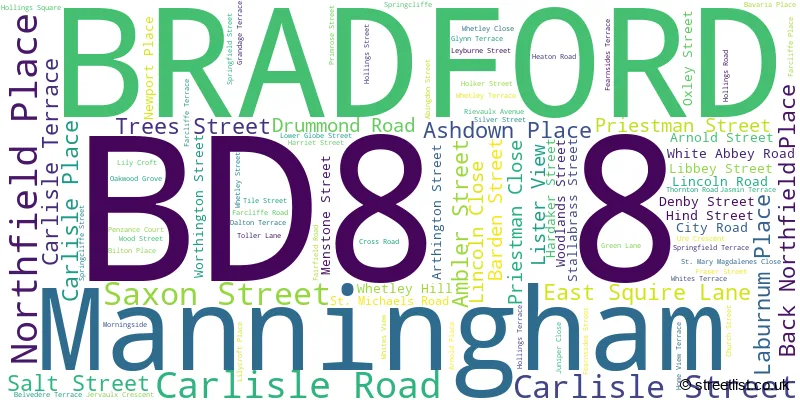
The largest settlements in the BD8 8 postal code are BRADFORD and Manningham.
The BD8 8 Postcode shares a border with BD1 2 (BRADFORD), BD8 7 (BRADFORD, Manningham), BD7 1 (BRADFORD, Great Horton), BD1 3 (BRADFORD), BD7 2 (BRADFORD), BD8 9 (BRADFORD, Manningham) and BD9 5 (BRADFORD).
The sector is within the post town of BRADFORD.
BD8 8 is a postcode sector within the BD8 postcode district which is within the BD Bradford postcode area.
The Royal Mail delivery office for the BD8 8 postal sector is the Bradford North Delivery Office.
The area of the BD8 8 postcode sector is 0.35 square miles which is 0.91 square kilometres or 224.88 square acres.

Map of the BD8 8 Postcode Sector
Explore the BD8 8 postcode sector by using our free interactive map.
| B | D | 8 | - | 8 | X | X |
| B | D | 8 | Space | 8 | Letter | Letter |
Official List of Streets
BRADFORD (86 Streets)
Manningham (4 Streets)
Unofficial Streets or Alternative Spellings
BRADFORD
ABERFORD ROAD AKAM ROAD BROWNROYD STREET GRACECHURCH STREET LILY STREET PRESTON STREET REBECCA STREET ROSE STREET SAPLIN STREET SUNBRIDGE ROAD TRENTON DRIVE WALKER DRIVE WESTGATE ANDERSON STREET ANVIL COURT ANVIL STREET ATLAS STREET BACK SOUTHFIELD SQUARE BACK WHITE ABBEY ROAD SW BACK WOOD STREET CENTURY PLACE CONDUIT STREET FEARNSIDE STREET GAYNOR STREET GLOBE FOLD HOCKNEY ROAD LABURNUM STREET LIBBY STREET MIDDLETON STREET NEWPORT ROAD NOSTELL CLOSE OAKWOOD COURT QURESHI VIEW SCOTTY LANE SPINK PLACE SPINK STREET ST MARYS ROAD WOOD PLACE WOODLANDS COURTManningham
ASHWELL ROADDenholme
THORNTON ROAD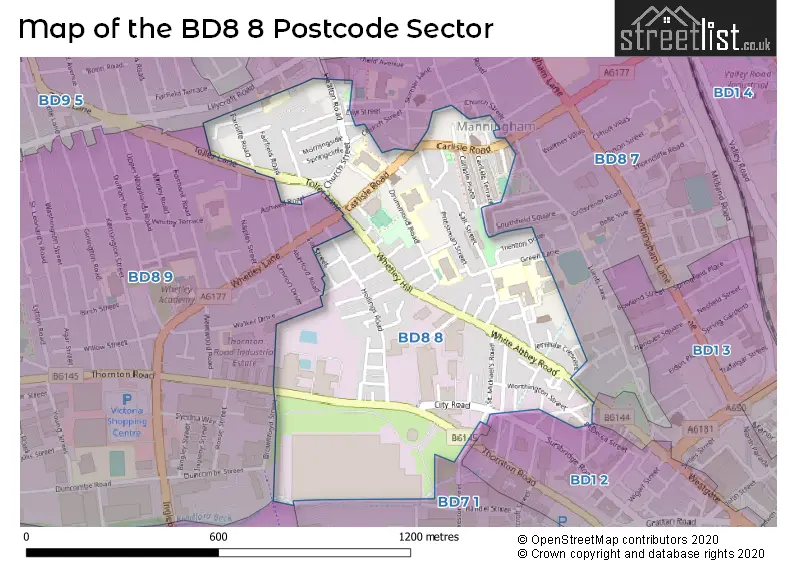
House Prices in the BD8 8 Postcode Sector
| Type of Property | 2018 Average | 2018 Sales | 2017 Average | 2017 Sales | 2016 Average | 2016 Sales | 2015 Average | 2015 Sales |
|---|---|---|---|---|---|---|---|---|
| Detached | £0 | 0 | £0 | 0 | £0 | 0 | £0 | 0 |
| Semi-Detached | £108,000 | 2 | £90,000 | 1 | £133,500 | 2 | £0 | 0 |
| Terraced | £83,370 | 27 | £95,878 | 29 | £75,725 | 20 | £86,159 | 22 |
| Flats | £0 | 0 | £0 | 0 | £35,000 | 1 | £0 | 0 |
Important Postcodes BD8 8 in the Postcode Sector
BD8 8BB is the postcode for Bradford Metropolitan District Council, Manningham Library and One Stop Shop
BD8 8DA is the postcode for NEW BUILDING, Iqra Primary School, Drummond Road, and WHOLE MAIN BUILDING, Iqra Primary School, Drummond Road
BD8 8DB is the postcode for MANNINGHAM SPORTS CENTRE, CARLISLE ROAD
BD8 8DL is the postcode for Atlas Cp, Lincoln Close, and Atlas Community Primary School, Lincoln Close
BD8 8ER is the postcode for Bradford Youth Service, 1 City Road
BD8 8HT is the postcode for Abbey Green Nursery, Green Lane, Green Lane Primary School, Green Lane, PRIESTLEY BUILDING, Green Lane Primary School, Green Lane, and NURSERY BLOCK, Green Lane Primary School, Green Lane
BD8 8HY is the postcode for Dixons Manningham Primary Academy, Wood Street, and Dixons Manningham Primary, Wood Street
BD8 8NL is the postcode for Whetley Hill Resource Centre, 3 Whetley Hill
BD8 8QH is the postcode for Farcliffe & Lilycroft, 56 Toller Lane
BD8 8RA is the postcode for Bradford and Airedale Teaching PCT, Westbourne Green Community Hospital, and Westbourne Green Community Health Care Centre, 50 Heaton Road
BD8 8RE is the postcode for Miriam Lord Community Primary School, Church Street
BD8 8RG is the postcode for Miriam Lord Primary School, Bavaria Place
| The BD8 8 Sector is within these Local Authorities |
|
|---|---|
| The BD8 8 Sector is within these Counties |
|
| The BD8 8 Sector is within these Water Company Areas |
|