Map of North Lodge
| Postcodes | ||
|---|---|---|
| Icon | Postcodes for North Lodge | |
| Walking Distances | ||
| Distance Info | Green Circle = 10 Minutes Walk (800 metres) | |
About North Lodge
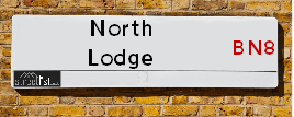
North Lodge is a street located in the village of Newick. It uses the postcode BN8 4LY. The street has a length of approximately 65 metres.
North Lodge is located within the Lewes Council's jurisdiction. They provide various services, like refuse collection, and manage council tax collection. It's situated in the South East region of the UK.
North Lodge is located within the county of East Sussex, situated in the South East region of the UK. It's 36.68 miles South from central London., 7.02 miles North from Lewes, 12.65 miles North East from Brighton and 30.18 miles South West from Maidstone.

Do you know why this road is called North Lodge?
What's it like to live here?
Ask the community a question about North Lodge.
Do you have any questions, memories to share or know any facts about North Lodge? We'd love to know more.
Also on streetlist.co.uk, can you help?
Swing Swang Lane
28th April 2024
I am trying to find out why the lane is named Swing Swang?
It has been known known this since at least 1905 when hedge making contents used to be held here.
Swing Swang is often used to describe a fairground ride. I remember Swing Boats. Were they a bit like this or is Swing Swang another name for swings?
Swing Swangs are also mentioned in connection to orchards. Or were orchards just good places to have swings?
Estate Agents near North Lodge
| Name | Address | Website |
|---|---|---|
| Mansell McTaggart | The Green, Newick, BN8 4LA | Visit Website |
| Duke Letting | 94B High Street, Uckfield, TN22 1PU | Visit Website |
| Freeman Forman | 94D High Street Uckfield TN22 1PU | Visit Website |
We have found 1 postcode for North Lodge
Location Details
| North Lodge | |
|---|---|

| |
| Latitude | 50.974992 |
| Longitude | 0.015643 |
| OS Easting (X): | 541493 |
| OS Northing (Y): | 121503 |
| OS Grid Reference: | TQ415215 |
Neighbourhood Policing |
| Police Force: Sussex |
 View Neighbourhood Crime and Policing View Neighbourhood Crime and Policing |
| Find a Local Neighbourhood Watch Scheme |
Frequently asked Questions for North Lodge
What Council (Local Authority) is North Lodge in?
North Lodge is located within the local authority area of Lewes Council which is a District Council.
What Parish Council is North Lodge in?
North Lodge is located within the area of Newick Parish Council.
What Electoral Ward is North Lodge in?
North Lodge is located within the ward of Newick.
What County is North Lodge in?
North Lodge is located within the ceremonial county of East Sussex.
What Constituency is North Lodge in?
North Lodge is located within the constituency of Lewes.
What Part of the UK is North Lodge in?
North Lodge is located within the South East (England) region of the United Kingdom.
What County Council area is North Lodge in?
North Lodge is located within the East Sussex Council area.
What Police Force area is North Lodge in?
North Lodge is located within the Sussex Police area.
Roads that have a Junction with North Lodge
| Street | Junction Type |
|---|---|
| Western Road (A272) | junction |
Sunset and Sunrise times for North Lodge , BN8 4LY
| Sunrise | 05:11 |
|---|---|
| Sunset | 20:40 |
Latest Weather Conditions for North Lodge, BN8 4LY
| Observed at Weather Station: | Herstmonceux West End 12 May 2024 at 17:00 (14.46 miles away) |
|---|---|
| Current Weather: | Sunny day |
| Temperature and Humidity: | 20.3°C (59.1%) |
| Wind Direction and Speed: | S (2 mph) |
Population Statistics
| ONS Area Code | E00106922 |
|---|---|
| ONS Area Name | Industrious Transitions |
| Average Age | 44.55 |
| Area Population | 1190.00 |
| Male Population | 601.00 (51%) |
| Female Population | 589.00 (49%) |
| Benefit Claimants | 7 (1%) |
| LSOA Code: | E01021053 |
|---|---|
| LSOA Name: | Lewes 001E |
| SOA Code: | 2b |
| SOA Name: | |
| MSOA Code: | E02004379 |
| MSOA Name: | Lewes 001 |
Nearest Supermarkets
| Tesco Uckfield Superstore |
|---|
| Bell Farm Rd, Uckfield, TN22 1BA |
| 0345 677 9689 |
| Distance: 3.44 Miles |
| Directions from North Lodge to Tesco Uckfield Superstore |
| Waitrose Uckfield |
|---|
| 96-98 High Street, Uckfield, East Sussex, TN22 1PU |
| 01825 763221 |
| Distance: 3.53 Miles |
| Directions from North Lodge to Waitrose Uckfield |
| Tesco Uckfield Browns Ln Express |
|---|
| 31-33 Browns Ln, Uckfield, TN22 1UN |
| 0345 671 9264 |
| Distance: 3.85 Miles |
| Directions from North Lodge to Tesco Uckfield Browns Ln Express |
| Tesco Haywards Heath Walnut Park Express |
|---|
| Walnut Park, Northlands Avenue, Haywards Heath, RH16 3TG |
| 0345 610 6725 |
| Distance: 4.48 Miles |
| Directions from North Lodge to Tesco Haywards Heath Walnut Park Express |
Telephone Information
| Area Code |
|---|
| Area Code: 01825 - Uckfield |
| Area Code: 01444 - Haywards Heath |
Broadband Information
| Speed | Average Speed | Median Speed | Maximum Speed | Next-generation access (NGA) | Number of Connections |
|---|---|---|---|---|---|
| Greater than 2 Mbps | 14.5 | 15.6 | 20.4 | N | 5 |
Local Government
| Local Council Details |
|---|
| Within the area of Lewes |
| Visit the Council's Website |
| 32 High Street, Lewes, East Sussex &BN7 2LX |
| Send email |
| Telephone Number: 01273 471 600 |
| Local Member of Parliament |
|---|
| Within the Westminster Parliamentary Constituency of Lewes |
| The Member of Parliament is Maria Caulfield |
| Details for the MP Maria Caulfield on parliament.uk |
| Details for the MP Maria Caulfield on theyworkforyou.com |
| In the 2019 General Election Maria Caulfield won with a majority of 2,457 the result was Con hold. The total electorate was 71,503 |
| Wards, Parish Councils and County Councils |
|---|
| Ward: Newick Ward |
| Ceremonial County: East Sussex |
Nearest Schools
England Primary Schools
Newick Church of England Primary School
Address: Newick Church of England Primary School, 63 Allington Road, Newick, Lewes, East Sussex, BN8 4NB
Distance: 0.30 miles
Contact: 01825723377
Chailey St Peter's Church of England Primary School
Address: Chailey St Peter's Church of England Primary School, Chailey St Peter's Ce Primary School, East Grinstead Road, North Chailey, Lewes, East Sussex, BN8 4DB
Distance: 1.87 miles
Contact: 01825722939
Nearest Hospitals
| Name | Address | Postcode | Distance | Map |
|---|
Nearest Dentists
Dentists near North Lodge
| Name | Address | Postcode | Distance | Map |
|---|
Nearest GP Surgeries
Doctors near North Lodge
MID DOWNS MEDICAL PRACTICE
Address: MARBLES ROAD, NEWICK, LEWES, EAST SUSSEX, BN8 4LR
Distance: 0.11 miles
Contact: tel: 01825 722272
MID DOWNS MEDICAL PRACTICE
Address: MARBLES ROAD, NEWICK, LEWES, BN8 4LR
Distance: 0.11 miles
Contact: :
SOUTH CHAILEY SURGERY
Address: MILL LANE, SOUTH CHAILEY, LEWES, EAST SUSSEX, BN8 4PY
Distance: 3.31 miles
Contact: tel: 01273 892999
THE MEADS SURGERY
Address: BELL FARM ROAD, UCKFIELD, EAST SUSSEX, TN22 1BA
Distance: 3.33 miles
Contact: tel: 01825 766055
THE MEADS MEDICAL CENTRE - COVID LOCAL VACCINATION SERVICE 2
Address: BELL FARM ROAD, NEWICK, UCKFIELD, TN22 1BA
Distance: 3.33 miles
Contact: :
BIRD-IN-EYE SURGERY
Address: UCKFIELD COMMUNITY HOSPITAL, FRAMFIELD ROAD, UCKFIELD, EAST SUSSEX, TN22 5AW
Distance: 3.97 miles
Contact: tel: 01825 763196
Nearest Dispensing Chemists
Pharmacies near North Lodge
| Name | Address | Postcode | Telephone | Map | Distance in Km |
|---|
Nearest Opticians
Opticians near North Lodge
VISION EXPRESS - UCKFIELD
Address: 27 HIGH STREET, UCKFIELD, TN22 1AG
Distance: 3.51 miles
Contact: :
BARRACLOUGH & STILES OPTICIANS (UCKFIELD)
Address: 53 HIGH STREET, UCKFIELD, EAST SUSSEX, TN22 1AP
Distance: 3.51 miles
Contact: :
SPECSAVERS (UCKFIELD)
Address: 100 HIGH STREET, UCKFIELD, EAST SUSSEX, TN22 1PX
Distance: 3.53 miles
Contact: :
LINDFIELD EYECARE
Address: 53 HIGH STREET, LINDFIELD, HAYWARDS HEATH, WEST SUSSEX, RH16 2HN
Distance: 4.97 miles
Contact: :
SCRIVENS OPTICIANS (HAYWARDS HEATH)
Address: 86 SOUTH ROAD, HAYWARDS HEATH, WEST SUSSEX, RH16 4LA
Distance: 5.32 miles
Contact: :
SPECSAVERS (HAYWARDS HEATH)
Address: 89 SOUTH ROAD, HAYWARDS HEATH, WEST SUSSEX, RH16 4LQ
Distance: 5.34 miles
Contact: :
Transport
Nearest Rail Stations
Uckfield Station is 3.54 miles away.
Address: Uckfield station, New Town, Uckfield, East Sussex, TN22 5DL
Uckfield is situated on the Oxted Line and is managed by Southern.
Uckfield Station is staffed on a part time basis.
Plumpton Station is 4.60 miles away.
Address: Plumpton station, Station Road, Plumpton Green, East Sussex, BN7 3DB
Plumpton is situated on the East Coastway Line and is managed by Southern.
Plumpton Station is staffed on a part time basis.