The CF63 1 postcode sector is within the county of South Glamorgan.
Did you know? According to the 2021 Census, the CF63 1 postcode sector is home to a bustling 8,962 residents!
Given that each sector allows for 400 unique postcode combinations. Letters C, I, K, M, O and V are not allowed in the last two letters of a postcode. With 183 postcodes already in use, this leaves 217 units available.
The CF63 1 postal code covers the settlement of BARRY.
The CF63 1 Postcode shares a border with CF5 6 (ST FAGANS, WENVOE, CREIGIAU), CF62 8 (BARRY), CF63 4 (BARRY), CF62 9 (BARRY), CF63 2 (BARRY), CF63 3 (BARRY) and CF64 4 (DINAS POWYS, MICHAELSTON LE PIT).
The sector is within the post town of BARRY.
CF63 1 is a postcode sector within the CF63 postcode district which is within the CF Cardiff postcode area.
The Royal Mail delivery office for the CF63 1 postal sector is the Barry Delivery Office.
The area of the CF63 1 postcode sector is 1.26 square miles which is 3.27 square kilometres or 807.35 square acres.

Map of the CF63 1 Postcode Sector
Explore the CF63 1 postcode sector by using our free interactive map.
| C | F | 6 | 3 | - | 1 | X | X |
| C | F | 6 | 3 | Space | 1 | Letter | Letter |
Official List of Streets
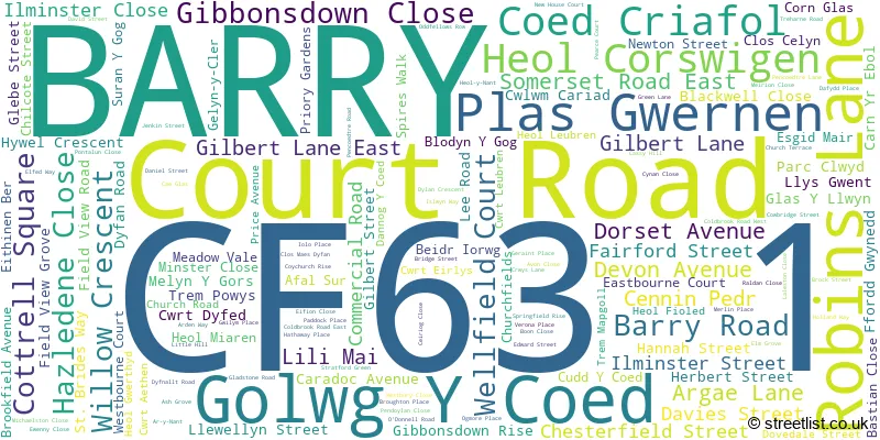
BARRY (139 Streets)
Unofficial Streets or Alternative Spellings
BARRY
ABERAERON CLOSE BELMONT STREET BEVERLEY STREET CAWLEY PLACE DOBBINS ROAD EVERARD STREET GELYN-Y-CL�R HEOL-Y-NANT KENILWORTH ROAD LANGLANDS ROAD MAPLE CLOSE MOUNT PLEASANT MYRTLE GROVE POPLAR COURT POWIS VIEW RAMSEY ROAD SEA VIEW TERRACE SKOMER ROAD SYCAMORE CRESCENT TYDFIL STREET VICTORIA PARK ROAD VINCENT CLOSE WYND STREET AR Y NANT BARRY DOCKS LINK ROAD CARN-YR-EBOL FFORDD GWYNETH GILBERT LANE WEST GLENCOE STREET HEBBLES LANE HEOL GORSWIGEN PORT ROAD CYCLEWAY ROBINS COURT SONSEIL LANE SURAN-Y-GOG TREM Y COED WILLOWS CRESCENTDINAS POWYS
WESTRAWenvoe
PORT ROAD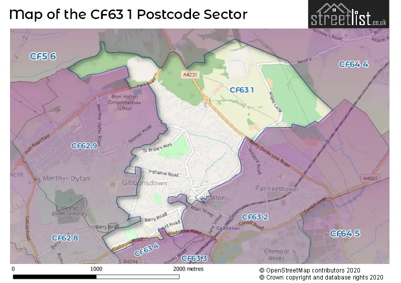
House Prices in the CF63 1 Postcode Sector
| Type of Property | 2018 Average | 2018 Sales | 2017 Average | 2017 Sales | 2016 Average | 2016 Sales | 2015 Average | 2015 Sales |
|---|---|---|---|---|---|---|---|---|
| Detached | £250,015 | 49 | £251,820 | 57 | £219,609 | 44 | £208,583 | 29 |
| Semi-Detached | £161,439 | 42 | £162,017 | 37 | £148,076 | 47 | £149,656 | 31 |
| Terraced | £124,440 | 49 | £116,132 | 73 | £112,171 | 75 | £109,803 | 64 |
| Flats | £145,250 | 2 | £0 | 0 | £83,000 | 2 | £97,500 | 2 |
Important Postcodes CF63 1 in the Postcode Sector
CF63 1BL is the postcode for St Richard Gwyn Rc High School, Argae Lane, St. Richard Gwyn RC High School, Argae Lane, and MATHS BLOCK, St. Richard Gwyn RC High School, Argae Lane
CF63 1DG is the postcode for Jenner Park Junior & Infant School, Hannah Street, INFANT SCHOOL, Jenner Park Junior & Infant School, Hannah Street, JUNIOR SCHOOL, Jenner Park Junior & Infant School, Hannah Street, and Jenner Park Junior And Infant School, Hannah Street
CF63 1DT is the postcode for Ysgol Maes Dyfan, Gibbonsdown Rise
CF63 1DU is the postcode for Ty Dyfan, St. Brides Way
CF63 1NH is the postcode for Barry Social Services, Ty Genner, Gladstone Road, and Flying Start Family Centre, Gladstone Road
CF63 1TD is the postcode for South Wales Police, Gladstone Road
| The CF63 1 Sector is within these Local Authorities |
|
|---|---|
| The CF63 1 Sector is within these Counties |
|
| The CF63 1 Sector is within these Water Company Areas |
|