The CH60 4 postcode sector is within the county of Merseyside.
Did you know? According to the 2021 Census, the CH60 4 postcode sector is home to a bustling 968 residents!
Given that each sector allows for 400 unique postcode combinations. Letters C, I, K, M, O and V are not allowed in the last two letters of a postcode. With 38 postcodes already in use, this leaves 362 units available.
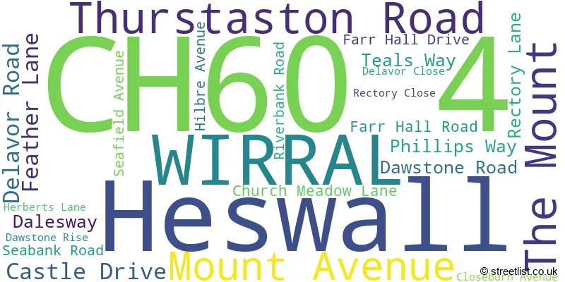
The largest settlements in the CH60 4 postal code are WIRRAL and Heswall.
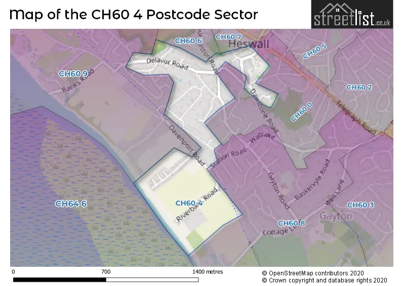
The CH60 4 Postcode shares a border with CH60 8 (WIRRAL, Heswall), CH60 0 (WIRRAL, Heswall), CH60 6 (WIRRAL, Heswall), CH60 7 (Heswall, WIRRAL) and CH60 9 (Heswall, WIRRAL).
The sector is within the post town of WIRRAL.
CH60 4 is a postcode sector within the CH6 postcode district which is within the CH Chester postcode area.
The Royal Mail delivery office for the CH60 4 postal sector is the unknown.
The area of the CH60 4 postcode sector is 0.28 square miles which is 0.73 square kilometres or 180.98 square acres.

Map of the CH60 4 Postcode Sector
Explore the CH60 4 postcode sector by using our free interactive map.
| C | H | 6 | 0 | - | 4 | X | X |
| C | H | 6 | 0 | Space | 4 | Letter | Letter |
Official List of Streets
Heswall (7 Streets)
WIRRAL (16 Streets)
Unofficial Streets or Alternative Spellings
Schools and Places of Education Within the CH60 4 Postcode Sector
Heswall St Peter's CofE Primary School
Voluntary aided school
Thurstaston Road, Wirral, Merseyside, CH60 4SA
Head: Headteacher Michael Parry
Ofsted Rating: Good
Inspection: 2019-01-22 (1956 days ago)
Website: Visit Heswall St Peter's CofE Primary School Website
Phone: 01513422556
Number of Pupils: 328
House Prices in the CH60 4 Postcode Sector
| Type of Property | 2018 Average | 2018 Sales | 2017 Average | 2017 Sales | 2016 Average | 2016 Sales | 2015 Average | 2015 Sales |
|---|---|---|---|---|---|---|---|---|
| Detached | £550,115 | 13 | £523,857 | 21 | £466,800 | 15 | £477,313 | 8 |
| Semi-Detached | £699,950 | 1 | £377,333 | 6 | £336,742 | 6 | £333,136 | 7 |
| Terraced | £0 | 0 | £409,333 | 3 | £0 | 0 | £0 | 0 |
| Flats | £213,750 | 4 | £195,700 | 5 | £234,000 | 5 | £120,000 | 1 |
Important Postcodes CH60 4 in the Postcode Sector
CH60 4SA is the postcode for ST PETERS C E PRIMARY SCHOOL, THURSTASTON ROAD, and St. Peters C of E Primary School, 83 Thurstaston Road
| The CH60 4 Sector is within these Local Authorities |
|
|---|---|
| The CH60 4 Sector is within these Counties |
|
| The CH60 4 Sector is within these Water Company Areas |
|