The CH64 1 postcode sector stands on the Cheshire and Merseyside border.
Did you know? According to the 2021 Census, the CH64 1 postcode sector is home to a bustling 1,316 residents!
Given that each sector allows for 400 unique postcode combinations. Letters C, I, K, M, O and V are not allowed in the last two letters of a postcode. With 63 postcodes already in use, this leaves 337 units available.
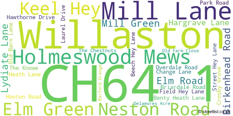
The CH64 1 postal code covers the settlement of Willaston.
The CH64 1 Postcode shares a border with CH63 4 (WIRRAL, Thornton Hough), CH66 7 (Hooton, Childer Thornton), CH66 6 (Hooton), CH62 9 (WIRRAL, Eastham), CH63 0 (WIRRAL, Bromborough, Raby Mere), CH64 2 (Willaston) and CH64 7 (NESTON).
The sector is within the post town of NESTON.
CH64 1 is a postcode sector within the CH6 postcode district which is within the CH Chester postcode area.
The Royal Mail delivery office for the CH64 1 postal sector is the unknown.
The area of the CH64 1 postcode sector is 1.88 square miles which is 4.87 square kilometres or 1,203.52 square acres.
The CH64 1 postcode sector is crossed by the M53 motorway.

Map of the CH64 1 Postcode Sector
Explore the CH64 1 postcode sector by using our free interactive map.
| C | H | 6 | 4 | - | 1 | X | X |
| C | H | 6 | 4 | Space | 1 | Letter | Letter |
Official List of Streets
Willaston (29 Streets)
Unofficial Streets or Alternative Spellings
WIRRAL
EASTHAM RAKE RABY HALL ROAD WILLOWBROW ROADWillaston
OLD VICARAGE ROAD PEMBERTON CLOSE THE COURTYARD BRUNCHION HEATH LANE OVERDALE SANDY HOLE LANE WIRRAL WAY WOOD LANEHooton
BENTY HEATH LANE HOOTON ROADChilder Thornton
HEATH LANEThornton Hough
WILLASTON ROADNESTON
BLUEBELL LANE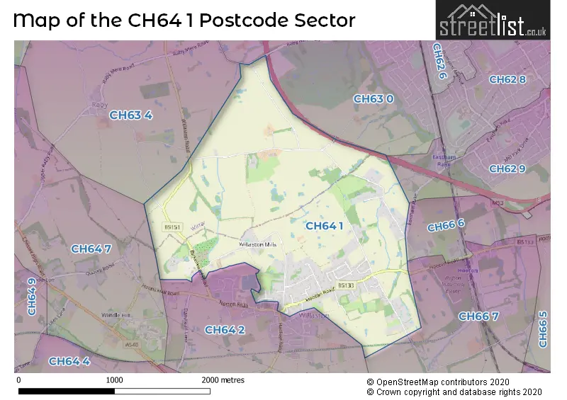
House Prices in the CH64 1 Postcode Sector
| Type of Property | 2018 Average | 2018 Sales | 2017 Average | 2017 Sales | 2016 Average | 2016 Sales | 2015 Average | 2015 Sales |
|---|---|---|---|---|---|---|---|---|
| Detached | £508,648 | 14 | £550,393 | 14 | £427,679 | 14 | £428,200 | 19 |
| Semi-Detached | £350,333 | 3 | £321,667 | 3 | £252,250 | 4 | £289,250 | 4 |
| Terraced | £218,000 | 1 | £195,943 | 4 | £192,250 | 2 | £0 | 0 |
| Flats | £0 | 0 | £175,000 | 1 | £191,678 | 2 | £0 | 0 |
| The CH64 1 Sector is within these Local Authorities |
|
|---|---|
| The CH64 1 Sector is within these Counties |
|
| The CH64 1 Sector is within these Water Company Areas |
|