The CH64 4 postcode sector is within the county of Cheshire.
Did you know? According to the 2021 Census, the CH64 4 postcode sector is home to a bustling 2,315 residents!
Given that each sector allows for 400 unique postcode combinations. Letters C, I, K, M, O and V are not allowed in the last two letters of a postcode. With 78 postcodes already in use, this leaves 322 units available.
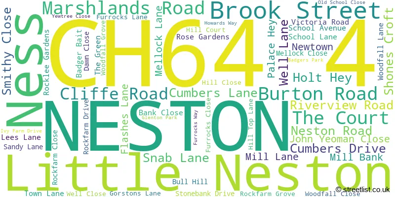
The largest settlements in the CH64 4 postal code are Little Neston and Ness.
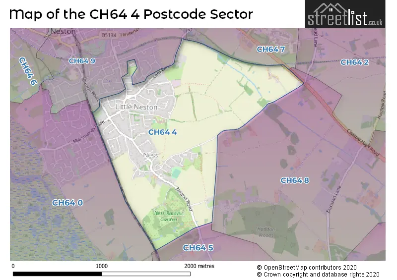
The CH64 4 Postcode shares a border with CH64 5 (Burton, Puddington), CH64 9 (NESTON, Little Neston), CH64 0 (NESTON, Little Neston, Burton), CH64 7 (NESTON) and CH64 8 (Burton, Ness).
The sector is within the post town of NESTON.
CH64 4 is a postcode sector within the CH6 postcode district which is within the CH Chester postcode area.
The Royal Mail delivery office for the CH64 4 postal sector is the unknown.
The area of the CH64 4 postcode sector is 1.06 square miles which is 2.76 square kilometres or 681.15 square acres.

Map of the CH64 4 Postcode Sector
Explore the CH64 4 postcode sector by using our free interactive map.
| C | H | 6 | 4 | - | 4 | X | X |
| C | H | 6 | 4 | Space | 4 | Letter | Letter |
Official List of Streets
Little Neston (34 Streets)
NESTON (2 Streets)
Ness (20 Streets)
Unofficial Streets or Alternative Spellings
Schools and Places of Education Within the CH64 4 Postcode Sector
Woodfall Primary School
Community school
Woodfall Lane, Neston, Cheshire, CH64 4BT
Head: Mrs Helen Hough
Ofsted Rating: Outstanding
Inspection: 2014-11-19 (3480 days ago)
Website: Visit Woodfall Primary School Website
Phone: 01518325020
Number of Pupils: 486
House Prices in the CH64 4 Postcode Sector
| Type of Property | 2018 Average | 2018 Sales | 2017 Average | 2017 Sales | 2016 Average | 2016 Sales | 2015 Average | 2015 Sales |
|---|---|---|---|---|---|---|---|---|
| Detached | £377,300 | 10 | £348,230 | 15 | £356,218 | 23 | £292,159 | 28 |
| Semi-Detached | £199,286 | 7 | £192,164 | 18 | £187,491 | 11 | £188,889 | 18 |
| Terraced | £157,000 | 7 | £156,735 | 17 | £171,188 | 8 | £162,308 | 13 |
| Flats | £123,000 | 1 | £0 | 0 | £85,000 | 2 | £102,500 | 2 |
Important Postcodes CH64 4 in the Postcode Sector
CH64 4AY is the postcode for ROSES TEA ROOMS INFORMATION AND VISITORS CENTRE, University of Liverpool, Ness Gardens, Neston Road, and Mickwell Brow, Neston Road
CH64 4BN is the postcode for Neston Surgery, Mellock Lane
CH64 4BT is the postcode for INFANTS BUILDING, Woodfall Primary School, Woodfall Lane, and JUNIORS BUILDING, Woodfall Primary School, Woodfall Lane
| The CH64 4 Sector is within these Local Authorities |
|
|---|---|
| The CH64 4 Sector is within these Counties |
|
| The CH64 4 Sector is within these Water Company Areas |
|
Tourist Attractions within the CH64 4 Postcode Area
We found 1 visitor attractions within the CH6 postcode area
| Ness Botanic Gardens |
|---|
| Gardens |
| Garden |
| View Ness Botanic Gardens on Google Maps |