The CH65 1 postcode sector stands on the Cheshire and Merseyside border.
Did you know? According to the 2021 Census, the CH65 1 postcode sector is home to a bustling 67 residents!
Given that each sector allows for 400 unique postcode combinations. Letters C, I, K, M, O and V are not allowed in the last two letters of a postcode. With 18 postcodes already in use, this leaves 382 units available.
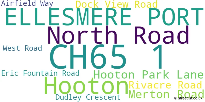
The largest settlements in the CH65 1 postal code are ELLESMERE PORT and Hooton.
The CH65 1 Postcode shares a border with CH66 5 (Childer Thornton, Little Sutton, Hooton), CH65 2 (ELLESMERE PORT), CH65 3 (ELLESMERE PORT), CH65 4 (ELLESMERE PORT), CH66 1 (ELLESMERE PORT, Little Sutton, Childer Thornton), CH62 0 (WIRRAL, Eastham) and CH62 9 (WIRRAL, Eastham).
The sector is within the post town of ELLESMERE PORT.
CH65 1 is a postcode sector within the CH6 postcode district which is within the CH Chester postcode area.
The Royal Mail delivery office for the CH65 1 postal sector is the unknown.
The area of the CH65 1 postcode sector is 1.66 square miles which is 4.31 square kilometres or 1,064.75 square acres.
The CH65 1 postcode sector is crossed by the M53 motorway.
Waterways within the CH65 1 postcode sector include the Manchester Ship Canal.

Map of the CH65 1 Postcode Sector
Explore the CH65 1 postcode sector by using our free interactive map.
| C | H | 6 | 5 | - | 1 | X | X |
| C | H | 6 | 5 | Space | 1 | Letter | Letter |
Official List of Streets
Hooton (6 Streets)
Unofficial Streets or Alternative Spellings
ELLESMERE PORT
NETHERPOOL ROAD POOLE HALL ROADHooton
HOOTON LANEWIRRAL
BANKFIELDS DRIVE EASTHAM INTERCHANGE NETHERPOOL ROAD INTERCHANGE SOUTH ROAD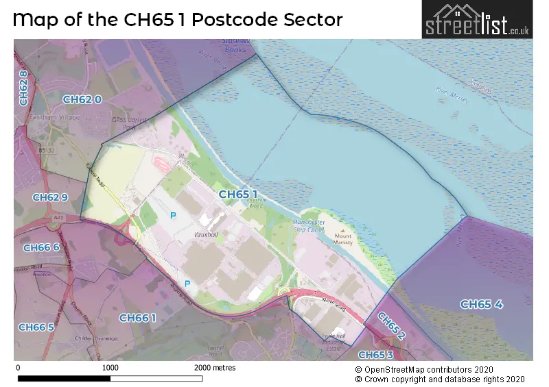
House Prices in the CH65 1 Postcode Sector
| Type of Property | 2018 Average | 2018 Sales | 2017 Average | 2017 Sales | 2016 Average | 2016 Sales | 2015 Average | 2015 Sales |
|---|---|---|---|---|---|---|---|---|
| Detached | £0 | 0 | £0 | 0 | £0 | 0 | £0 | 0 |
| Semi-Detached | £141,250 | 4 | £0 | 0 | £134,000 | 2 | £0 | 0 |
| Terraced | £0 | 0 | £0 | 0 | £0 | 0 | £0 | 0 |
| Flats | £0 | 0 | £0 | 0 | £0 | 0 | £0 | 0 |
| The CH65 1 Sector is within these Local Authorities |
|
|---|---|
| The CH65 1 Sector is within these Counties |
|
| The CH65 1 Sector is within these Water Company Areas |
|