The CH64 2 postcode sector is within the county of Cheshire.
Did you know? According to the 2021 Census, the CH64 2 postcode sector is home to a bustling 1,291 residents!
Given that each sector allows for 400 unique postcode combinations. Letters C, I, K, M, O and V are not allowed in the last two letters of a postcode. With 54 postcodes already in use, this leaves 346 units available.
The CH64 2 postal code covers the settlement of Willaston.
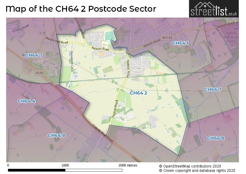
The CH64 2 Postcode shares a border with CH66 7 (Hooton, Childer Thornton), CH66 8 (Ledsham, Little Sutton), CH64 1 (Willaston), CH64 7 (NESTON) and CH64 8 (Burton, Ness).
The sector is within the post town of NESTON.
CH64 2 is a postcode sector within the CH64 postcode district which is within the CH Chester postcode area.
The Royal Mail delivery office for the CH64 2 postal sector is the Neston Delivery Office.
The area of the CH64 2 postcode sector is 1.18 square miles which is 3.05 square kilometres or 752.62 square acres.

Map of the CH64 2 Postcode Sector
Explore the CH64 2 postcode sector by using our free interactive map.
| C | H | 6 | 4 | - | 2 | X | X |
| C | H | 6 | 4 | Space | 2 | Letter | Letter |
Official List of Streets
Willaston (30 Streets)
Unofficial Streets or Alternative Spellings
Schools and Places of Education Within the CH64 2 Postcode Sector
Willaston CofE Primary School
Voluntary controlled school
Neston Road, Neston, Cheshire, CH64 2TN
Head: Acting Headteacher Gary Graham
Ofsted Rating: Good
Inspection: 2022-12-01 (538 days ago)
Website: Visit Willaston CofE Primary School Website
Phone: 01518325360
Number of Pupils: 208
House Prices in the CH64 2 Postcode Sector
| Type of Property | 2018 Average | 2018 Sales | 2017 Average | 2017 Sales | 2016 Average | 2016 Sales | 2015 Average | 2015 Sales |
|---|---|---|---|---|---|---|---|---|
| Detached | £346,329 | 12 | £276,685 | 13 | £307,222 | 9 | £302,564 | 7 |
| Semi-Detached | £239,317 | 6 | £324,250 | 6 | £319,814 | 7 | £250,279 | 7 |
| Terraced | £218,975 | 2 | £240,750 | 6 | £244,871 | 7 | £267,833 | 6 |
| Flats | £135,000 | 1 | £158,750 | 2 | £233,700 | 5 | £0 | 0 |
Important Postcodes CH64 2 in the Postcode Sector
CH64 2TN is the postcode for Willaston C of E Primary School, Neston Road, and WILLASTON CHURCH OF ENGLAND PRIMARY SCHOOL, NESTON ROAD, WILLASTON
| The CH64 2 Sector is within these Local Authorities |
|
|---|---|
| The CH64 2 Sector is within these Counties |
|
| The CH64 2 Sector is within these Water Company Areas |
|