The CW11 4 postcode sector is within the county of Cheshire.
Did you know? According to the 2021 Census, the CW11 4 postcode sector is home to a bustling 7,029 residents!
Given that each sector allows for 400 unique postcode combinations. Letters C, I, K, M, O and V are not allowed in the last two letters of a postcode. With 197 postcodes already in use, this leaves 203 units available.
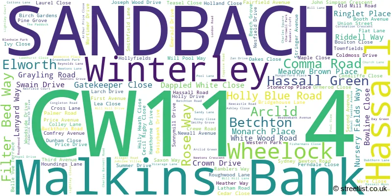
The largest settlement in the CW11 4 postal code is SANDBACH followed by Winterley, and Malkins Bank.
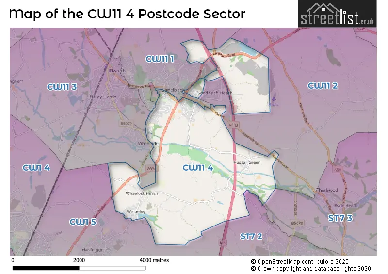
The CW11 4 Postcode shares a border with ST7 2 (Alsager), ST7 3 (Scholar Green, Church Lawton, Rode Heath), CW11 2 (SANDBACH, Smallwood, Arclid), CW1 5 (CREWE, Haslington, Oakhanger), CW11 1 (SANDBACH, Brereton, Bradwall) and CW11 3 (SANDBACH, Elworth, Moston).
The sector is within the post town of SANDBACH.
CW11 4 is a postcode sector within the CW11 postcode district which is within the CW Crewe postcode area.
The Royal Mail delivery office for the CW11 4 postal sector is the Sandbach Delivery Office.
The area of the CW11 4 postcode sector is 6.57 square miles which is 17.02 square kilometres or 4,204.66 square acres.
The CW11 4 postcode sector is crossed by the M6 motorway.
Waterways within the CW11 4 postcode sector include the Trent and Mersey Canal, River Wheelock, Fowler Brook.

Map of the CW11 4 Postcode Sector
Explore the CW11 4 postcode sector by using our free interactive map.
| C | W | 1 | 1 | - | 4 | X | X |
| C | W | 1 | 1 | Space | 4 | Letter | Letter |
Official List of Streets
Hassall (5 Streets)
Winterley (28 Streets)
Arclid (2 Streets)
SANDBACH (88 Streets)
Betchton (4 Streets)
Malkins Bank (6 Streets)
Hassall Green (3 Streets)
Wheelock (3 Streets)
Unofficial Streets or Alternative Spellings
Church Lawton
BETCHTON LANE ASHFIELD WAY BROOK WOOD TRAIL BROOKHOUSE ROAD CORONATION WOOD TRAIL COTTON LANE DAYGREEN LANE DEAN HILL ROAD FRANK KEATING CLOSE FREDERICK HOWARTH WAY HASLINGTON BYPASS HEMMINGSHAW LANE HOOD LANE KENTS GREEN LANE LONGCROFT BRIDGE MILLPOOL WAY RIDELL WAY ROADCHEF SANDBACH SERVICES ROUGHWOOD HOLLOW SANDBACH INTERCHANGE SANDBACH SERVICES SOUTHBOUND ST MARYS DELL TRAIL STANNERHOUSE LANE THE SALT LINE TOWN FIELDS WHEELOCK BYPASS WHEELOCK RAIL TRAIL ZAN INDUSTRIAL ESTATEAlsager
HASSALL ROADSANDBACH
BATH STREET BROOK COURT FIELDS DRIVE HIND HEATH LANE HOLMES CHAPEL ROAD PARK HOUSE DRIVE PARK LANE THE HILLBetchton
CAPPERS LANE NEW INN LANEHaslington
CLAY LANE GEORGE GALLIMORE DRIVECrewe Green
CREWE ROADSchools and Places of Education Within the CW11 4 Postcode Sector
Sandbach Primary Academy
Academy converter
Crewe Road, Sandbach, Cheshire, CW11 4NS
Head: Mrs Claire Caldwell
Ofsted Rating: Good
Inspection: 2023-02-15 (463 days ago)
Website: Visit Sandbach Primary Academy Website
Phone: 01270918922
Number of Pupils: 133
House Prices in the CW11 4 Postcode Sector
| Type of Property | 2018 Average | 2018 Sales | 2017 Average | 2017 Sales | 2016 Average | 2016 Sales | 2015 Average | 2015 Sales |
|---|---|---|---|---|---|---|---|---|
| Detached | £285,069 | 94 | £303,600 | 52 | £277,639 | 56 | £280,486 | 54 |
| Semi-Detached | £187,796 | 49 | £178,796 | 64 | £184,555 | 39 | £164,644 | 36 |
| Terraced | £166,264 | 30 | £181,219 | 24 | £140,571 | 17 | £149,859 | 29 |
| Flats | £92,957 | 7 | £94,853 | 11 | £107,863 | 4 | £122,667 | 3 |
Important Postcodes CW11 4 in the Postcode Sector
CW11 4NE is the postcode for Cheshire County Council, Sandbach House, 36 Crewe Road
CW11 4NS is the postcode for Sandbach Primary Academy, Crewe Road
CW11 4PY is the postcode for Wheelock Primary School, Crewe Road
| The CW11 4 Sector is within these Local Authorities |
|
|---|---|
| The CW11 4 Sector is within these Counties |
|
| The CW11 4 Sector is within these Water Company Areas |
|