This section of the site is all about the CW Postcode area, also known as the Crewe Postal Area. Explore links to the next level to learn more about specific postcode districts such as CW1.
The CW postcode area represents a group of postal districts in the Crewe area of the United Kingdom. The area code CW stands for the letters c and w in CreWe. CW has a population of 309,489 and covers an area of 932,734 hectares. Fun fact: 0.48% of the population of Great Britain lives in this area.
The postcode area falls within the following counties: Cheshire (97.84%), Staffordshire (1.79%), Shropshire (0.37%).
Post Towns and Postcode Districts for the CW Postcode
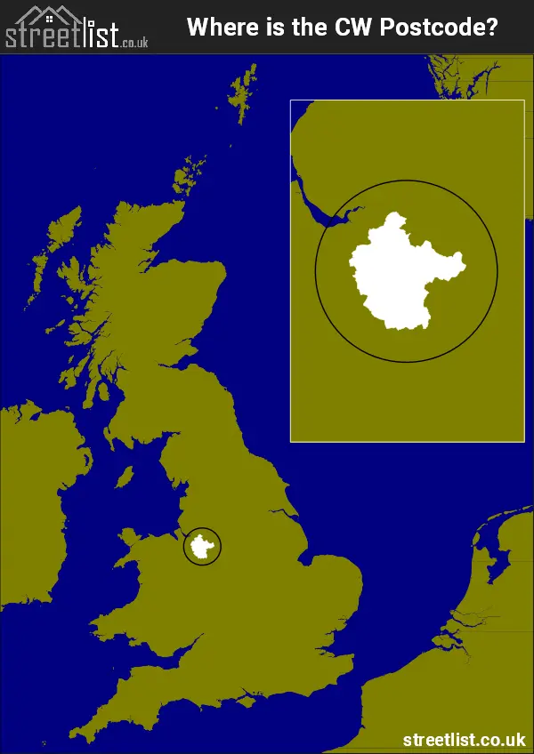
Where is the CW Postcode Area?
The CW Crewe Postcode is in the North West of England. The postal area borders the following neighbouring postal areas: TF - Telford, SY - Shrewsbury, ST - Stoke-on-Trent, SK - Stockport, CH - Chester and WA - Warrington, and is located inland.
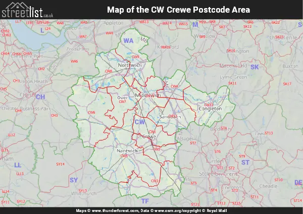
Map of the CW Crewe Postcode Area
Explore the CW Crewe postcode area by using our interactive map.

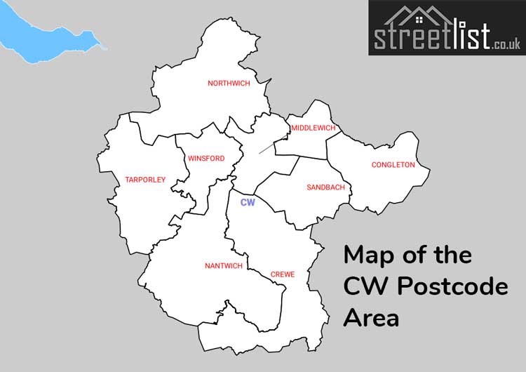
Postcode Districts within the CW Crewe Postcode Area
There are 12 postcode districts within the Crewe postcode area
A map showing the boundary of in relation to other areas
There are 8 towns within the Crewe postcode area.
| Unit | Area² |
|---|---|
| Hectares | 932,734² |
| Miles | 3,601² |
| Feet | 100,398,555,026² |
| Kilometres | 9,327² |
Postal Delivery Offices serving the CW Crewe Postcode Area
- Audlem Scale Payment Delivery Office
- Congleton Delivery Office
- Crewe Delivery Office
- Little Madeley Scale Payment Delivery Office
- Nantwich Delivery Office
- Northwich Delivery Office
- Sandbach Delivery Office
- Tarporley Delivery Office
- Winsford Delivery Office
- Wrinehill Scale Payment Delivery Office
Councils with Postcodes in CW
Towns and Villages within the CW Crewe Postcode Area
- Acton - village
- Acton Bridge - village
- Alpraham - village
- Antrobus - village
- Arclid - village
- Astbury - village
- Aston - village
- Aston juxta Mondrum - village
- Audlem - village
- Balterley Heath - village
- Barbridge - village
- Barnton - village
- Barthomley - village
- Basford - village
- Beeston-brook - village
- Betchton Heath - otherSettlement
- Betley - village
- Birchall Moss - otherSettlement
- Boothsdale - village
- Brereton Green - village
- Brereton Heath - village
- Brookhouse Green - village
- Brownlow - village
- Brownlow Heath - village
- Buerton - village
- Bunbury - village
- Burland - village
- Byley - village
- Calveley - village
- Chorlton - village
- Church Minshull - village
- Clotton - village
- Cloud Side - otherSettlement
- Comberbach - village
- Congleton - town
- Coppenhall Moss - village
- Cotebrook - village
- Cranage - village
- Crewe - town
- Crowton - village
- Cuddington - village
- Daleford - village
- Davenham - village
- Delamere - village
- Duddon - village
- Eaton - village
- Eaton - village
- Elworth - village
- Ettiley Heath - village
- Faddiley - village
- Foxwist Green - village
- Goostrey - village
- Great Budworth - village
- Hack Green - otherSettlement
- Hankelow - village
- Hartford - village
- Haslington - village
- Hassall Green - village
- Hatherton - village
- Haughton - village
- Higher Marston - village
- Higher Wincham - village
- Holmes Chapel - village
- Hough - village
- Jodrell Bank - village
- Kelsall - village
- Key Green - village
- Kingsmead - village
- Lach Dennis - village
- Leftwich - village
- Lightwood Green - village
- Little Budworth - village
- Little Leigh - village
- Lostock Gralam - village
- Lostock Green - village
- Madeley - town
- Madeley Park - village
- Malkin's Bank - village
- Marston - village
- Marton - village
- Meadowbank - village
- Mere Heath - village
- Middlewich - town
- Moston - village
- Moulton - village
- Nantwich - town
- Northwich - town
- Oakhanger - village
- Onneley - village
- Peckforton - village
- Plumley - village
- Radway Green - otherSettlement
- Ravenshall - village
- Ravensmoor - village
- Rease Heath - village
- Rudheath - village
- Rudheath Woods - village
- Salterswall - village
- Sandbach - town
- Sandiway - village
- Shavington - village
- Smallwood - village
- Somerford Booths - otherSettlement
- Sound - village
- Sproston Green - village
- Spurstow - village
- Stapeley - village
- Swettenham - village
- Tarporley - village
- Tilstone Fearnall - village
- Timbersbrook - village
- Tiverton - village
- Twemlow Green - village
- Utkinton - village
- Walgherton - village
- Warmingham - village
- Weaverham - village
- Weston - village
- Wheelock - village
- Wheelock Heath - village
- Whitegate - village
- Whitemoor - village
- Willaston - village
- Wincham - otherSettlement
- Winsford - town
- Winterley - village
- Woore - village
- Wrenbury Heath - village
- Wrenbury-cum-Frith - village
- Wybunbury - village