This section of the site is all about the ST Postcode area, also known as the Stoke-on-Trent Postal Area. Explore links to the next level to learn more about specific postcode districts such as ST1.
The ST postcode area represents a group of postal districts in the Stoke-on-Trent area of the United Kingdom. The area code ST stands for the letters s and t in Stoke-on Trent. ST has a population of 644,068 and covers an area of 1,486,938 hectares. Fun fact: 0.99% of the population of Great Britain lives in this area.
The postcode area falls within the following counties: Staffordshire (97.02%), Cheshire (2.96%), Derbyshire (0.02%), Shropshire (0.00%).
Post Towns and Postcode Districts for the ST Postcode
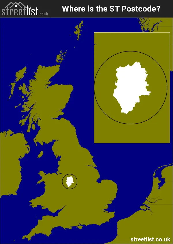
Where is the ST Postcode Area?
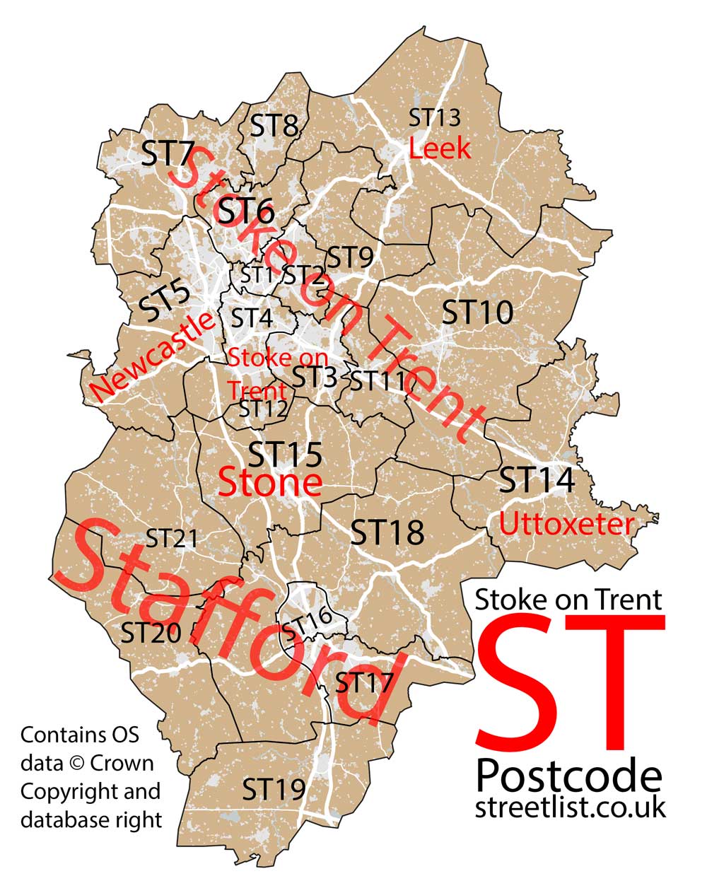
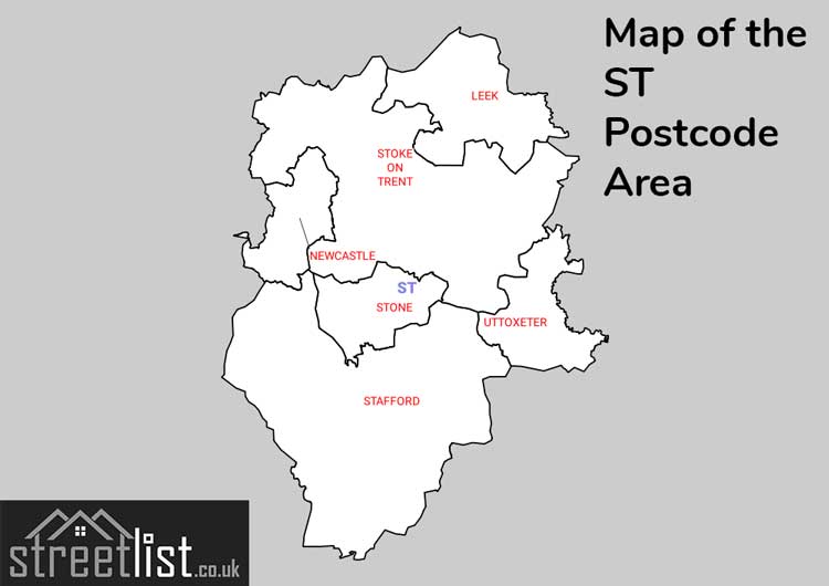
Most of the ST Postcode area is in Staffordshire and has 21 postcode districts. Stoke on Trent has 11 districts, Stafford has 6 while Leek, Newcastle, Stone and Uttoxeter have one district each.
The area is in the West Midlands between Birmingham and the Northwestern cities of Manchester and Liverpool.
The postcode area is 36 miles across at its widest point and occupies an area known as the potteries because of its tradition of producing ceramics.
The Stoke-on-Trent ST Postcode is in the West Midlands of England. The postal area borders the following neighbouring postal areas: DE - Derby, TF - Telford, CW - Crewe, WV - Wolverhampton, WS - Walsall and SK - Stockport, and is located inland.
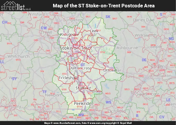
Map of the ST Stoke-on-Trent Postcode Area
Explore the ST Stoke-on-Trent postcode area by using our interactive map.
Postcode Districts within the ST Stoke-on-Trent Postcode Area
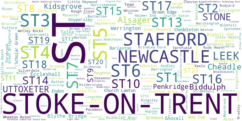
There are 21 postcode districts within the Stoke-on-Trent postcode area
A map showing the boundary of in relation to other areas
There are 12 towns within the Stoke-on-Trent postcode area.
| Unit | Area² |
|---|---|
| Hectares | 1,486,938² |
| Miles | 5,741² |
| Feet | 160,052,519,382² |
| Kilometres | 14,869² |
Postal Delivery Offices serving the ST Stoke-on-Trent Postcode Area
- Barlaston Scale Payment Delivery Office
- Biddulph Delivery Office
- Brewood Scale Payment Delivery Office
- Burslem Delivery Office
- Cheadle (st) Delivery Office
- Cotes Heath Scale Payment Delivery Office
- Croxton Scale Payment Delivery Office
- Gnosall Scale Payment Delivery Office
- Ipstones Scale Payment Delivery Office
- Kidsgrove Delivery Office
- Leek Delivery Office
- Longton Delivery Office
- Newcastle Under Lyme Delivery Office
- Stafford Delivery Office
- Stockton Brook Scale Payment Delivery Office
- Stoke-hanley Delivery Office
- Stone Delivery Office
- Uttoxeter Delivery Office
- Werrington Scale Payment Delivery Office
- Wetley Rocks Scale Payment Delivery Office
- Woodseaves Scale Payment Delivery Office
Councils with Postcodes in ST
Towns and Villages within the ST Stoke-on-Trent Postcode Area
- Acton - village
- Acton Gate - otherSettlement
- Acton Trussell - village
- Adbaston - village
- Alsager - town
- Alsagers Bank - village
- Alton - village
- Aston-By-Stone - village
- Audley - village
- Bagnall - village
- Baldwin's Gate - village
- Barlaston - village
- Bednall - village
- Bednall Head - otherSettlement
- Beech - otherSettlement
- Biddulph - town
- Biddulph Moor - village
- Bignall End - village
- Birchall - village
- Bishops Wood - village
- Blackbrook - otherSettlement
- Blackshaw Moor - village
- Blythe Bridge - village
- Bottom House - otherSettlement
- Boundary - village
- Bradley - village
- Bradnop - village
- Bramshall - village
- Brewood - village
- Brocton - village
- Brown Edge - village
- Burston - village
- Butterton - village
- Butterton - village
- Calton - village
- Cauldon - village
- Caverswall - village
- Chapel Chorlton - village
- Cheadle - town
- Checkley - village
- Cheddleton - village
- Cheddleton Heath - village
- Church Eaton - village
- Church Leigh - village
- Coldmeece - village
- Colwich - village
- Cookshill - village
- Coppenhall - village
- Cotes Heath - village
- Coton - otherSettlement
- Cotton - village
- Cranberry - village
- Cresswell - village
- Croxton - village
- Denford - village
- Denstone - village
- Derrington - village
- Dilhorne - village
- Draycott in the Moors - village
- Dunston - village
- Eccleshall - town
- Ellenhall - village
- Endon - village
- Fairoak - village
- Forsbrook - village
- Foxt - village
- Fradswell - village
- Froghall - otherSettlement
- Fulford - village
- Gailey - village
- Gayton - village
- Gnosall - village
- Gnosall Heath - village
- Gratton - otherSettlement
- Great Bridgeford - village
- Great Haywood - village
- Halmer End - village
- Hanchurch - village
- Harriseahead - village
- Haughton - village
- High Offley - village
- Hilderstone - village
- Hill Chorlton - village
- Hixon - village
- Hoften's Cross - village
- Hollington - village
- Hopton - village
- Horsebrook - village
- Hyde Lea - village
- Ingestre - village
- Ipstones - village
- Keele - village
- Kidsgrove - town
- Kingsley - village
- Kingsley Holt - village
- Kingstone - village
- Knightley - village
- Lapley - village
- Lawton Heath End - village
- Leek - town
- Leekbrook - village
- Leycett - otherSettlement
- Little Haywood - village
- Longsdon - village
- Lower Leigh - village
- Lower Tean - village
- Madeley - town
- Madeley Park - village
- Marchington - village
- Marston - village
- Meaford - village
- Miles Green - village
- Milford - village
- Moddershall - village
- Mossgate - village
- Mow Cop - village
- Newcastle-under-Lyme - town
- Newchapel - village
- Norbury - village
- Norton Bridge - village
- Oakamoor - village
- Offleyhay - village
- Onecote - village
- Oulton - village
- Outlands - otherSettlement
- Penkridge - town
- Radway Green - otherSettlement
- Ranton - village
- Rocester - village
- Rode Heath - village
- Rudyard - village
- Salt - village
- Sandon - village
- Sandonbank - village
- Sandyford - otherSettlement
- Scholar Green - village
- Scot Hay - village
- Seighford - village
- Stableford - village
- Stafford - town
- Stallington - village
- Standon - village
- Stanley - village
- Stanley Moor - village
- Stockton Brook - village
- Stoke-on-Trent - city
- Stone - town
- Stowe-by-Chartley - village
- Stramshall - village
- Stretton - otherSettlement
- Swynnerton - village
- Talke - village
- Talke Pits - village
- The Bank - village
- Tittensor - village
- Tixall - village
- Upper Tean - village
- Uttoxeter - town
- Waterfall - village
- Waterhouses - village
- Werrington - village
- Weston - village
- Wetley Rocks - village
- Wheaton Aston - village
- Whiston - village
- Whitmore - village
- Withington - village
- Wood Lane - village
- Woodseaves - village
- Wootton - otherSettlement
- Yarlet - village
- Yarnfield - village