The ST11 postcode district is a postal district located in the ST Stoke-on-Trent postcode area with a population of 9,801 residents according to the 2021 England and Wales Census.
The area of the ST11 postcode district is 10.37 square miles which is 26.86 square kilometres or 6,636.58 acres.
Currently, the ST11 district has about 232 postcode units spread across 1 geographic postcode sectors.
Given that each sector allows for 400 unique postcode combinations, the district has a capacity of 400 postcodes. With 232 postcodes already in use, this leaves 168 units available.
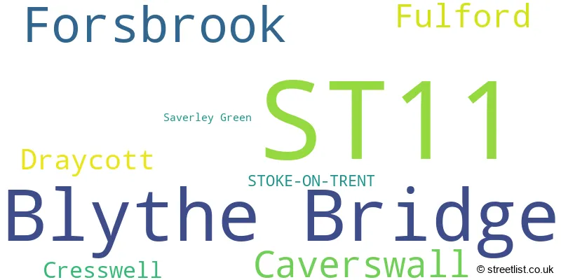
The largest settlement in the ST11 postal code is Blythe Bridge followed by Forsbrook, and Caverswall.
The ST11 Postcode shares a border with ST15 (STONE, Yarnfield, Hilderstone), ST3 (STOKE-ON-TRENT, Weston Coyney) and ST10 (Cheadle, Tean, Alton).
The primary settlement in the ST11 postcode district is Stoke-on-Trent, which is located in the county of Staffordshire, England. Other significant settlements in the district include Blythe Bridge, Caverswall, Cresswell, Draycott, Forsbrook, and Fulford.
For the district ST11, we have data on 1 postcode sectors. Here's a breakdown: The sector ST11 9, covers Blythe Bridge and Forsbrook in Staffordshire.
ST11 Postcode Sectors

Map of the ST11 Postcode District
Explore the ST11 postcode district by using our free interactive map.

When it comes to local government, postal geography often disregards political borders. However, for a breakdown in the ST11 District: the district mostly encompasses the Staffordshire Moorlands District (154 postcodes), and finally, the Stafford District (B) area (80 postcodes).
Recent House Sales in ST11
| Date | Price | Address |
|---|---|---|
| 27/10/2023 | £350,000 | Hillside Close, Fulford, Stoke-on-trent, ST11 9RU |
| 09/10/2023 | £167,500 | Cheadle Road, Forsbrook, Stoke-on-trent, ST11 9AS |
| 11/09/2023 | £195,000 | Elmwood Drive, Blythe Bridge, Stoke-on-trent, ST11 9NY |
| 01/09/2023 | £255,000 | Highview Road, Fulford, Stoke-on-trent, ST11 9QQ |
| 31/08/2023 | £232,575 | Meadow Close, Forsbrook, Stoke-on-trent, ST11 9DW |
| 21/08/2023 | £233,000 | Mount Place, Forsbrook, Stoke-on-trent, ST11 9PS |
| 21/08/2023 | £173,000 | Dale View Court, Fulford, Stoke-on-trent, ST11 9BA |
| 18/08/2023 | £230,000 | Greenacres Avenue, Blythe Bridge, Stoke-on-trent, ST11 9HU |
| 18/08/2023 | £282,975 | Gordon Road, Blythe Bridge, Stoke-on-trent, ST11 9FJ |
| 17/08/2023 | £435,000 | Stallington Road, Blythe Bridge, Stoke-on-trent, ST11 9PB |
Where is the ST11 Postcode District?
The postcode district ST11 is located in the town of Stoke-on-Trent. It is situated near several nearby towns, including Stone in the South West (5.17 miles away), Newcastle in the North West (8.47 miles away), Leek in the North (9.57 miles away), Uttoxeter in the South East (9.97 miles away), and Ashbourne in the North East (15.26 miles away). Additionally, the distance from ST11 to London is approximately 129.82 miles.
The district is within the post town of STOKE-ON-TRENT.
The sector has postcodes within the nation of England.
The ST11 Postcode District is covers the following regions.
- Staffordshire CC - Shropshire and Staffordshire - West Midlands (England)
- Stoke-on-Trent - Shropshire and Staffordshire - West Midlands (England)
Weather Forecast for ST11
Press Button to Show Forecast for Blythe Bridge
| Time Period | Icon | Description | Temperature | Rain Probability | Wind |
|---|---|---|---|---|---|
| 18:00 to 21:00 | Light rain | 15.0°C (feels like 12.0°C) | 64.00% | SE 13 mph | |
| 21:00 to 00:00 | Heavy rain | 14.0°C (feels like 11.0°C) | 90.00% | SE 13 mph |
Press Button to Show Forecast for Blythe Bridge
| Time Period | Icon | Description | Temperature | Rain Probability | Wind |
|---|---|---|---|---|---|
| 00:00 to 03:00 | Light rain | 13.0°C (feels like 11.0°C) | 62.00% | SE 11 mph | |
| 03:00 to 06:00 | Heavy rain | 13.0°C (feels like 11.0°C) | 91.00% | ESE 11 mph | |
| 06:00 to 09:00 | Heavy rain | 13.0°C (feels like 11.0°C) | 91.00% | SE 11 mph | |
| 09:00 to 12:00 | Heavy rain | 13.0°C (feels like 11.0°C) | 85.00% | SE 11 mph | |
| 12:00 to 15:00 | Light rain | 15.0°C (feels like 13.0°C) | 46.00% | SE 11 mph | |
| 15:00 to 18:00 | Light rain | 15.0°C (feels like 13.0°C) | 41.00% | SE 11 mph | |
| 18:00 to 21:00 | Cloudy | 15.0°C (feels like 13.0°C) | 10.00% | SE 11 mph | |
| 21:00 to 00:00 | Cloudy | 13.0°C (feels like 11.0°C) | 6.00% | ESE 9 mph |
Press Button to Show Forecast for Blythe Bridge
| Time Period | Icon | Description | Temperature | Rain Probability | Wind |
|---|---|---|---|---|---|
| 00:00 to 03:00 | Cloudy | 12.0°C (feels like 10.0°C) | 5.00% | ESE 9 mph | |
| 03:00 to 06:00 | Cloudy | 11.0°C (feels like 9.0°C) | 7.00% | ESE 9 mph | |
| 06:00 to 09:00 | Overcast | 11.0°C (feels like 9.0°C) | 13.00% | E 9 mph | |
| 09:00 to 12:00 | Cloudy | 14.0°C (feels like 12.0°C) | 16.00% | ESE 9 mph | |
| 12:00 to 15:00 | Cloudy | 16.0°C (feels like 14.0°C) | 20.00% | ESE 9 mph | |
| 15:00 to 18:00 | Light rain shower (day) | 17.0°C (feels like 15.0°C) | 32.00% | ESE 9 mph | |
| 18:00 to 21:00 | Partly cloudy (day) | 15.0°C (feels like 14.0°C) | 8.00% | ESE 9 mph | |
| 21:00 to 00:00 | Clear night | 12.0°C (feels like 11.0°C) | 2.00% | E 7 mph |
Press Button to Show Forecast for Blythe Bridge
| Time Period | Icon | Description | Temperature | Rain Probability | Wind |
|---|---|---|---|---|---|
| 00:00 to 03:00 | Clear night | 11.0°C (feels like 10.0°C) | 2.00% | E 4 mph | |
| 03:00 to 06:00 | Clear night | 9.0°C (feels like 9.0°C) | 3.00% | E 4 mph | |
| 06:00 to 09:00 | Cloudy | 12.0°C (feels like 11.0°C) | 6.00% | ENE 4 mph | |
| 09:00 to 12:00 | Partly cloudy (day) | 15.0°C (feels like 15.0°C) | 5.00% | SE 4 mph | |
| 12:00 to 15:00 | Cloudy | 18.0°C (feels like 17.0°C) | 12.00% | WNW 4 mph | |
| 15:00 to 18:00 | Light rain shower (day) | 17.0°C (feels like 17.0°C) | 36.00% | NW 4 mph | |
| 18:00 to 21:00 | Light rain shower (day) | 16.0°C (feels like 15.0°C) | 38.00% | WNW 7 mph | |
| 21:00 to 00:00 | Cloudy | 13.0°C (feels like 12.0°C) | 12.00% | NNW 7 mph |
Press Button to Show Forecast for Blythe Bridge
| Time Period | Icon | Description | Temperature | Rain Probability | Wind |
|---|---|---|---|---|---|
| 00:00 to 03:00 | Cloudy | 12.0°C (feels like 11.0°C) | 8.00% | N 7 mph | |
| 03:00 to 06:00 | Cloudy | 11.0°C (feels like 10.0°C) | 8.00% | NNE 7 mph | |
| 06:00 to 09:00 | Overcast | 12.0°C (feels like 11.0°C) | 10.00% | N 7 mph | |
| 09:00 to 12:00 | Overcast | 15.0°C (feels like 14.0°C) | 11.00% | NNE 7 mph | |
| 12:00 to 15:00 | Light rain shower (day) | 17.0°C (feels like 15.0°C) | 31.00% | WNW 7 mph | |
| 15:00 to 18:00 | Light rain shower (day) | 17.0°C (feels like 16.0°C) | 35.00% | NW 9 mph | |
| 18:00 to 21:00 | Light rain shower (day) | 16.0°C (feels like 14.0°C) | 33.00% | NNW 9 mph | |
| 21:00 to 00:00 | Clear night | 13.0°C (feels like 11.0°C) | 7.00% | NNW 9 mph |
Postcode Sectors within the ST11 District
| Postcode Sector | Delivery Office |
|---|---|
| ST11 9 | Longton Delivery Office |
| S | T | 1 | 1 | - | X | X | X |
| S | T | 1 | 1 | Space | Numeric | Letter | Letter |
Current Monthly Rental Prices
| # Bedrooms | Min Price | Max Price | Avg Price |
|---|---|---|---|
| 1 | £450 | £1,000 | £765 |
| 2 | £900 | £900 | £900 |
| 3 | £900 | £900 | £900 |
Current House Prices
| # Bedrooms | Min Price | Max Price | Avg Price |
|---|---|---|---|
| £250,000 | £250,000 | £250,000 | |
| 2 | £105,000 | £250,000 | £203,522 |
| 3 | £180,000 | £600,000 | £269,295 |
| 4 | £249,950 | £750,000 | £439,875 |
| 5 | £340,000 | £685,000 | £563,750 |
| 6 | £725,000 | £725,000 | £725,000 |
Estate Agents who Operate in the ST11 District
| Logo | Name | Brand Name | Address | Contact Number | Total Properties |
|---|---|---|---|---|---|
 | Stoke On Trent | Platinum Property | 422 Sandon Road, Meir Heath, Stoke-On-Trent, ST3 7LH | 01782 493538 | 17 |
 | Stoke-On-Trent | Goodchilds | 27 Piccadilly, Hanley, Stoke-On-Trent, ST1 1EN | 01782 493709 | 9 |
 | Stone | James Du Pavey | Christchurch house Christchurch Way, Stone, ST15 8BZ | 01785 335509 | 8 |
 | Stoke-On-Trent | Keys Estate Agents | Chimney's House Warner Street Hanley Stoke-On-Trent ST1 3DH | 01782 890178 | 6 |
 | Trent Vale | Critchlow Estate Agents | Suite 8, Federation House Station Road Stoke-On-Trent ST4 2SA | 01782 493386 | 5 |
Yearly House Price Averages for the ST11 Postcode District
| Type of Property | 2018 Average | 2018 Sales | 2017 Average | 2017 Sales | 2016 Average | 2016 Sales | 2015 Average | 2015 Sales |
|---|---|---|---|---|---|---|---|---|
| Detached | £291,185 | 51 | £256,728 | 70 | £242,014 | 62 | £237,122 | 78 |
| Semi-Detached | £185,532 | 74 | £164,616 | 57 | £166,441 | 74 | £157,625 | 61 |
| Terraced | £181,468 | 19 | £140,945 | 11 | £146,905 | 22 | £149,884 | 16 |
| Flats | £67,000 | 2 | £102,780 | 5 | £97,375 | 4 | £124,000 | 3 |