The ST15 postcode district is a postal district located in the ST Stoke-on-Trent postcode area with a population of 22,922 residents according to the 2021 England and Wales Census.
The area of the ST15 postcode district is 35.94 square miles which is 93.10 square kilometres or 23,004.65 acres.
Currently, the ST15 district has about 687 postcode units spread across 2 geographic postcode sectors.
Given that each sector allows for 400 unique postcode combinations, the district has a capacity of 800 postcodes. With 687 postcodes already in use, this leaves 113 units available.
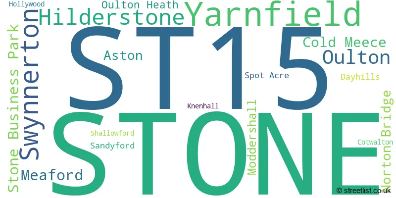
The largest settlement in the ST15 postal code is STONE followed by Yarnfield, and Hilderstone.
The ST15 Postcode shares a border with ST11 (Blythe Bridge, Forsbrook, Caverswall), ST18 (STAFFORD, Great Haywood, Hixon), ST12 (Barlaston, Tittensor), ST3 (STOKE-ON-TRENT, Weston Coyney), ST10 (Cheadle, Tean, Alton) and ST21 (Eccleshall, Cotes Heath, Standon).
The primary settlement in the ST15 postcode district is Stone. Stone is located in the county of Staffordshire in England. Other significant settlements in the district include Aston, Cold Meece, Meaford, Norton Bridge, Sandyford, Shallowford, Stone Business Park, Swynnerton, and Yarnfield. These settlements are also located in Staffordshire. The post town for this district is Stone.
For the district ST15, we have data on 3 postcode sectors. Here's a breakdown: The sector ST15 0, covers Stone and Yarnfield in Staffordshire. The sector ST15 8, covers Stone in Staffordshire. The sector ST15 9 is non-geographic. It's often designated for PO Boxes, large organisations, or special services.

Map of the ST15 Postcode District
Explore the ST15 postcode district by using our free interactive map.

When it comes to local government, postal geography often disregards political borders. However, for a breakdown in the ST15 District: the district mostly encompasses the Stafford District (B) area with a total of 695 postcodes.
Recent House Sales in ST15
| Date | Price | Address |
|---|---|---|
| 20/10/2023 | £185,000 | Melrose Avenue, Stone, ST15 8SU |
| 11/10/2023 | £175,000 | Newcastle Road, Stone, ST15 8LD |
| 06/10/2023 | £300,000 | Castle Court, Stone, ST15 8YY |
| 29/09/2023 | £63,000 | Fillybrook Close, Stone, ST15 0DZ |
| 28/09/2023 | £160,000 | Princes Street, Stone, ST15 8HY |
| 28/09/2023 | £185,000 | Stone, ST15 8AY |
| 26/09/2023 | £64,000 | Brookside Lane, Stone, ST15 0HZ |
| 18/09/2023 | £160,000 | Chestnut Grove, Stone, ST15 8GP |
| 11/09/2023 | £220,000 | St Vincent Road, Stone, ST15 0DU |
| 07/09/2023 | £125,000 | Stafford Street, Stone, ST15 8QZ |
Weather Forecast for ST15
Press Button to Show Forecast for Stone
| Time Period | Icon | Description | Temperature | Rain Probability | Wind |
|---|---|---|---|---|---|
| 12:00 to 15:00 | Overcast | 9.0°C (feels like 6.0°C) | 17.00% | ENE 11 mph | |
| 15:00 to 18:00 | Overcast | 9.0°C (feels like 6.0°C) | 17.00% | ENE 9 mph | |
| 18:00 to 21:00 | Cloudy | 8.0°C (feels like 6.0°C) | 12.00% | ENE 9 mph | |
| 21:00 to 00:00 | Cloudy | 6.0°C (feels like 4.0°C) | 5.00% | NE 9 mph |
Press Button to Show Forecast for Stone
| Time Period | Icon | Description | Temperature | Rain Probability | Wind |
|---|---|---|---|---|---|
| 00:00 to 03:00 | Cloudy | 6.0°C (feels like 3.0°C) | 7.00% | NNE 7 mph | |
| 03:00 to 06:00 | Cloudy | 5.0°C (feels like 2.0°C) | 46.00% | N 9 mph | |
| 06:00 to 09:00 | Light rain | 5.0°C (feels like 2.0°C) | 54.00% | N 9 mph | |
| 09:00 to 12:00 | Light rain | 6.0°C (feels like 3.0°C) | 53.00% | NNW 11 mph | |
| 12:00 to 15:00 | Overcast | 9.0°C (feels like 6.0°C) | 24.00% | NW 11 mph | |
| 15:00 to 18:00 | Cloudy | 10.0°C (feels like 8.0°C) | 13.00% | WNW 11 mph | |
| 18:00 to 21:00 | Sunny day | 10.0°C (feels like 8.0°C) | 4.00% | WNW 9 mph | |
| 21:00 to 00:00 | Clear night | 6.0°C (feels like 4.0°C) | 1.00% | WSW 7 mph |
Press Button to Show Forecast for Stone
| Time Period | Icon | Description | Temperature | Rain Probability | Wind |
|---|---|---|---|---|---|
| 00:00 to 03:00 | Clear night | 4.0°C (feels like 2.0°C) | 2.00% | SSW 7 mph | |
| 03:00 to 06:00 | Clear night | 4.0°C (feels like 1.0°C) | 1.00% | S 7 mph | |
| 06:00 to 09:00 | Sunny day | 5.0°C (feels like 3.0°C) | 1.00% | SSE 9 mph | |
| 09:00 to 12:00 | Partly cloudy (day) | 10.0°C (feels like 7.0°C) | 2.00% | S 13 mph | |
| 12:00 to 15:00 | Overcast | 12.0°C (feels like 10.0°C) | 10.00% | S 13 mph | |
| 15:00 to 18:00 | Cloudy | 13.0°C (feels like 11.0°C) | 7.00% | S 13 mph | |
| 18:00 to 21:00 | Cloudy | 13.0°C (feels like 10.0°C) | 6.00% | S 11 mph | |
| 21:00 to 00:00 | Clear night | 10.0°C (feels like 7.0°C) | 2.00% | SSE 9 mph |
Press Button to Show Forecast for Stone
| Time Period | Icon | Description | Temperature | Rain Probability | Wind |
|---|---|---|---|---|---|
| 00:00 to 03:00 | Clear night | 8.0°C (feels like 6.0°C) | 3.00% | SE 9 mph | |
| 03:00 to 06:00 | Partly cloudy (night) | 7.0°C (feels like 5.0°C) | 2.00% | ESE 11 mph | |
| 06:00 to 09:00 | Sunny day | 8.0°C (feels like 5.0°C) | 2.00% | ESE 11 mph | |
| 09:00 to 12:00 | Partly cloudy (day) | 12.0°C (feels like 9.0°C) | 5.00% | ESE 13 mph | |
| 12:00 to 15:00 | Cloudy | 15.0°C (feels like 12.0°C) | 10.00% | SE 13 mph | |
| 15:00 to 18:00 | Cloudy | 15.0°C (feels like 13.0°C) | 12.00% | SE 11 mph | |
| 18:00 to 21:00 | Partly cloudy (day) | 14.0°C (feels like 13.0°C) | 9.00% | ESE 9 mph | |
| 21:00 to 00:00 | Partly cloudy (night) | 11.0°C (feels like 10.0°C) | 4.00% | E 9 mph |
Where is the ST15 Postcode District?
The data indicates that the postcode district for ST15 is located in the town of Stone. Stone is situated near several nearby towns, including Stafford to the south (7.61 miles away), Stoke-on-Trent to the north (7.63 miles away), Newcastle to the northwest (8.60 miles away), Uttoxeter to the east (12.09 miles away), Rugeley to the southeast (13.58 miles away), Newport to the southwest (13.66 miles away), and Market Drayton to the west (13.71 miles away). Additionally, the distance from Stone to the center of London is approximately 129.16 miles.
The district is within the post town of STONE.
The sector has postcodes within the nation of England.
The ST15 Postcode District is in the Staffordshire CC region of Shropshire and Staffordshire within the West Midlands (England).
| Postcode Sector | Delivery Office |
|---|---|
| ST15 0 | Stone Delivery Office |
| ST15 8 | Stone Delivery Office |
| S | T | 1 | 5 | - | X | X | X |
| S | T | 1 | 5 | Space | Numeric | Letter | Letter |
Current Monthly Rental Prices
| # Bedrooms | Min Price | Max Price | Avg Price |
|---|---|---|---|
| 1 | £435 | £860 | £574 |
| 2 | £595 | £1,150 | £780 |
| 3 | £795 | £1,250 | £1,022 |
| 4 | £1,295 | £1,750 | £1,510 |
| 6 | £6,000 | £6,000 | £6,000 |
Current House Prices
| # Bedrooms | Min Price | Max Price | Avg Price |
|---|---|---|---|
| £1,000 | £200,000 | £35,167 | |
| 1 | £75,000 | £200,000 | £126,871 |
| 2 | £75,000 | £515,000 | £205,229 |
| 3 | £175,000 | £750,000 | £292,601 |
| 4 | £250,000 | £1,050,000 | £468,336 |
| 5 | £394,950 | £950,000 | £643,950 |
| 6 | £420,000 | £2,000,000 | £1,017,000 |
| 7 | £799,950 | £880,000 | £839,975 |
| 9 | £1,700,000 | £1,700,000 | £1,700,000 |
Estate Agents who Operate in the ST15 District
| Logo | Name | Brand Name | Address | Contact Number | Total Properties |
|---|---|---|---|---|---|
 | Stone | Tinsley-Garner Independent Estate Agents | The Market House, Mill Street, Stone, ST15 8BA | 01785 335494 | 55 |
 | Stone | Austin & Roe Independent Estate Agents | Granville Square 75a High Street Stone Staffordshire ST15 8AE | 01785 335492 | 45 |
 | Stone | James Du Pavey | Christchurch house Christchurch Way, Stone, ST15 8BZ | 01785 335509 | 40 |
 | Stafford | Belvoir Sales | The Old Studio, 33b Marsh Street, Stafford, ST16 3BQ | 01785 254441 | 14 |
 | Stone | Belvoir | 42b Kings Court Radford Street Stone ST15 8DA | 01785 335363 | 9 |
| Type of Property | 2018 Average | 2018 Sales | 2017 Average | 2017 Sales | 2016 Average | 2016 Sales | 2015 Average | 2015 Sales |
|---|---|---|---|---|---|---|---|---|
| Detached | £292,143 | 233 | £307,337 | 234 | £295,760 | 238 | £287,463 | 220 |
| Semi-Detached | £188,270 | 96 | £187,680 | 121 | £178,172 | 121 | £163,716 | 103 |
| Terraced | £171,749 | 95 | £164,961 | 101 | £157,721 | 129 | £146,676 | 92 |
| Flats | £122,028 | 32 | £132,277 | 43 | £108,802 | 51 | £121,184 | 48 |