This section of the site is all about the WV Postcode area, also known as the Wolverhampton Postal Area. Explore links to the next level to learn more about specific postcode districts such as WV1.
Map of the WV Postcode for Wolverhampton
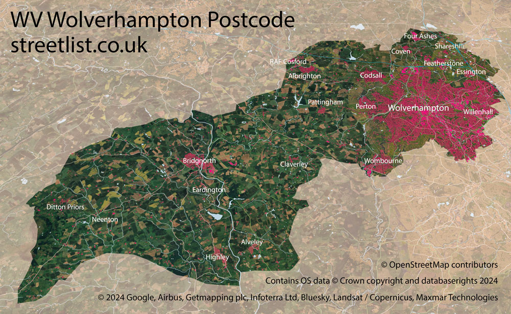
The WV postcode area represents a group of postal districts in the Wolverhampton area of the United Kingdom. The area code WV stands for the letters w and v in WolQVg>erhampton. WV has a population of 395,857 and covers an area of 590,190 hectares. Fun fact: 0.61% of the population of Great Britain lives in this area.
The postcode area falls within the following counties: West Midlands (75.21%), Staffordshire (13.77%), Shropshire (11.02%).
Post Towns and Postcode Districts for the WV Postcode
-
WV1 West MidlandsWV2 West MidlandsWV3 West MidlandsWV4 Staffordshire (8%), West Midlands (91%)WV5 Shropshire (10%), Staffordshire (89%)WV6 Shropshire (2%), Staffordshire (24%), West Midlands (73%)WV7 Shropshire (93%), Staffordshire (3%), West Midlands (3%)WV8 Shropshire (1%), Staffordshire (71%), West Midlands (27%)WV9 Staffordshire (41%), West Midlands (58%)WV10 Staffordshire (15%), West Midlands (84%)WV11 Staffordshire (12%), West Midlands (87%)WV98 WV99
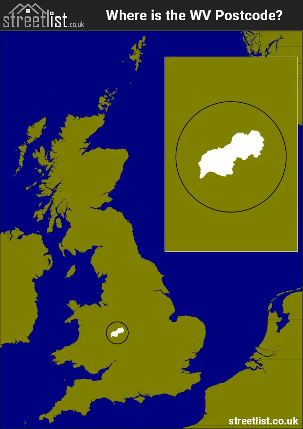
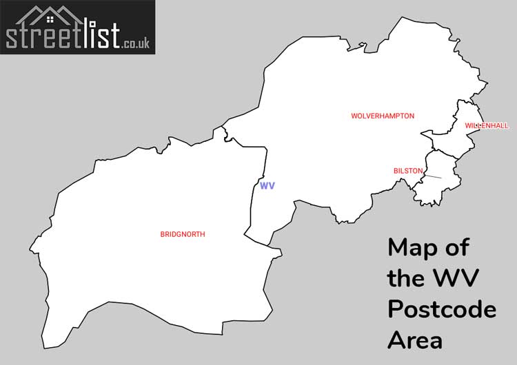
Where is the WV Postcode Area?
The Wolverhampton WV Postcode is in the West Midlands of England. The postal area borders the following neighbouring postal areas: TF - Telford, SY - Shrewsbury, WS - Walsall, ST - Stoke-on-Trent and DY - Dudley, and is located inland.
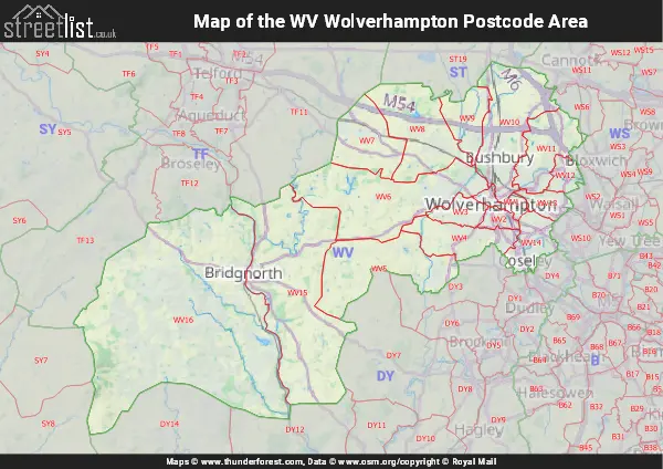
Map of the WV Wolverhampton Postcode Area
Explore the WV Wolverhampton postcode area by using our interactive map.
Postcode Districts within the WV Wolverhampton Postcode Area
There are 16 postcode districts within the Wolverhampton postcode area
A map showing the boundary of in relation to other areas
There are 8 towns within the Wolverhampton postcode area.
| Unit | Area² |
|---|---|
| Hectares | 590,190² |
| Miles | 2,279² |
| Feet | 63,527,461,410² |
| Kilometres | 5,902² |
Postal Delivery Offices serving the WV Wolverhampton Postcode Area
- Albrighton Scale Payment Delivery Office
- Bilston Delivery Office
- Bridgnorth Delivery Office
- Wolverhampton Delivery Office
- Wolverhampton Ne Delivery Office
- Wolverhampton Nw Delivery Office
- Wombourne Delivery Office
Councils with Postcodes in WV
Towns and Villages within the WV Wolverhampton Postcode Area
- Ackleton - village
- Albrighton - village
- Alveley - village
- Badger - village
- Bilbrook - village
- Billingsley - village
- Bilston - town
- Bloxwich - town
- Boningale - village
- Bridgnorth - town
- Burnhill Green - village
- Burwarton - village
- Calf Heath - village
- Chelmarsh - village
- Claverley - village
- Codsall - village
- Codsall Wood - village
- Coseley - town
- Coven - village
- Coven Heath - village
- Cross Green - village
- Darlaston - town
- Ditton Priors - village
- Eardington - village
- Essington - village
- Featherstone - village
- Four Ashes - village
- Highley - village
- Hilton - village
- Kingswood - village
- Linley Brook - village
- Lower Chorley - village
- Lower Penn - village
- Monkhopton - village
- Morville - village
- Neenton - village
- Netherton - village
- Nordley - village
- Nurton - village
- Oaken - village
- Old Perton - village
- Oldbury - village
- Pattingham - village
- Perton - village
- Quatford - village
- Quatt - village
- Sedgley - town
- Seisdon - village
- Shareshill - village
- Slade Heath - village
- Springhill - village
- Standeford - village
- Stanley - village
- Stanmore - village
- Sutton - otherSettlement
- The Down - otherSettlement
- Tipton - town
- Trysull - village
- Willenhall - town
- Wolverhampton - city
- Wombourne - Settlement
- Wootton - otherSettlement
- Worfield - village
- Wyken - village