The WV8 postcode district is a postal district located in the WV Wolverhampton postcode area with a population of 16,091 residents according to the 2021 England and Wales Census.
The area of the WV8 postcode district is 13.78 square miles which is 35.69 square kilometres or 8,819.15 acres.
Currently, the WV8 district has about 426 postcode units spread across 2 geographic postcode sectors.
Given that each sector allows for 400 unique postcode combinations, the district has a capacity of 800 postcodes. With 426 postcodes already in use, this leaves 374 units available.
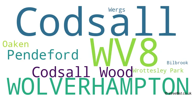
The largest settlement in the WV8 postal code is Codsall followed by WOLVERHAMPTON, and Pendeford.
The WV8 Postcode shares a border with ST19 (Penkridge, Brewood, Wheaton Aston), WV9 (WOLVERHAMPTON, Coven, Pendeford), WV6 (WOLVERHAMPTON, Perton, Pattingham) and WV7 (Albrighton).
The primary settlement in the WV8 postcode district is Codsall, located in the county of Staffordshire. The most significant Postal Town in this district is Wolverhampton, which is situated in the West Midlands.
For the district WV8, we have data on 2 postcode sectors. Here's a breakdown: The sector WV8 1, covers Codsall in Staffordshire. The sector WV8 1, covers Wolverhampton in West Midlands. The sector WV8 2, covers Codsall in Staffordshire.

Map of the WV8 Postcode District
Explore the WV8 postcode district by using our free interactive map.

When it comes to local government, postal geography often disregards political borders. However, for a breakdown in the WV8 District: the district mostly encompasses the South Staffordshire District (345 postcodes), followed by the City of Wolverhampton District (B) area (76 postcodes), and finally, the Shropshire area (10 postcodes).
Recent House Sales in WV8
| Date | Price | Address |
|---|---|---|
| 17/10/2023 | £92,000 | Bilbrook Road, Codsall, Wolverhampton, WV8 1BT |
| 22/09/2023 | £480,000 | Oaken Lanes, Codsall, Wolverhampton, WV8 2AW |
| 21/09/2023 | £185,000 | Droxford Walk, Wolverhampton, WV8 1YS |
| 07/09/2023 | £165,000 | Crompton Court, Codsall, Wolverhampton, WV8 1GE |
| 07/09/2023 | £165,000 | Crompton Court, Codsall, Wolverhampton, WV8 1GE |
| 01/09/2023 | £275,000 | Chadwell Gardens, Codsall, Wolverhampton, WV8 1AF |
| 01/09/2023 | £445,000 | Elliotts Lane, Codsall, Wolverhampton, WV8 1PG |
| 29/08/2023 | £258,000 | Alexander Road, Codsall, Wolverhampton, WV8 1JQ |
| 25/08/2023 | £795,000 | Lansdowne Avenue, Codsall, Wolverhampton, WV8 2EN |
| 18/08/2023 | £280,000 | Manor House Park, Codsall, Wolverhampton, WV8 1ES |
Weather Forecast for WV8
Press Button to Show Forecast for Codsall
| Time Period | Icon | Description | Temperature | Rain Probability | Wind |
|---|---|---|---|---|---|
| 12:00 to 15:00 | Cloudy | 8.0°C (feels like 6.0°C) | 9.00% | E 7 mph | |
| 15:00 to 18:00 | Cloudy | 9.0°C (feels like 7.0°C) | 10.00% | ENE 9 mph | |
| 18:00 to 21:00 | Cloudy | 8.0°C (feels like 6.0°C) | 9.00% | ENE 9 mph | |
| 21:00 to 00:00 | Cloudy | 6.0°C (feels like 4.0°C) | 7.00% | ENE 9 mph |
Press Button to Show Forecast for Codsall
| Time Period | Icon | Description | Temperature | Rain Probability | Wind |
|---|---|---|---|---|---|
| 00:00 to 03:00 | Cloudy | 6.0°C (feels like 3.0°C) | 9.00% | ENE 9 mph | |
| 03:00 to 06:00 | Cloudy | 5.0°C (feels like 2.0°C) | 8.00% | ENE 7 mph | |
| 06:00 to 09:00 | Cloudy | 5.0°C (feels like 2.0°C) | 9.00% | ENE 9 mph | |
| 09:00 to 12:00 | Cloudy | 7.0°C (feels like 4.0°C) | 17.00% | ENE 11 mph | |
| 12:00 to 15:00 | Overcast | 8.0°C (feels like 5.0°C) | 19.00% | ENE 9 mph | |
| 15:00 to 18:00 | Light rain | 8.0°C (feels like 6.0°C) | 45.00% | ENE 9 mph | |
| 18:00 to 21:00 | Overcast | 8.0°C (feels like 5.0°C) | 12.00% | NE 11 mph | |
| 21:00 to 00:00 | Cloudy | 7.0°C (feels like 4.0°C) | 6.00% | NE 9 mph |
Press Button to Show Forecast for Codsall
| Time Period | Icon | Description | Temperature | Rain Probability | Wind |
|---|---|---|---|---|---|
| 00:00 to 03:00 | Cloudy | 6.0°C (feels like 3.0°C) | 17.00% | NNE 9 mph | |
| 03:00 to 06:00 | Light rain | 5.0°C (feels like 2.0°C) | 54.00% | N 9 mph | |
| 06:00 to 09:00 | Light rain | 5.0°C (feels like 2.0°C) | 56.00% | N 9 mph | |
| 09:00 to 12:00 | Light rain | 6.0°C (feels like 3.0°C) | 54.00% | NNW 11 mph | |
| 12:00 to 15:00 | Light rain | 9.0°C (feels like 6.0°C) | 44.00% | NW 9 mph | |
| 15:00 to 18:00 | Cloudy | 10.0°C (feels like 8.0°C) | 12.00% | NW 9 mph | |
| 18:00 to 21:00 | Cloudy | 10.0°C (feels like 8.0°C) | 7.00% | W 7 mph | |
| 21:00 to 00:00 | Clear night | 7.0°C (feels like 5.0°C) | 1.00% | SW 7 mph |
Press Button to Show Forecast for Codsall
| Time Period | Icon | Description | Temperature | Rain Probability | Wind |
|---|---|---|---|---|---|
| 00:00 to 03:00 | Clear night | 5.0°C (feels like 3.0°C) | 1.00% | SSW 7 mph | |
| 03:00 to 06:00 | Clear night | 5.0°C (feels like 2.0°C) | 1.00% | S 7 mph | |
| 06:00 to 09:00 | Sunny day | 5.0°C (feels like 3.0°C) | 1.00% | S 9 mph | |
| 09:00 to 12:00 | Partly cloudy (day) | 10.0°C (feels like 7.0°C) | 1.00% | S 11 mph | |
| 12:00 to 15:00 | Overcast | 13.0°C (feels like 10.0°C) | 9.00% | S 13 mph | |
| 15:00 to 18:00 | Cloudy | 13.0°C (feels like 11.0°C) | 8.00% | S 13 mph | |
| 18:00 to 21:00 | Partly cloudy (day) | 13.0°C (feels like 10.0°C) | 4.00% | S 11 mph | |
| 21:00 to 00:00 | Clear night | 10.0°C (feels like 8.0°C) | 2.00% | SSE 9 mph |
Press Button to Show Forecast for Codsall
| Time Period | Icon | Description | Temperature | Rain Probability | Wind |
|---|---|---|---|---|---|
| 00:00 to 03:00 | Clear night | 9.0°C (feels like 7.0°C) | 3.00% | SE 9 mph | |
| 03:00 to 06:00 | Clear night | 8.0°C (feels like 6.0°C) | 2.00% | SE 9 mph | |
| 06:00 to 09:00 | Sunny day | 8.0°C (feels like 6.0°C) | 2.00% | ESE 9 mph | |
| 09:00 to 12:00 | Partly cloudy (day) | 12.0°C (feels like 10.0°C) | 6.00% | ESE 11 mph | |
| 12:00 to 15:00 | Partly cloudy (day) | 15.0°C (feels like 12.0°C) | 11.00% | SE 13 mph | |
| 15:00 to 18:00 | Cloudy | 15.0°C (feels like 13.0°C) | 32.00% | SE 11 mph | |
| 18:00 to 21:00 | Partly cloudy (day) | 14.0°C (feels like 13.0°C) | 10.00% | SE 9 mph | |
| 21:00 to 00:00 | Partly cloudy (night) | 12.0°C (feels like 11.0°C) | 7.00% | ESE 7 mph |
Where is the WV8 Postcode District?
The postcode district WV8 is located in Wolverhampton. It is near the towns of Shifnal, Willenhall, Cannock, Kingswinford, and Walsall. The distance to the centre of London is approximately 118.37 miles.
The district is within the post town of WOLVERHAMPTON.
The sector has postcodes within the nation of England.
The WV8 Postcode District is covers the following regions.
- Staffordshire CC - Shropshire and Staffordshire - West Midlands (England)
- Wolverhampton - West Midlands - West Midlands (England)
- Shropshire CC - Shropshire and Staffordshire - West Midlands (England)
| Postcode Sector | Delivery Office |
|---|---|
| WV8 1 | Wolverhampton Nw Delivery Office |
| WV8 2 | Wolverhampton Nw Delivery Office |
| W | V | 8 | - | X | X | X |
| W | V | 8 | Space | Numeric | Letter | Letter |
Current Monthly Rental Prices
| # Bedrooms | Min Price | Max Price | Avg Price |
|---|---|---|---|
| 1 | £950 | £950 | £950 |
| 2 | £675 | £1,100 | £914 |
| 3 | £1,100 | £1,695 | £1,398 |
Current House Prices
| # Bedrooms | Min Price | Max Price | Avg Price |
|---|---|---|---|
| £370,000 | £550,000 | £460,000 | |
| 1 | £115,000 | £195,000 | £163,333 |
| 2 | £87,500 | £459,950 | £255,244 |
| 3 | £130,000 | £950,000 | £370,688 |
| 4 | £290,000 | £700,000 | £503,950 |
| 5 | £475,000 | £975,000 | £619,286 |
Estate Agents who Operate in the WV8 District
| Logo | Name | Brand Name | Address | Contact Number | Total Properties |
|---|---|---|---|---|---|
 | Tettenhall | Berriman Eaton | 15 High Street, Tettenhall, Wolverhampton, WV6 8QS | 01902 953057 | 29 |
 | Codsall | Tidmarsh Land & Estate Agents | The Square, Wolverhampton Road, Codsall, Wolverhampton, WV8 1PT | 01902 943011 | 18 |
 | Tettenhall | Peter James Property Ltd | 2 High Street, Tettenhall, Wolverhampton, WV6 8QT | 01902 953402 | 17 |
 | Tettenhall | Thomas Harvey | 1 The Arcade, High Street, Tettenhall, Wolverhampton, WV6 8QS | 01902 943555 | 12 |
 | Wolverhampton | Worthington Estates Ltd | 94a Wolverhampton Road, Codsall, WV8 1PE | 01902 943095 | 11 |
| Type of Property | 2018 Average | 2018 Sales | 2017 Average | 2017 Sales | 2016 Average | 2016 Sales | 2015 Average | 2015 Sales |
|---|---|---|---|---|---|---|---|---|
| Detached | £357,641 | 87 | £336,077 | 84 | £334,387 | 55 | £299,340 | 65 |
| Semi-Detached | £206,503 | 96 | £186,611 | 78 | £202,123 | 63 | £188,137 | 83 |
| Terraced | £152,123 | 55 | £176,152 | 37 | £172,054 | 66 | £157,166 | 40 |
| Flats | £160,120 | 59 | £101,830 | 15 | £102,892 | 12 | £109,700 | 17 |