The ST17 postcode district is a postal district located in the ST Stoke-on-Trent postcode area with a population of 38,529 residents according to the 2021 England and Wales Census.
The area of the ST17 postcode district is 17.35 square miles which is 44.94 square kilometres or 11,104.03 acres.
Currently, the ST17 district has about 894 postcode units spread across 3 geographic postcode sectors.
Given that each sector allows for 400 unique postcode combinations, the district has a capacity of 1,200 postcodes. With 894 postcodes already in use, this leaves 306 units available.
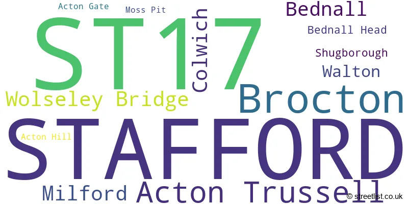
The largest settlement in the ST17 postal code is STAFFORD followed by Brocton, and Acton Trussell.
The ST17 Postcode shares a border with WS12 (Hednesford, CANNOCK, Huntington), ST16 (STAFFORD), ST18 (STAFFORD, Great Haywood, Hixon), ST19 (Penkridge, Brewood, Wheaton Aston) and WS15 (RUGELEY, Brereton, Abbots Bromley).
The primary settlement in the ST17 postcode district, located in the county of Staffordshire, is Stafford. Other significant settlements in this district include Acton Trussell, Brocton, Colwich, Milford, and Wolseley Bridge. The most significant post town in this district is Stafford in the county of Staffordshire, England.
For the district ST17, we have data on 3 postcode sectors. Here's a breakdown: The sector ST17 0, covers Stafford and Brocton in Staffordshire. The sector ST17 4, covers Stafford in Staffordshire. The sector ST17 9, covers Stafford in Staffordshire.

Map of the ST17 Postcode District
Explore the ST17 postcode district by using our free interactive map.

When it comes to local government, postal geography often disregards political borders. However, for a breakdown in the ST17 District: the district mostly encompasses the Stafford District (B) (860 postcodes), and finally, the South Staffordshire District area (39 postcodes).
Recent House Sales in ST17
| Date | Price | Address |
|---|---|---|
| 20/10/2023 | £228,000 | Sylvan Way, Stafford, ST17 4RZ |
| 11/10/2023 | £260,000 | Pintail Close, Stafford, ST17 4JR |
| 29/09/2023 | £249,000 | Birch Close, Stafford, ST17 0LZ |
| 28/09/2023 | £225,000 | Nash Lane, Acton Trussell, Stafford, ST17 0RW |
| 25/09/2023 | £425,000 | Beechfield Drive, Stafford, ST17 0YH |
| 25/09/2023 | £560,000 | Heather Hill, Brocton, Stafford, ST17 0TQ |
| 22/09/2023 | £335,000 | Rickerscote, Stafford, ST17 4HA |
| 15/09/2023 | £330,000 | Isabel Close, Stafford, ST17 9FS |
| 08/09/2023 | £255,000 | Hollyhurst, Stafford, ST17 4RS |
| 07/09/2023 | £368,500 | Silkmore Crescent, Stafford, ST17 4JL |
Weather Forecast for ST17
Press Button to Show Forecast for Shugborough Estate
| Time Period | Icon | Description | Temperature | Rain Probability | Wind |
|---|---|---|---|---|---|
| 09:00 to 12:00 | Cloudy | 8.0°C (feels like 5.0°C) | 12.00% | ENE 11 mph | |
| 12:00 to 15:00 | Overcast | 8.0°C (feels like 6.0°C) | 18.00% | ENE 11 mph | |
| 15:00 to 18:00 | Overcast | 9.0°C (feels like 6.0°C) | 16.00% | ENE 11 mph | |
| 18:00 to 21:00 | Overcast | 8.0°C (feels like 6.0°C) | 12.00% | ENE 11 mph | |
| 21:00 to 00:00 | Cloudy | 6.0°C (feels like 4.0°C) | 6.00% | NE 9 mph |
Press Button to Show Forecast for Shugborough Estate
| Time Period | Icon | Description | Temperature | Rain Probability | Wind |
|---|---|---|---|---|---|
| 00:00 to 03:00 | Cloudy | 6.0°C (feels like 3.0°C) | 13.00% | NE 9 mph | |
| 03:00 to 06:00 | Light rain | 5.0°C (feels like 2.0°C) | 53.00% | NNE 9 mph | |
| 06:00 to 09:00 | Light rain | 5.0°C (feels like 2.0°C) | 55.00% | N 9 mph | |
| 09:00 to 12:00 | Light rain | 7.0°C (feels like 3.0°C) | 54.00% | NNW 11 mph | |
| 12:00 to 15:00 | Overcast | 9.0°C (feels like 6.0°C) | 22.00% | NW 11 mph | |
| 15:00 to 18:00 | Cloudy | 10.0°C (feels like 8.0°C) | 12.00% | WNW 11 mph | |
| 18:00 to 21:00 | Sunny day | 10.0°C (feels like 8.0°C) | 4.00% | W 7 mph | |
| 21:00 to 00:00 | Clear night | 6.0°C (feels like 4.0°C) | 1.00% | SW 7 mph |
Press Button to Show Forecast for Shugborough Estate
| Time Period | Icon | Description | Temperature | Rain Probability | Wind |
|---|---|---|---|---|---|
| 00:00 to 03:00 | Clear night | 5.0°C (feels like 3.0°C) | 1.00% | SW 7 mph | |
| 03:00 to 06:00 | Clear night | 4.0°C (feels like 2.0°C) | 1.00% | SSW 7 mph | |
| 06:00 to 09:00 | Sunny day | 6.0°C (feels like 3.0°C) | 1.00% | S 7 mph | |
| 09:00 to 12:00 | Partly cloudy (day) | 11.0°C (feels like 8.0°C) | 1.00% | S 11 mph | |
| 12:00 to 15:00 | Cloudy | 13.0°C (feels like 10.0°C) | 6.00% | S 13 mph | |
| 15:00 to 18:00 | Cloudy | 14.0°C (feels like 11.0°C) | 7.00% | S 13 mph | |
| 18:00 to 21:00 | Cloudy | 13.0°C (feels like 10.0°C) | 6.00% | S 11 mph | |
| 21:00 to 00:00 | Clear night | 10.0°C (feels like 7.0°C) | 2.00% | SSE 9 mph |
Press Button to Show Forecast for Shugborough Estate
| Time Period | Icon | Description | Temperature | Rain Probability | Wind |
|---|---|---|---|---|---|
| 00:00 to 03:00 | Clear night | 8.0°C (feels like 6.0°C) | 3.00% | SE 9 mph | |
| 03:00 to 06:00 | Clear night | 7.0°C (feels like 5.0°C) | 2.00% | ESE 9 mph | |
| 06:00 to 09:00 | Sunny day | 8.0°C (feels like 5.0°C) | 2.00% | ESE 9 mph | |
| 09:00 to 12:00 | Partly cloudy (day) | 12.0°C (feels like 10.0°C) | 5.00% | ESE 11 mph | |
| 12:00 to 15:00 | Partly cloudy (day) | 15.0°C (feels like 12.0°C) | 11.00% | SE 13 mph | |
| 15:00 to 18:00 | Light rain shower (day) | 15.0°C (feels like 13.0°C) | 31.00% | SE 11 mph | |
| 18:00 to 21:00 | Partly cloudy (day) | 14.0°C (feels like 13.0°C) | 10.00% | ESE 9 mph | |
| 21:00 to 00:00 | Partly cloudy (night) | 11.0°C (feels like 10.0°C) | 5.00% | ESE 7 mph |
Where is the ST17 Postcode District?
The postcode district ST17 is located in the town of Stafford. It is surrounded by nearby towns including Cannock to the South (distance of 5.87 miles), Rugeley to the East (distance of 5.97 miles), Burntwood to the South East (distance of 9.07 miles), Stone to the North (distance of 9.58 miles), and Uttoxeter to the North East (distance of 11.34 miles). Additionally, the postcode district is approximately 120.17 miles away from the centre of London.
The district is within the post town of STAFFORD.
The sector has postcodes within the nation of England.
The ST17 Postcode District is in the Staffordshire CC region of Shropshire and Staffordshire within the West Midlands (England).
| Postcode Sector | Delivery Office |
|---|---|
| ST17 0 | Stafford Delivery Office |
| ST17 4 | Stafford Delivery Office |
| ST17 9 | Stafford Delivery Office |
| S | T | 1 | 7 | - | X | X | X |
| S | T | 1 | 7 | Space | Numeric | Letter | Letter |
Current Monthly Rental Prices
| # Bedrooms | Min Price | Max Price | Avg Price |
|---|---|---|---|
| 1 | £575 | £680 | £618 |
| 2 | £650 | £925 | £760 |
| 3 | £750 | £1,150 | £913 |
| 4 | £1,175 | £1,250 | £1,213 |
Current House Prices
| # Bedrooms | Min Price | Max Price | Avg Price |
|---|---|---|---|
| £80,000 | £450,000 | £218,333 | |
| 1 | £92,000 | £190,000 | £133,245 |
| 2 | £80,000 | £535,000 | £207,218 |
| 3 | £125,000 | £550,000 | £267,775 |
| 4 | £160,000 | £950,000 | £443,509 |
| 5 | £275,000 | £850,000 | £561,779 |
| 6 | £630,000 | £985,000 | £835,000 |
| 7 | £895,000 | £895,000 | £895,000 |
Estate Agents who Operate in the ST17 District
| Logo | Name | Brand Name | Address | Contact Number | Total Properties |
|---|---|---|---|---|---|
 | Stafford | Dourish & Day | 14 Salter Street, Stafford, ST16 2JU | 01785 904848 | 85 |
 | Stafford | John German | 5 Pool Lane Brocton Stafford ST17 0TR | 01785 335590 | 32 |
 | Stafford | Connells | Unit 3C Salter Street, Stafford, ST16 2JU | 01785 335500 | 20 |
 | Stafford | Bridgfords | Bank House 40 Greengate Street Stafford ST16 2JB | 01785 335732 | 13 |
 | Stafford | D B Roberts & Partners | 18 Salter Street, Stafford, ST16 2JU | 01785 335520 | 13 |
| Type of Property | 2018 Average | 2018 Sales | 2017 Average | 2017 Sales | 2016 Average | 2016 Sales | 2015 Average | 2015 Sales |
|---|---|---|---|---|---|---|---|---|
| Detached | £306,383 | 217 | £286,102 | 208 | £271,138 | 201 | £273,247 | 212 |
| Semi-Detached | £177,504 | 257 | £167,174 | 254 | £170,207 | 262 | £160,722 | 243 |
| Terraced | £148,430 | 131 | £142,546 | 135 | £140,899 | 140 | £138,926 | 130 |
| Flats | £109,013 | 31 | £151,297 | 50 | £156,554 | 102 | £102,329 | 24 |