E4 6NU is a postal code used within the United Kingdom for delivering mail.
Postcodes are made up of two parts. The part before the space (E4) is called the outward code. The part after the space (6NU) is called the inward code. The letters C, I, K, M, O and V are not allowed in the inward code. In addition to the inward and outward code, the postcode can be broken up into four parts:
- Postal Area. In our case E which means London - E.
- Postal District. In our case E4.
- Postal Sector. In our case E4 6.
- Postcode Unit. The last two letters. In our case NU.
The regional mail center for the post area E is the Princess Royal Distribution Centre, which is located at Blackmore Drive, North Circular, LONDON , NW10 7RH.
The final port of call for any post addressed to the E4 6NU postcode is the local delivery office (DO) which is . Here the post will be sorted ready for delivery.
The properties in the E4 6NU postcode have the street address of New Road
Did you know? According to the 2021 Census, the E4 6NU postcode is home to a bustling 34 residents!
It is situated within the post town of LONDON within the old postal county of Essex.
E4 6NU is within Chingford.
Our data shows that E4 6NU is a residential postcode.
The E4 6NU postcode area is composed of 100% residential properties, 0% commercial properties, and 0% public properties.
According to our data. Most dwellings in E4 6NU are houses. The remainder of residential properties consist of flats. Of these houses, most are semi-detached. Of these flats, most are semi-detached.
Most properties in E4 6NU are owned by the occupiers with the rest being social housing.

Interactive Mapping Showing UPRNs within the E4 6NU Postcode Boundaries
Use the search box to search for other postcodes or places.
Map of the E4 6NU Postcode

| Property Type | Percentage |
|---|---|
| Residential | 100% |
| Commercial | 0% |
| Public | 0% |
Telephone Area Code for E4 6NU
The telephone area code for E4 6NU is 020 London.
Map Coordinates for E4 6NU
| Latitude | 51.6184973762 |
|---|---|
| Longitude | -0.00106174685102 |

What are the Broadband Speeds like in the E4 6NU Postcode?
Download Speeds For E4 6NU

| Average Mbps | 113.900 |
|---|---|
| Median Mbps | 107.000 |
| Maximum Mbps | 460.000 |
E4 6NU has an average download speed of 113.9 Megabits per second (Mbps).
642 other postcode units have the same broadband speed.
76% of postcodes (896,106) have slower broadband speeds.
24% of postcodes (287,893) have faster broadband speeds.
Upload Speeds For E4 6NU

| Average Mbps | 12.900 |
|---|---|
| Median Mbps | 10.000 |
| Maximum Mbps | 36.000 |
E4 6NU has an average upload speed of 12.9 Megabits per second (Mbps).
10,824 other postcode units have the same upload speed.
44% of postcodes (524,739) have slower upload speeds.
55% of postcodes (649,078) have faster upload speeds.
Schools within a five minute drive of E4 6NU Postcode
England Primary Schools
St Antony's Catholic Primary School
Address: St Antony's Catholic Primary School, Mornington Road, Woodford Green, Essex, IG8 0TX
Distance: 1.09 miles
Contact: 02085044706
Wells Primary School
Address: Wells Primary School, Barclay Oval, Woodford Green, Essex, IG8 0PP
Distance: 1.21 miles
Contact: 02087080500
Woodford Green Primary School
Address: Woodford Green Primary School, Sunset Avenue, Woodford Green, Essex, IG8 0ST
Distance: 1.07 miles
Contact:
Whitehall Primary School
Address: Whitehall Primary School, 90 Normanton Park, London, E4 6ES
Distance: 0.71 miles
Contact: 02085293813
Handsworth Primary School
Address: Handsworth Primary School, Handsworth Avenue, Highams Park, London, E4 9PJ
Distance: 0.71 miles
Contact: 02085275991
St Mary's Catholic Primary School
Address: St Mary's Catholic Primary School, Station Road, Chingford, London, E4 7BJ
Distance: 0.90 miles
Contact: 02085294723
Chingford CofE Primary School
Address: Chingford CofE Primary School, King's Road, London, E4 7EY
Distance: 0.72 miles
Contact: 02085297601
Selwyn Primary School
Address: Selwyn Primary School, 105 Selwyn Avenue, London, E4 9NE
Distance: 0.90 miles
Contact: 02085273814
Longshaw Primary School
Address: Longshaw Primary School, Longshaw Road, Chingford, London, E4 6LH
Distance: 0.27 miles
Contact:
Selwyn Primary School
Address: Selwyn Primary School, Cavendish Road, Highams Park, London, E4 9NG
Distance: 0.94 miles
Contact:
Salisbury Manor Primary School
Address: Salisbury Manor Primary School, 4 Burnside Avenue, Chingford, London, E4 8YJ
Distance: 1.17 miles
Contact:
Ainslie Wood Primary School
Address: Ainslie Wood Primary School, 140 Ainslie Wood Road, Waltham Forest, London, E4 9DD
Distance: 0.62 miles
Contact: 02085237913
Parkside Primary School
Address: Parkside Primary School, 21 Wellington Avenue, Chingford, E4 6RE
Distance: 0.68 miles
Contact: 02085594278
Lime Academy Larkswood
Address: Lime Academy Larkswood, New Road, London, E4 8ET
Distance: 0.56 miles
Contact: 02085294979
Chase Lane Primary School
Address: Chase Lane Primary School, York Road, Chingford, London, E4 8LA
Distance: 0.96 miles
Contact: 02085296827
England Secondary Schools
Woodford County High School
Address: Woodford County High School, High Road, Woodford Green, Essex, IG8 9LA
Distance: 1.13 miles
Contact: 02085040611
Heathcote School & Science College
Address: Heathcote School & Science College, Normanton Park, Chingford, London, E4 6ES
Distance: 0.71 miles
Contact: 02084985110
Highams Park School
Address: Highams Park School, 34 Handsworth Avenue, Highams Park, London, Essex, E4 9PJ
Distance: 0.71 miles
Contact: 02085274051
Chingford Foundation School
Address: Chingford Foundation School, Nevin Drive, Chingford, London, E4 7LT
Distance: 0.84 miles
Contact: 02085291853
South Chingford Foundation School
Address: South Chingford Foundation School, Stadium Close, Chingford, London, E4 8SG
Distance: 1.14 miles
Contact: 02085319231
Nearest Dentists
Dentists near E4 6NU
THE AVENUE DENTAL CENTRE
Address: 180 THE AVENUE, HIGHAMS PARK, LONDON, GREATER LONDON, E4 9RD
Distance: 0.45 miles
Contact: :
DENTAL SURGERY
Address: 252A CHINGFORD MOUNT ROAD, LONDON, GREATER LONDON, E4 8JL
Distance: 0.71 miles
Contact: :
CHINGFORD MOUNT DENTAL PRACTICE
Address: 35 HALL LANE, LONDON, GREATER LONDON, E4 8HH
Distance: 0.78 miles
Contact: :
ALLURING SMILES
Address: 2A STATION ROAD, LONDON, E4 7BE
Distance: 0.93 miles
Contact: :
APOLLINE HOUSE DENTAL PRACTICE
Address: 2A BUXTON ROAD, LONDON, E4 7DP
Distance: 1.02 miles
Contact: :
DENTAL SURGERY
Address: 101 OAK HILL, WOODFORD GREEN, ESSEX, IG8 9PF
Distance: 1.04 miles
Contact: :
Nearest Chemists
Pharmacies near E4 6NU
HATCH PHARMACY
Address: 30 HATCH LANE, CHINGFORD, LONDON, GREATER LONDON, E4 6LQ
Distance: 0.32 miles
Contact: :
WELL
Address: 20 HATCH LANE, CHINGFORD, LONDON, GREATER LONDON, E4 6LQ
Distance: 0.32 miles
Contact: :
BOOTS
Address: 9-11 OLD CHURCH ROAD, CHINGFORD, LONDON, GREATER LONDON, E4 6SJ
Distance: 0.69 miles
Contact: :
WELL
Address: 10 THE AVENUE, HIGHAM PARK, LONDON, GREATER LONDON, E4 9LD
Distance: 0.70 miles
Contact: tel: 02085 271727
BENJAMIN PHARMACY
Address: 263 CHINGFORD MOUNT ROAD, CHINGFORD, LONDON, GREATER LONDON, E4 8LP
Distance: 0.74 miles
Contact: tel: 020 85298263
WELL
Address: 267 CHINGFORD MOUNT ROAD, SOUTH CHINGFORD, LONDON, GREATER LONDON, E4 8LP
Distance: 0.74 miles
Contact: :
Nearest Opticians
Opticians near E4 6NU
SCRIVENS OPTICIANS (CHINGFORD)
Address: 13 OLD CHURCH ROAD, LONDON, GREATER LONDON, E4 6SJ
Distance: 0.69 miles
Contact: :
AQUILA OPTOMETRIST
Address: 12 OLD CHURCH ROAD, CHINGFORD, LONDON, GREATER LONDON, E4 8DD
Distance: 0.72 miles
Contact: :
SPECSAVERS (CHINGFORD)
Address: 26 OLD CHURCH ROAD, CHINGFORD, LONDON, GREATER LONDON, E4 8DD
Distance: 0.72 miles
Contact: :
DERMOTT EYECARE
Address: 245 CHINGFORD MOUNT ROAD, CHINGFORD, LONDON, GREATER LONDON, E4 8LP
Distance: 0.74 miles
Contact: :
HENRY MORGAN OPHTHALMIC OPTICIANS LTD
Address: 3 BANK BUILDINGS, THE AVENUE, HIGHAMS PARK, LONDON, GREATER LONDON, E4 9LE
Distance: 0.75 miles
Contact: :
VICKERY AND UTTERIDGE LTD
Address: 20 STATION ROAD, LONDON, E4 7BE
Distance: 0.93 miles
Contact: :
Nearest GP Surgeries
Doctors near E4 6NU
THE OLD CHURCH SURGERY
Address: SILVERTHORN CENTRE, 2 FRIARS CLOSE, CHINGFORD, LONDON, GREATER LONDON, E4 6UN
Distance: 0.11 miles
Contact: tel: 020 85295543
LARKSHALL MEDICAL CENTRE
Address: 1 LARKSHALL ROAD, CHINGFORD, LONDON, GREATER LONDON, E4 7HS
Distance: 0.61 miles
Contact: tel: 020 85246355
HANDSWORTH MEDICAL PRACTICE
Address: HANDSWORTH AVENUE, HIGHAMS PARK, LONDON, GREATER LONDON, E4 9PD
Distance: 0.74 miles
Contact: tel: 020 30069216
CHURCHILL MEDICAL CENTRE
Address: 1 CHURCHILL TERRACE, CHINGFORD, LONDON, GREATER LONDON, E4 8DG
Distance: 0.75 miles
Contact: tel: 020 84307020
THE RIDGEWAY SURGERY
Address: 1 MOUNT ECHO AVENUE, CHINGFORD, LONDON, GREATER LONDON, E4 7JX
Distance: 0.82 miles
Contact: tel: 020 85237722
THE MICROFACULTY
Address: 107-109 CHINGFORD MOUNT ROAD, CHINGFORD, LONDON, GREATER LONDON, E4 8LT
Distance: 0.85 miles
Contact: tel: 020 85241230
Motorway Junctions near E4 6NU
Train Stations
Motorway Junctions near E4 6NU
Distances represent the quickest route by car.
Who are my Elected Representatives in the E4 6NU Postcode?
| Westminster Constituency | Chingford and Woodford Green Boro Const |
|---|---|
| Member or Parliament | 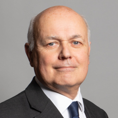 |
| Contact Details | Contact Sir Iain Duncan Smith |
| Political Party | Conservative |
What Council is the E4 6NU Postcode in?
The Local Council for this Postcode is Waltham Forest London Boro Council and the County Council is Greater London Authority Council.
Greater London Authority Council is responsible for providing education, libraries and maintaining highways.
Waltham Forest London Boro Council is responsible for duties such as council tax, rubbish collection, housing, environmental health and planning.
You can visit the website for Waltham Forest London Boro at the following link Waltham Forest London Boro.How much is the Council Tax?
Waltham Forest London Boro Council is responsible for collecting council tax. This will vary depending on which council tax band the property falls within. You can check the council tax band at the gov.uk website.
Once you know the council tax band you can view how much Waltham Forest London Boro charge for that band by visiting the The Council Tax section of their website.
Planning Applications
When moving house to a new post code it is worth checking out what will be built in the neighbourhood.
Few people want to live next door to a building site, have their garden overlooked or have the views from their property ruined.
Visit the local planning department and search for planning applications in this postcode granted within the last three years or still awaiting a decision. This will give an indication of what could still be built.
Where can I find out where the nearest Library to the E4 6NU Postcode is?
Libraries are the responsibility of Waltham Forest council
Visit the link for more information. Please note that some councils outsource library services to private companies and community groups ran by volunteers.
Local libraries | London Borough of Waltham ForestPostcodes near the E4 6NU Postcode
What Popular Supermarkets are near the E4 6NU Postcode?
| Supermarket | Distance | Directions |
|---|---|---|
| Iceland, Old Church Road, Waltham Forest, LONDON, E4 6SJ | 1.11 miles | Directions from E4 6NU to Iceland |
| Tesco, Larkshall Road, Waltham Forest, LONDON, E4 9EF | 1.16 miles | Directions from E4 6NU to Tesco |
| Sainsburys, Hall Lane, Waltham Forest, LONDON, E4 8HH | 1.25 miles | Directions from E4 6NU to Sainsburys |
| Morrisons, Morrison Avenue, Waltham Forest, LONDON, E4 8SN | 1.85 miles | Directions from E4 6NU to Morrisons |
| Sainsburys, Walthamstow Avenue, Waltham Forest, LONDON, E4 8ST | 2.11 miles | Directions from E4 6NU to Sainsburys |
What Popular Restaurants are near the E4 6NU Postcode?
| Burger King | Distance | Directions |
|---|---|---|
| Unit C5, Tottenham Hale Retail Park, London, N15 4QD | 3.38 miles | Directions from E4 6NU to Unit C5, Tottenham Hale Retail Park |
| 374 Eastern Avenue, Gants Hill, Ilford, IG2 6NW | 3.99 miles | Directions from E4 6NU to 374 Eastern Avenue, Gants Hill |
| Unit F, Leyton Mills Retail Park, London, E10 5QF | 4.36 miles | Directions from E4 6NU to Unit F, Leyton Mills Retail Park |
| 170 Bullsmoor Lane, Enfield, EN1 4SE | 4.70 miles | Directions from E4 6NU to 170 Bullsmoor Lane |
| Mcdonald's | Distance | Directions |
|---|---|---|
| McDonald's, Sewardstone Road, Waltham Forest, LONDON, E4 7PU | 1.26 miles | Directions from E4 6NU to McDonald's, Sewardstone Road, Waltham Forest, LONDON, E4 7PU |
| McDonald's, Hoe Street, Waltham Forest, LONDON, E17 3AX | 2.52 miles | Directions from E4 6NU to McDonald's, Hoe Street, Waltham Forest, LONDON, E17 3AX |
| McDonald's, Woodford Trading Estate, Southend Road, WOODFORD GREEN, IG8 8HF | 2.63 miles | Directions from E4 6NU to McDonald's, Woodford Trading Estate, Southend Road, WOODFORD GREEN, IG8 8HF |
| McDonald's, Fore Street, Enfield, LONDON, N18 2XA | 2.75 miles | Directions from E4 6NU to McDonald's, Fore Street, Enfield, LONDON, N18 2XA |
| Restaurant | Distance | Directions |
|---|---|---|
| KFC, Albert Crescent, Waltham Forest, LONDON, E4 6SH | 0.75 miles | Directions from E4 6NU to KFC Chingford - Albert Crescent |
| KFC, George Lane, Redbridge, LONDON, E18 1AY | 2.03 miles | Directions from E4 6NU to KFC South Woodford - George Lane |
| KFC, Fore Street, Enfield, LONDON, N18 2XA | 2.75 miles | Directions from E4 6NU to KFC Edmonton - Fore Street |
| KFC, Lea Bridge Road, Waltham Forest, LONDON, E10 7DN | 3.09 miles | Directions from E4 6NU to KFC Leyton - Lea Bridge Road |
| KFC, High Road, LOUGHTON, IG10 1AD | 3.17 miles | Directions from E4 6NU to KFC Loughton - High Road |