This section of the site is all about the E Postcode area, also known as the East London Postal Area. Explore links to the next level to learn more about specific postcode districts such as E1.
Map of the E Postcode for East London
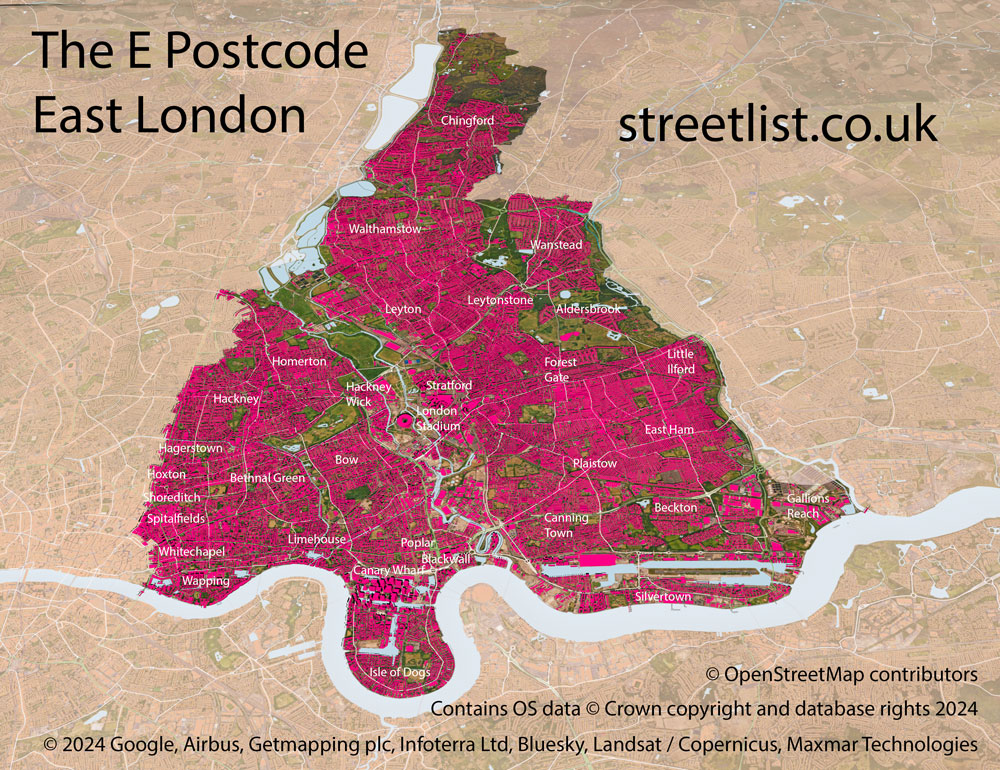
The E postcode area is situated in East London, north of the River Thames.
The area has its head district (E1) in Whitechapel. The delivery offices are based on Whitechapel Road.
Like several postcode areas in London (but not the pattern elsewhere), postcode districts are ordered alphabetically by delivery office name, so excluding the Head district it goes from Bethnal Green (E2) to Walthamstow (E17).
The area stretches from St Katherine's Dock ( just east of the Tower of London) and ends in Galleons Reach where the river Rodding flows into the Thames. The waterfront is characterised by East London's dockland heritage. Canary Wharf is now London's financial heart and has been transformed with dizzying high rise buildings which gives the area a skyline worthy of New York.
Galleons Reach is not named after majestic ships sailing down the Thames but after a Late Medieval Family the "Galyons" who owned much of the land there.
In the docklands between Silvertown and Beckton you will find the London City Airport which opened in 1988.
Silvertown is named after S.W. Silver & Company who founded a rubber factory here in 1852 giving the area it's name. The rubber works closed in the 1960's.
Nearby is Canning Town. I always thought it was named after factories which put food in cans but it is actually named after the first Viceroy of India. Charles John Canning who was responsible for the suppression of the Indian uprising of 1857 at the height of English Colonialism. When I learned that I wished it was named after factories that made tinned food.
The E postcode area is bisected by the River Lee which meets the Thames at Bow Creek and marks the start of the Lee Valley. The route of the river provides a vital wild life corridor into the heart of the city via the Queen Elizabeth Olympic Park, Hackney Marshes and Walthamstow Marshes and wet lands.
The Olympic Park and London Stadium were built for the 2012 London Olympics.
The E Postcode area has long been a natural border, it marked the division between Saxon England and Viking Territory under the Dane Law and it marks the transition from East London to the outskirts of the city as the river Thames flows towards the sea.
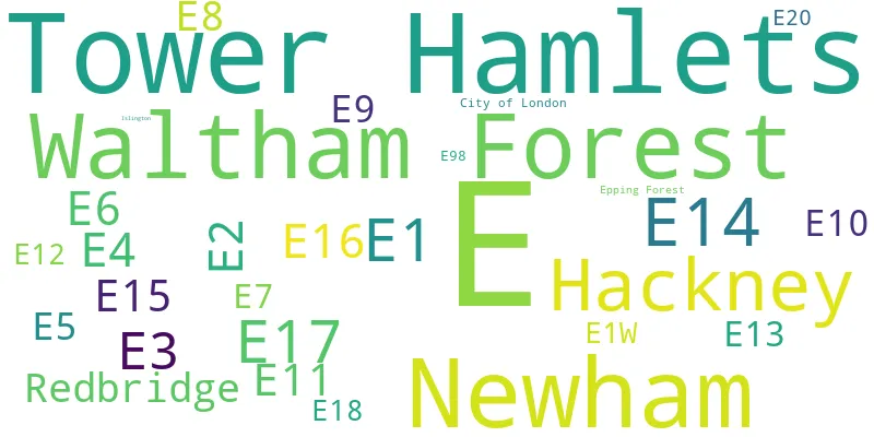
The E postcode area represents a group of postal districts in the East London area of the United Kingdom. The area code E stands for the letters e in East London. E has a population of 990,035 and covers an area of 119,145 hectares. Fun fact: 1.52% of the population of Great Britain lives in this area.
The postcode area falls within the following counties: Greater London (99.57%), City and County of the City of London (0.31%), Essex (0.12%).
Post Towns and Postcode Districts for the E Postcode
-
E1W Greater LondonE1 City and County of the City of London (2%), Greater London (97%)E2 Greater LondonE3 Greater LondonE4 Essex (2%), Greater London (97%)E5 Greater LondonE6 Greater LondonE7 Greater LondonE8 Greater LondonE9 Greater LondonE10 Greater LondonE11 Greater LondonE12 Greater LondonE13 Greater LondonE14 Greater LondonE15 Greater LondonE16 Greater LondonE17 Greater LondonE18 Greater LondonE20 E98
Where is the E Postcode Area?
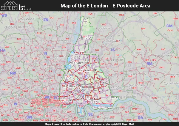
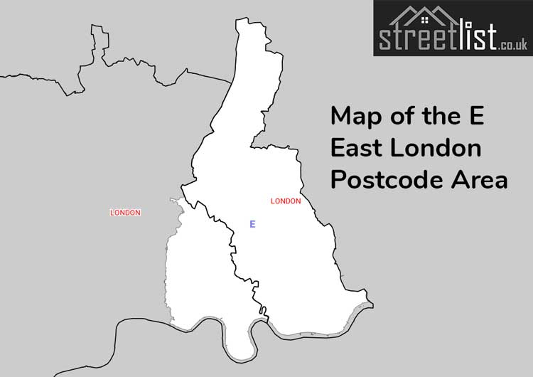
The East London - E Postcode is in the London Region. The postal area borders the following neighbouring postal areas: SE - London - SE, EN - Enfield, IG - Ilford, EC - London - EC and N - London - N, It also borders The Tidal Thames,
Map of the E East London Postcode Area
Explore the E East London postcode area by using our interactive map.

Postcode Districts within the E East London Postcode Area
There are 19 postcode districts within the East London postcode area
A map showing the boundary of in relation to other areas
| Unit | Area² |
|---|---|
| Hectares | 119,145² |
| Miles | 460² |
| Feet | 12,824,648,655² |
| Kilometres | 1,191² |
Postal Delivery Offices serving the E East London Postcode Area
- Bethnal Green S Delivery Office
- Bow S Delivery Office
- Chingford S Delivery Office
- Clapton S Delivery Office
- Docklands Delivery Office
- East Ham S Delivery Office
- Forest Gate S Delivery Office
- Hackney S Delivery Office
- Homerton S Delivery Office
- Leyton S Delivery Office
- Leytonstone S Delivery Office
- Manor Park S Delivery Office
- Plaistow S Delivery Office
- South Woodford S Delivery Office
- Stratford S Delivery Office
- Victoria Docks S Delivery Office
- Walthamstow S Delivery Office
- Whitechapel Delivery Office (e1)
Councils with Postcodes in E
Towns and Villages within the E East London Postcode Area
- Aberfeldy Village - Urban Area
- Barking - Urban Area
- Bethnal Green - Urban Area
- Bow - Urban Area
- Canary Wharf - Urban Area
- Chingford - Urban Area
- Clapton - Urban Area
- Cubitt Town - Urban Area
- De Beauvoir - Urban Area
- Docklands - Urban Area
- East Ham - Urban Area
- Forest Gate - Urban Area
- Hackney - Urban Area
- Haggerston - Urban Area
- Homerton - Urban Area
- Hoxton - Urban Area
- Ilford - Urban Area
- Leyton - Urban Area
- Leytonstone - Urban Area
- Limehouse - Urban Area
- Lower Edmonton - Urban Area
- Manor Park - Urban Area
- Mile End - Urban Area
- Millwall - Urban Area
- Plaistow - Urban Area
- Poplar - Urban Area
- Sewardstone - village
- Shadwell - Urban Area
- Shoreditch - Urban Area
- South Tottenham - Urban Area
- Spitalfields - Urban Area
- Stepney - Urban Area
- Stoke Newington - Urban Area
- Stratford - Urban Area
- The City - city
- Totenham - Urban Area
- Upper Edmonton - Urban Area
- Walthamstow - Urban Area
- Wapping - Urban Area
- Whitechapel - Urban Area
- Woodford - Urban Area