This section of the site is all about the N Postcode area, also known as the North London Postal Area. Explore links to the next level to learn more about specific postcode districts such as N1.
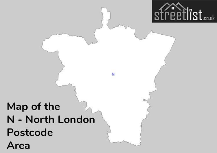
Map of the N Postcode for North London
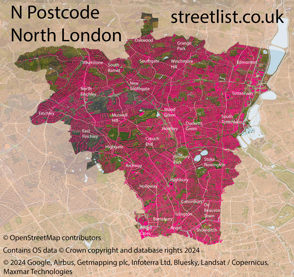
The N postcode area represents a group of postal districts in the North London area of the United Kingdom. The area code N stands for the letters n in North London. N has a population of 848,197 and covers an area of 111,337 hectares. Fun fact: 1.30% of the population of Great Britain lives in this area.
The postcode area falls within the following counties: Greater London (100.00%).
Post Towns and Postcode Districts for the N Postcode
-
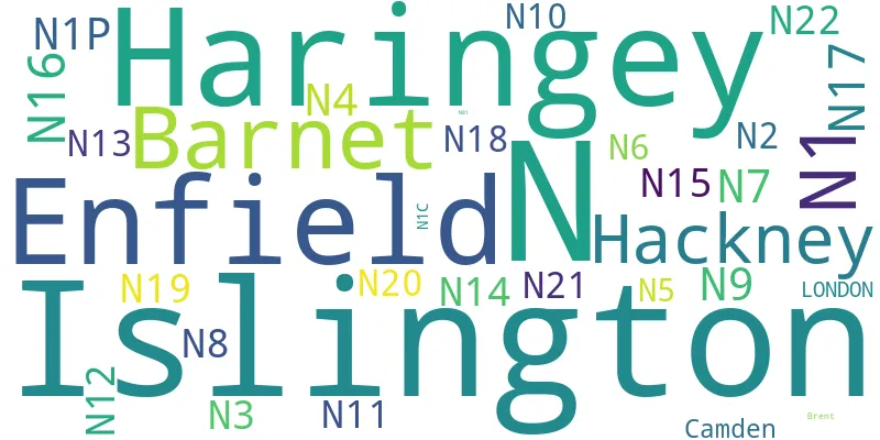
N1C Greater LondonN1P N1 Greater LondonN2 Greater LondonN3 Greater LondonN4 Greater LondonN5 Greater LondonN6 Greater LondonN7 Greater LondonN8 Greater LondonN9 Greater LondonN10 Greater LondonN11 Greater LondonN12 Greater LondonN13 Greater LondonN14 Greater LondonN15 Greater LondonN16 Greater LondonN17 Greater LondonN18 Greater LondonN19 Greater LondonN20 Greater LondonN21 Greater LondonN22 Greater LondonN81
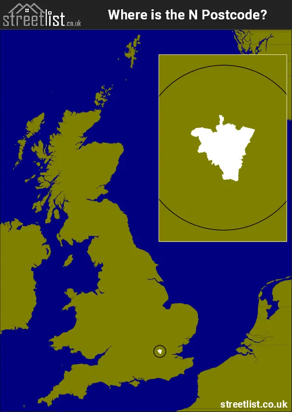
Where is the N Postcode Area?
The North London N postcode area is in London Region of England. The postal area borders the following neighbouring postal areas: E - London - E, WC - London - WC, NW - London - NW, EN - Enfield and EC - London - EC, and is located inland.
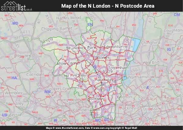
Map of the N North London Postcode Area
Explore the N North London postcode area by using our interactive map.
Postcode Districts within the N North London Postcode Area
There are 23 postcode districts within the North London postcode area
A map showing the boundary of in relation to other areas
| Unit | Area² |
|---|---|
| Hectares | 111,337² |
| Miles | 430² |
| Feet | 11,984,203,343² |
| Kilometres | 1,113² |
Postal Delivery Offices serving the N North London Postcode Area
- East Finchley S Delivery Office
- Finchley Church End S Delivery Office
- Finsbury Park S Delivery Office
- Highbury S Delivery Office
- Highgate S Delivery Office
- Holloway S Delivery Office
- Hornsey S Delivery Office
- Islington Delivery Office
- Lower Edmonton S Delivery Office
- Muswell Hill S Delivery Office
- New Southgate S Delivery Office
- North Finchley S Delivery Office
- Palmers Green S Delivery Office
- South Tottenham S Delivery Office
- Southgate S Delivery Office
- Stoke Newington S Delivery Office
- Tottenham S Delivery Office
- Upper Edmonton S Delivery Office
- Upper Holloway S Delivery Office
- Whetstone S Delivery Office
- Winchmore Hill S Delivery Office
- Wood Green S Delivery Office
Councils with Postcodes in N
Towns and Villages within the N North London Postcode Area
- Barnet - Urban Area
- Bethnal Green - Urban Area
- Camden Town - Urban Area
- Canonbury - Urban Area
- Chingford - Urban Area
- Clapton - Urban Area
- Clerkenwell - Urban Area
- De Beauvoir - Urban Area
- East Finchley - Urban Area
- Enfield - Urban Area
- Finchley - Urban Area
- Finsbury Park - Urban Area
- Golders Green - Urban Area
- Hackney - Urban Area
- Hampstead - Urban Area
- Hendon - Urban Area
- Highbury - Urban Area
- Highgate - Urban Area
- Hornsey - Urban Area
- Hoxton - Urban Area
- Islington - Urban Area
- Kentish Town - Urban Area
- Kings Cross - Urban Area
- Lower Edmonton - Urban Area
- Lower Holloway - Urban Area
- Mill Hill - Urban Area
- Muswell Hill - Urban Area
- New Southgate - Urban Area
- North Finchley - Urban Area
- Palmers Green - Urban Area
- Ponders End - Urban Area
- Somers Town - Urban Area
- South Tottenham - Urban Area
- Southgate - Urban Area
- St Lukes - Urban Area
- Stoke Newington - Urban Area
- Totenham - Urban Area
- Upper Edmonton - Urban Area
- Upper Holloway - Urban Area
- Walthamstow - Urban Area
- Whetstone - Urban Area
- Winchmore Hill - Urban Area
- Wood Green - Urban Area