This section of the site is all about the EC Postcode area, also known as the East Central London Postal Area. Explore links to the next level to learn more about specific postcode districts such as EC1A.
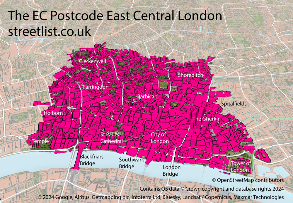
Map of the EC East Central London Postcode
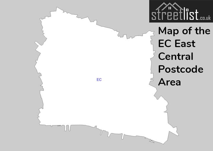
The EC Postcode area is for the eastern half of central London, the western half is the WC area.
It includes much of old London and what is known as the city. Which was London's financial heart before it upped sticks and moved to Canary Wharf.
At its heart is St Pauls Cathedral. Once this domed cathedral towered over London's skyline now it seems diminutive in comparison to the skyscrapers of EC3A such as the Gherkin of St Mary Axe.
WC encompasses The City of London which was the old Roman city of Londinium and sections of Roman Wall still exist. The City of London is a City within a City and a County in its own right. It extends along the North bank of the Thames from the Temple to the Tower of London. Inland it extends to Clerkenwell and Shoreditch.
Here you will find the Monument to the Great Fire of London and nearby its starting point at Pudding Lane. But looking at the area now in modern times it is hard to imagine how London looked then.
If you feel overwhelmed by the scale of modern London, I'll share a hidden EC gem with you. At EC4Y you will find the Inner Temple. In peaceful gardens you will find a fountain courtyard in the dappled shade of ancient trees. Nearby is the Temple church, survivor of the great fire and associated with the Knights Templar.
My favourite museum The Museum of London was located at the Barbican. At the time of writing it is closed and will relocate to nearby West Smithfield.
The EC postcode area represents a group of postal districts in the East Central London area of the United Kingdom. The area code EC stands for the letters e and c in Eastern Central. EC has a population of 33,205 and covers an area of 5,345 hectares. Fun fact: 0.05% of the population of Great Britain lives in this area.
The postcode area falls within the following counties: City and County of the City of London (58.60%), Greater London (41.40%).
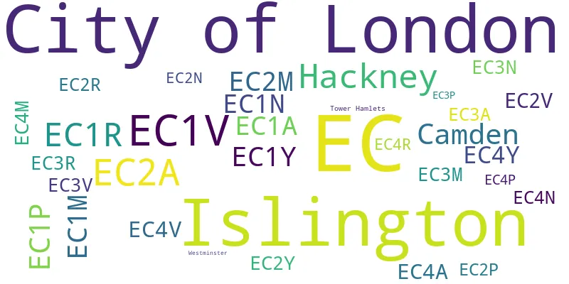
Post Towns and Postcode Districts for the EC Postcode
-
EC1A City and County of the City of London (90%), Greater London (9%)EC1M City and County of the City of London (2%), Greater London (97%)EC1N City and County of the City of London (13%), Greater London (86%)EC1P EC1R Greater LondonEC1V Greater LondonEC1Y City and County of the City of London (10%), Greater London (89%)EC2A City and County of the City of London (5%), Greater London (94%)EC2M City and County of the City of London (83%), Greater London (16%)EC2N City and County of the City of London (91%), Greater London (8%)EC2P EC2R City and County of the City of London (88%), Greater London (11%)EC2V City and County of the City of London (92%), Greater London (7%)EC2Y City and County of the City of London (76%), Greater London (23%)EC3A City and County of the City of London (94%), Greater London (5%)EC3M City and County of the City of London (95%), Greater London (4%)EC3N City and County of the City of London (80%), Greater London (19%)EC3P EC3R City and County of the City of London (91%), Greater London (8%)EC3V City and County of the City of London (94%), Greater London (5%)EC4A City and County of the City of London (88%), Greater London (11%)EC4M City and County of the City of London (90%), Greater London (9%)EC4N City and County of the City of London (88%), Greater London (11%)EC4P EC4R City and County of the City of London (93%), Greater London (6%)EC4V City and County of the City of London (93%), Greater London (6%)EC4Y City and County of the City of London (88%), Greater London (11%)
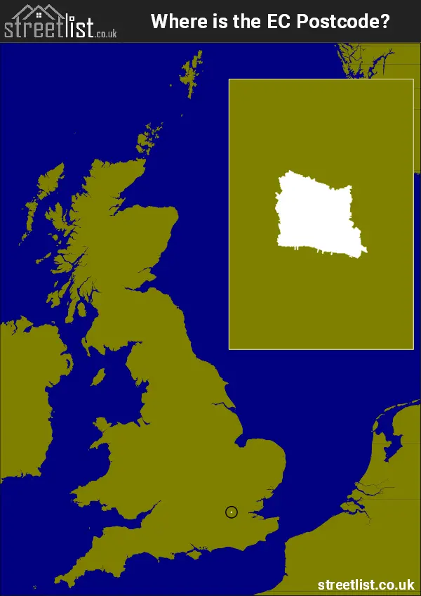
Where is the EC Postcode Area?
The East Central London - EC Postcode is in the London Region of England. The postal area borders the following neighbouring postal areas: E - London - E, WC - London - WC, SE - London - SE and N - London - N, It also borders The Tidal Thames,
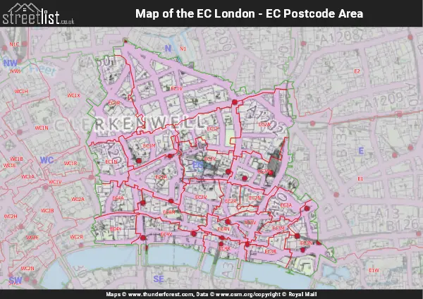
Map of the EC East Central London Postcode Area
Explore the EC East Central London postcode area by using our interactive map.
Postcode Districts within the EC East Central London Postcode Area
There are 23 postcode districts within the East Central London postcode area
A map showing the boundary of in relation to other areas
| Unit | Area² |
|---|---|
| Hectares | 5,345² |
| Miles | 21² |
| Feet | 575,330,455² |
| Kilometres | 53² |
Postal Delivery Offices serving the EC East Central London Postcode Area
- Mount Pleasant Ec1
- Mount Pleasant Ec2
- Mount Pleasant Ec3
- Mount Pleasant Ec4