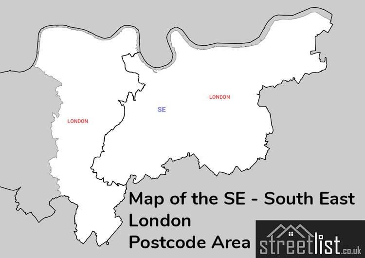
Map of the SE postcode area
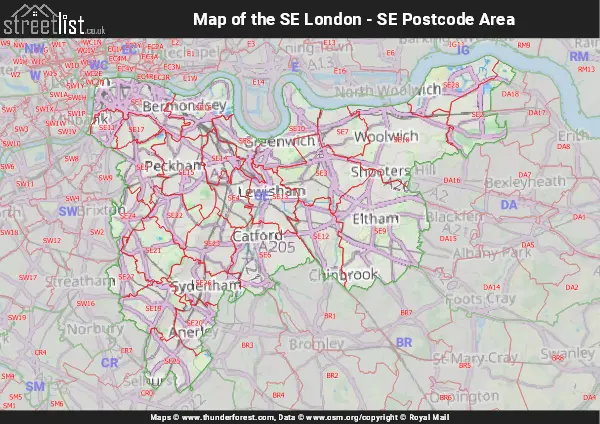
Use the interactive map to explore the area boundary and neighbouring postcode areas.
Overview
The SE Postcode Area
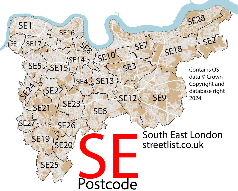
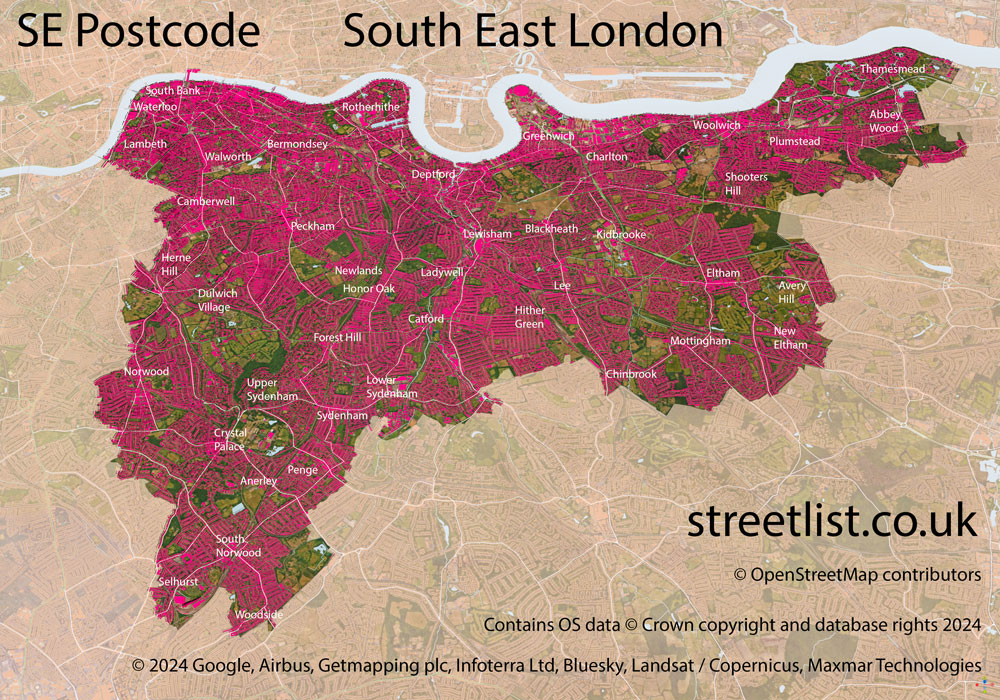
The SE postcode area covers much of south-east London and lies entirely within Greater London, bordered to the north by the River Thames from Vauxhall to Thamesmead. The area includes important cultural, historic and residential districts, extending from the South Bank out to the city’s south-eastern suburbs.
Along the Thames, SE contains major landmarks and attractions including London Waterloo, one of Britain’s busiest railway stations, the London Eye, Lambeth Palace, the Imperial War Museum, Tate Modern, Shakespeare’s Globe, and the arts and performance venues of the South Bank. Further east along the river lie Bermondsey and Rotherhithe, followed by Greenwich, home to the Cutty Sark and the Prime Meridian, and Woolwich, historically associated with naval dockyards and military industry. On the Greenwich Peninsula stands The O2, originally built as the Millennium Dome.
Away from the river, the area includes a wide range of neighbourhoods such as Kennington, Walworth, Elephant and Castle, Camberwell, Peckham, New Cross, Lewisham, Eltham and Catford, alongside districts to the west including Dulwich, Herne Hill, Tulse Hill and Upper Norwood.
One of the area’s most distinctive landmarks is Crystal Palace, named after the rebuilt Crystal Palace structure that was destroyed by fire in 1936, with surviving terraces and parkland, Victorian dinosaur sculptures and a prominent transmitter mast overlooking south London.
The SE area is shaped not only by the Thames but also by smaller waterways such as the River Quaggy, which joins the Ravensbourne before flowing into the Thames at Deptford Creek, contributing to the varied landscape and historic development of south-east London.
The SE postcode area covers South East London.
The postcode area borders the following neighbouring postcode areas: DA - Dartford, E - London - E, CR - Croydon, SW - London - SW, WC - London - WC, BR - Bromley, RM - Romford, IG - Ilford and EC - London - EC. It also borders The Tidal Thames.
The postcode area falls within the following counties: Greater London (100.00%).
Map of the SE Postcode for South East London
Quick facts
| Width east to west | 11.69 mi |
|---|---|
| Height north to south | 9.19 mi |
| Area | 53.05 mi² |
| Maximum width | 13.09 mi |
| Perimeter | 58.54 mi |
| Postcode districts | 29 |
| Postcode sectors | 127 |
| Post towns | 1 |
| Postcodes | 20,475 |
| Population | 988,702 |
The SE postcode area has a population of 988,702 and covers 134,508 hectares. Roughly 1.52% of the population of Great Britain lives here.
How this area fits into London postcodes
The SE area is part of London’s distinctive postcode system.
View London postcodesPost towns and postcode districts
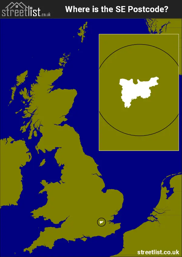
Where is the SE postcode area?
How built up is the postcode area?
This compares building footprint coverage against the total land area across each postcode district. The least urban district is SE21 and the most urban is SE1.
| Postcode district | Total area (m²) | Footprint area (m²) | Built percentage |
|---|---|---|---|
| SE21 | 4,576,256 | 529,106 | 11.56% |
| SE2 | 5,779,461 | 679,786 | 11.76% |
| SE9 | 15,021,532 | 1,912,054 | 12.73% |
| SE28 | 5,270,889 | 700,613 | 13.29% |
| SE3 | 6,944,599 | 1,027,293 | 14.79% |
| SE12 | 5,149,827 | 784,292 | 15.23% |
| SE19 | 4,536,512 | 703,620 | 15.51% |
| SE26 | 4,270,791 | 766,800 | 17.95% |
| SE18 | 10,336,989 | 1,902,758 | 18.41% |
| SE25 | 4,847,246 | 922,524 | 19.03% |
| SE20 | 2,903,313 | 569,013 | 19.60% |
| SE23 | 4,182,274 | 840,344 | 20.09% |
| SE10 | 5,077,628 | 1,030,403 | 20.29% |
| SE24 | 2,573,550 | 522,207 | 20.29% |
| SE7 | 3,755,410 | 769,451 | 20.49% |
| SE6 | 7,197,749 | 1,481,350 | 20.58% |
| SE4 | 3,159,838 | 656,360 | 20.77% |
| SE8 | 2,554,698 | 587,917 | 23.01% |
| SE16 | 4,599,732 | 1,062,612 | 23.10% |
| SE22 | 3,210,616 | 776,370 | 24.18% |
| SE14 | 2,516,757 | 619,201 | 24.60% |
| SE13 | 4,225,751 | 1,061,155 | 25.11% |
| SE5 | 4,187,152 | 1,052,142 | 25.13% |
| SE27 | 2,279,579 | 580,836 | 25.48% |
| SE15 | 5,854,965 | 1,511,885 | 25.82% |
| SE11 | 1,676,827 | 476,944 | 28.44% |
| SE17 | 1,894,277 | 557,981 | 29.46% |
| SE1 | 5,917,325 | 2,099,625 | 35.48% |
| Total | 134,501,543 | 26,184,642 | 19.47% |
Area measurements
| Hectares | 134,508 |
|---|---|
| Square miles | 519.34 |
| Square feet | 14,478,306,612.00 |
| Square kilometres | 1,345.08 |
Postal delivery offices
- Abbey Wood S Delivery Office
- Anerley S Delivery Office
- Blackheath S Delivery Office
- Brockley S Delivery Office
- Camberwell S Delivery Office
- Catford S Delivery Office
- Charlton S Delivery Office
- Deptford S Delivery Office
- Dulwich S Delivery Office
- East Dulwich S Delivery Office
- Eltham S Delivery Office
- Forest Hill S Delivery Office
- Greenwich S Delivery Office
- Herne Hill S Delivery Office
- Kennington S Delivery Office
- Lee S Delivery Office
- Lewisham S Delivery Office
- New Cross S Delivery Office
- Norwood S Delivery Office
- Peckham S Delivery Office
- Rotherhithe S Delivery Office
- South Norwood S Delivery Office
- Southwark S Delivery Office
- Sydenham S Delivery Office
- Thamesmead S Delivery Office
- Walworth S Delivery Office
- West Norwood S Delivery Office
- Woolwich S Delivery Office
Tourist attractions within the area
We found 19 visitor attractions within the South Eastern London postcode area.
| Imperial War Museum London |
|---|
| Museums & Art Galleries |
| Museum and / or Art Gallery |
| View on Google Maps |
| Tate Modern |
| Museums & Art Galleries |
| Museum and / or Art Gallery |
| View on Google Maps |
| Shakespeare's Globe |
| Historic Properties |
| Other Historic Property |
| View on Google Maps |
| Tower Bridge Exhibition |
| Historic Properties |
| Historic Monument / Archaeological Site |
| View on Google Maps |
| Crystal Palace Museum |
| Museums & Art Galleries |
| Museum and / or Art Gallery |
| View on Google Maps |
| Horniman Museum and Gardens |
| Museums & Art Galleries |
| Museum and / or Art Gallery |
| View on Google Maps |
| Brunel Engine House Rotherhithe |
| Museums & Art Galleries |
| Museum and / or Art Gallery |
| View on Google Maps |
| St Alfege Church |
| Places of Worship |
| Place of Worship (still in use) |
| View on Google Maps |
| Discover Greenwich Visitor Centre |
| Visitor Centres |
| Heritage / Visitor Centre |
| View on Google Maps |
| Old Royal Naval College Chapel |
| Places of Worship |
| Place of Worship (still in use) |
| View on Google Maps |
| Old Royal Naval College Painted Hall |
| Historic Properties |
| Other Historic Property |
| View on Google Maps |
| Maritime Exhibition |
| Museums & Art Galleries |
| Museum and / or Art Gallery |
| View on Google Maps |
| Maritime Museum |
| Museums & Art Galleries |
| Museum and / or Art Gallery |
| View on Google Maps |
| Maritime Museum |
| Museums & Art Galleries |
| Museum and / or Art Gallery |
| View on Google Maps |
| Maritime Museum |
| Museums & Art Galleries |
| Museum and / or Art Gallery |
| View on Google Maps |
| The Wernher Collection at Ranger's House |
| Historic Properties |
| Historic House / House and Garden / Palace |
| View on Google Maps |
| DIG |
| Museums & Art Galleries |
| Museum and / or Art Gallery |
| View on Google Maps |
| Eltham Palace |
| Historic Properties |
| Historic House / House and Garden / Palace |
| View on Google Maps |
| Crossness Engines |
| Museums & Art Galleries |
| Museum and / or Art Gallery |
| View on Google Maps |
Neighbouring context
The postcode area borders the following neighbouring postcode areas: DA - Dartford, E - London - E, CR - Croydon, SW - London - SW, WC - London - WC, BR - Bromley, RM - Romford, IG - Ilford and EC - London - EC. It also borders The Tidal Thames.
Towns and villages within the area
- Abbey Wood — Urban Area
- Addiscombe — Urban Area
- Anerley — Urban Area
- Beckenham — Urban Area
- Belvedere — Urban Area
- Bermondsey — Urban Area
- Blackheath — Urban Area
- Brixton — Urban Area
- Brockley — Urban Area
- Brockwell Park — Urban Area
- Camberwell — Urban Area
- Catford — Urban Area
- Charlton — Urban Area
- Chislehurst — Urban Area
- Croydon — Urban Area
- Deptford — Urban Area
- Downham — Urban Area
- Dulwich — Urban Area
- East Dulwich — Urban Area
- Elephant and Castle — Urban Area
- Elmers End — Greater London
- Eltham — Urban Area
- Forest Hill — Urban Area
- Greenwich — Urban Area
- Herne Hill — Urban Area
- Kennington — Urban Area
- Lambeth — Urban Area
- Lee — Urban Area
- Lewisham — Urban Area
- New Cross — Urban Area
- Newington — Urban Area
- Peckham — Urban Area
- Penge — Urban Area
- Pimlico — Urban Area
- Plaistow — Urban Area
- Rotherhyth — Urban Area
- Sidcup — Urban Area
- South Bank — urban area
- South Lambeth — Urban Area
- South Norwood — Urban Area
- Southwark — Urban Area
- Streatham — Urban Area
- Streatham Hill — Urban Area
- Sydenham — Urban Area
- Temple — Urban Area
- Thamesmead — Urban Area
- The City — city
- Thornton Heath — Urban Area
- Tulse Hill — Urban Area
- Upper Norwood — Urban Area
- Vauxhall — Urban Area
- Walworth — Urban Area
- Wapping — Urban Area
- Welling — Urban Area
- West Norwood — Urban Area
- Westminster — Urban Area
- Woolwich — Urban Area