The SE19 postcode district is a postal district located in the SE London - SE postcode area with a population of 28,914 residents according to the 2021 England and Wales Census.
The area of the SE19 postcode district is 1.75 square miles which is 4.53 square kilometres or 1,120.59 acres.
Currently, the SE19 district has about 600 postcode units spread across 3 geographic postcode sectors.
Given that each sector allows for 400 unique postcode combinations, the district has a capacity of 1,200 postcodes. With 600 postcodes already in use, this leaves 600 units available.
The largest settlement in the SE19 postal code is UPPER NORWOOD followed by LONDON, and ANERLEY.
The SE19 Postcode shares a border with SE25 (SOUTH NORWOOD), SE26 (LONDON, SYDENHAM), CR7 (THORNTON HEATH), SE20 (PENGE), SE21 (LONDON), SE27 (LONDON) and SW16 (LONDON, NORBURY).
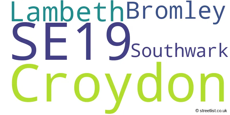
The primary settlement in the SE19 postcode district is Lambeth, which is located in London, Greater London. Other significant settlements include Southwark, Bromley, and Croydon.
For the district SE19, we have data on 4 postcode sectors. Here's a breakdown: The sector SE19 1, covers Lambeth and Southwark in Greater London. The sector SE19 2, covers Croydon and Bromley in Greater London. The sector SE19 3, covers Croydon in Greater London. The sector SE19 9 is non-geographic. It's often designated for PO Boxes, large organisations, or special services.

Map of the SE19 Postcode District
Explore the SE19 postcode district by using our free interactive map.

When it comes to local government, postal geography often disregards political borders. However, for a breakdown in the SE19 District: the district mostly encompasses the Croydon London Boro (356 postcodes), followed by the Lambeth London Boro area (108 postcodes), followed by the Bromley London Boro area (79 postcodes), and finally, the Southwark London Boro area (57 postcodes).
Recent House Sales in SE19
| Date | Price | Address |
|---|---|---|
| 12/10/2023 | £175,000 | Church Road, London, SE19 2UD |
| 29/09/2023 | £530,000 | Fox Hill, London, SE19 2UJ |
| 29/09/2023 | £875,000 | Downsview Road, London, SE19 3XD |
| 29/09/2023 | £217,500 | Beulah Hill, London, SE19 3NF |
| 27/09/2023 | £780,000 | Rushden Close, London, SE19 3QB |
| 15/09/2023 | £345,000 | Church Road, London, SE19 2PR |
| 07/09/2023 | £394,550 | Alexandra Drive, London, SE19 1AN |
| 07/09/2023 | £445,000 | Sylvan Hill, London, SE19 2QB |
| 07/09/2023 | £797,000 | High View Close, London, SE19 2DS |
| 05/09/2023 | £280,000 | Rusholme Grove, London, SE19 1HY |
Weather Forecast for SE19
Press Button to Show Forecast for Crystal Palace National Sports Centre
| Time Period | Icon | Description | Temperature | Rain Probability | Wind |
|---|---|---|---|---|---|
| 09:00 to 12:00 | Overcast | 8.0°C (feels like 5.0°C) | 15.00% | ENE 9 mph | |
| 12:00 to 15:00 | Cloudy | 11.0°C (feels like 9.0°C) | 14.00% | NE 9 mph | |
| 15:00 to 18:00 | Cloudy | 12.0°C (feels like 10.0°C) | 19.00% | ENE 9 mph | |
| 18:00 to 21:00 | Light rain | 11.0°C (feels like 9.0°C) | 55.00% | ENE 11 mph | |
| 21:00 to 00:00 | Heavy rain | 9.0°C (feels like 7.0°C) | 84.00% | NE 11 mph |
Press Button to Show Forecast for Crystal Palace National Sports Centre
| Time Period | Icon | Description | Temperature | Rain Probability | Wind |
|---|---|---|---|---|---|
| 00:00 to 03:00 | Heavy rain | 9.0°C (feels like 6.0°C) | 86.00% | NE 9 mph | |
| 03:00 to 06:00 | Heavy rain | 9.0°C (feels like 7.0°C) | 87.00% | ENE 9 mph | |
| 06:00 to 09:00 | Heavy rain | 8.0°C (feels like 7.0°C) | 84.00% | E 7 mph | |
| 09:00 to 12:00 | Heavy rain | 9.0°C (feels like 6.0°C) | 81.00% | W 9 mph | |
| 12:00 to 15:00 | Light rain | 9.0°C (feels like 6.0°C) | 57.00% | W 11 mph | |
| 15:00 to 18:00 | Light rain | 10.0°C (feels like 8.0°C) | 47.00% | W 11 mph | |
| 18:00 to 21:00 | Cloudy | 11.0°C (feels like 9.0°C) | 10.00% | WSW 9 mph | |
| 21:00 to 00:00 | Partly cloudy (night) | 9.0°C (feels like 7.0°C) | 3.00% | SW 7 mph |
Press Button to Show Forecast for Crystal Palace National Sports Centre
| Time Period | Icon | Description | Temperature | Rain Probability | Wind |
|---|---|---|---|---|---|
| 00:00 to 03:00 | Clear night | 8.0°C (feels like 6.0°C) | 2.00% | SW 4 mph | |
| 03:00 to 06:00 | Clear night | 7.0°C (feels like 5.0°C) | 1.00% | SSW 4 mph | |
| 06:00 to 09:00 | Sunny day | 7.0°C (feels like 6.0°C) | 1.00% | S 4 mph | |
| 09:00 to 12:00 | Sunny day | 11.0°C (feels like 9.0°C) | 1.00% | S 9 mph | |
| 12:00 to 15:00 | Cloudy | 14.0°C (feels like 12.0°C) | 5.00% | S 11 mph | |
| 15:00 to 18:00 | Partly cloudy (day) | 15.0°C (feels like 12.0°C) | 2.00% | S 11 mph | |
| 18:00 to 21:00 | Sunny day | 14.0°C (feels like 12.0°C) | 2.00% | S 9 mph | |
| 21:00 to 00:00 | Clear night | 11.0°C (feels like 10.0°C) | 1.00% | SE 7 mph |
Press Button to Show Forecast for Crystal Palace National Sports Centre
| Time Period | Icon | Description | Temperature | Rain Probability | Wind |
|---|---|---|---|---|---|
| 00:00 to 03:00 | Clear night | 10.0°C (feels like 8.0°C) | 1.00% | SE 7 mph | |
| 03:00 to 06:00 | Clear night | 9.0°C (feels like 7.0°C) | 3.00% | ESE 7 mph | |
| 06:00 to 09:00 | Sunny day | 9.0°C (feels like 8.0°C) | 5.00% | ESE 7 mph | |
| 09:00 to 12:00 | Partly cloudy (day) | 12.0°C (feels like 11.0°C) | 4.00% | SE 7 mph | |
| 12:00 to 15:00 | Cloudy | 15.0°C (feels like 14.0°C) | 10.00% | SE 9 mph | |
| 15:00 to 18:00 | Cloudy | 16.0°C (feels like 14.0°C) | 13.00% | SE 9 mph | |
| 18:00 to 21:00 | Cloudy | 16.0°C (feels like 14.0°C) | 11.00% | SE 9 mph | |
| 21:00 to 00:00 | Cloudy | 13.0°C (feels like 12.0°C) | 11.00% | ESE 7 mph |
Where is the SE19 Postcode District?
The data provided indicates that the postcode district SE19 is located in the town of Upper Norwood, which is in the London district. In terms of nearby towns, the data lists Anerley to the east, Norbury to the west, South Norwood to the south, and Forest Hill to the northeast. Additionally, the data states that the distance between SE19 and the center of London is approximately 6.44 miles.
The district is within the post town of LONDON.
The sector has postcodes within the nation of England.
The SE19 Postcode District is covers the following regions.
- Lambeth - Inner London - East - London
- Croydon - Outer London - South - London
- Lewisham and Southwark - Inner London - East - London
- Bromley - Outer London - South - London
| Postcode Sector | Delivery Office |
|---|---|
| SE19 1 | Norwood Sdelivery Office |
| SE19 2 | Norwood Sdelivery Office |
| SE19 3 | Norwood Sdelivery Office |
| S | E | 1 | 9 | - | X | X | X |
| S | E | 1 | 9 | Space | Numeric | Letter | Letter |
Tourist Attractions within the Postcode Area
We found 1 visitor attractions within the SE19 postcode area
| Crystal Palace Museum |
|---|
| Museums & Art Galleries |
| Museum and / or Art Gallery |
| View Crystal Palace Museum on Google Maps |
Current Monthly Rental Prices
| # Bedrooms | Min Price | Max Price | Avg Price |
|---|---|---|---|
| £1,150 | £1,150 | £1,150 | |
| 1 | £920 | £3,500 | £1,556 |
| 2 | £1,450 | £4,000 | £2,204 |
| 3 | £1,700 | £2,800 | £2,300 |
| 4 | £2,700 | £3,500 | £3,129 |
| 5 | £5,000 | £10,000 | £7,500 |
Current House Prices
| # Bedrooms | Min Price | Max Price | Avg Price |
|---|---|---|---|
| £170,000 | £240,000 | £195,000 | |
| 1 | £106,250 | £415,000 | £295,552 |
| 2 | £113,750 | £995,000 | £442,105 |
| 3 | £214,500 | £1,350,000 | £625,932 |
| 4 | £163,250 | £1,430,000 | £810,737 |
| 5 | £500,000 | £2,700,000 | £1,648,684 |
| 6 | £995,000 | £3,000,000 | £2,081,667 |
| 7 | £1,750,000 | £1,750,000 | £1,750,000 |
| 8 | £1,500,000 | £1,500,000 | £1,500,000 |
| 10 | £1,600,000 | £1,600,000 | £1,600,000 |
Estate Agents who Operate in the SE19 District
| Logo | Name | Brand Name | Address | Contact Number | Total Properties |
|---|---|---|---|---|---|
 | Crystal Palace | Pedder | Pissarro House, 77a Westow Hill, London, SE19 1TX | 020 3962 0429 | 39 |
 | Crystal Palace | Kinleigh Folkard & Hayward - Sales | 15-17 Westow Hill, London, SE19 1TQ | 020 3871 6004 | 37 |
 | Crystal Palace | Foxtons | 26 Westow Hill, Crystal Palace, SE19 1TQ | 020 3840 3918 | 30 |
 | Crystal Palace | Streets Ahead | Crystal Palace Office Westow Street, London, SE19 3AH | 020 3835 4161 | 28 |
 | Crystal Palace | Acorn | 29 Westow Street, London, SE19 3RW | 020 3835 5081 | 20 |
| Type of Property | 2018 Average | 2018 Sales | 2017 Average | 2017 Sales | 2016 Average | 2016 Sales | 2015 Average | 2015 Sales |
|---|---|---|---|---|---|---|---|---|
| Detached | £914,472 | 18 | £941,000 | 13 | £922,146 | 24 | £880,454 | 23 |
| Semi-Detached | £620,453 | 33 | £760,729 | 34 | £606,848 | 41 | £586,766 | 54 |
| Terraced | £568,594 | 74 | £589,708 | 84 | £598,136 | 66 | £503,143 | 100 |
| Flats | £395,938 | 328 | £370,507 | 322 | £353,805 | 371 | £318,514 | 443 |