This section of the site is all about the DA Postcode area, also known as the Dartford Postal Area. Explore links to the next level to learn more about specific postcode districts such as DA1.
The DA postcode area represents a group of postal districts in the Dartford area of the United Kingdom. The area code DA stands for the letters d and a in DArtford. DA has a population of 430,560 and covers an area of 264,623 hectares. Fun fact: 0.66% of the population of Great Britain lives in this area.
The postcode area falls within the following counties: Kent (52.18%), Greater London (47.82%).
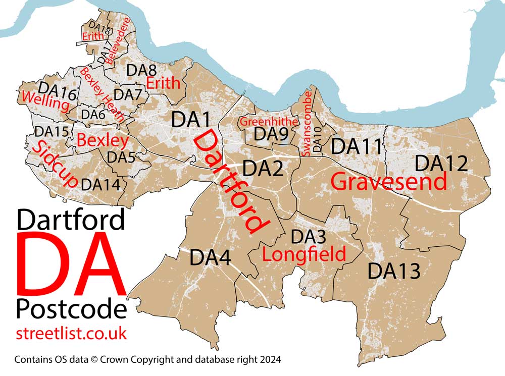
Post Towns and Postcode Districts for the DA Postcode
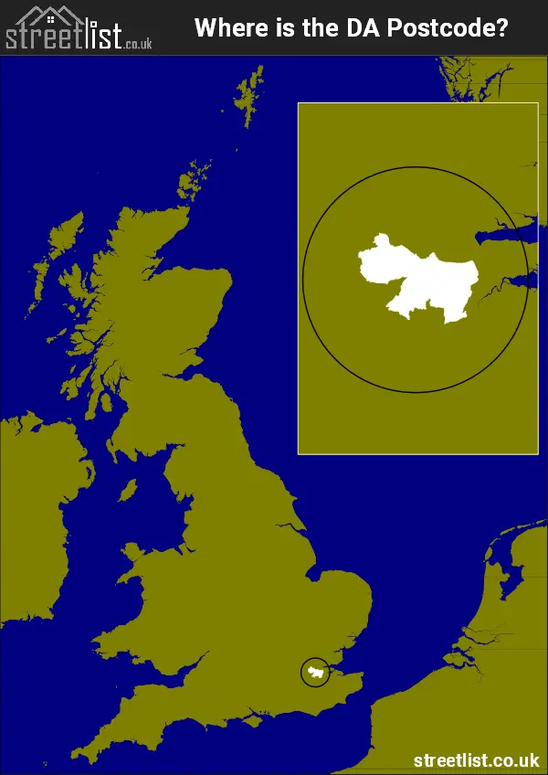
Where is the DA Postcode Area?
The DA Dartford postcode has it's West is in the London Region and it's East is in the South East of England. The postal area borders the following neighbouring postal areas: SE - London - SE, BR - Bromley, RM - Romford, ME - Medway and TN - Tonbridge, It also borders The Tidal Thames,
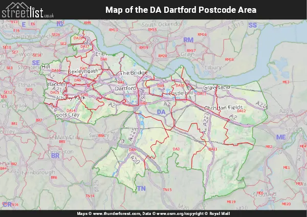
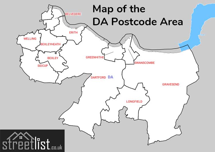
Map of the DA Dartford Postcode Area
Explore the DA Dartford postcode area by using our interactive map.
Postcode Districts within the DA Dartford Postcode Area
There are 18 postcode districts within the Dartford postcode area
A map showing the boundary of in relation to other areas
There are 5 towns within the Dartford postcode area.
| Unit | Area² |
|---|---|
| Hectares | 264,623² |
| Miles | 1,022² |
| Feet | 28,483,755,097² |
| Kilometres | 2,646² |
Postal Delivery Offices serving the DA Dartford Postcode Area
- Belvedere Delivery Office
- Bexley Delivery Office
- Bexleyheath Delivery Office
- Dartford Delivery Office
- Erith Delivery Office
- Gravesend Delivery Office
- Longfield Delivery Office
- Sidcup Delivery Office
- Swanscombe Delivery Office
Councils with Postcodes in DA
Towns and Villages within the DA Dartford Postcode Area
- Abbey Wood - Urban Area
- Bean - village
- Belvedere - Urban Area
- Betsham - village
- Bexley - Urban Area
- Bexley Heath - Urban Area
- Cobham - village
- Coldblow - village
- Crayford - Settlement
- Culverstone Green - village
- Darenth - village
- Dartford - town
- Eltham - Urban Area
- Erith - Urban Area
- Eynsford - village
- Farningham - village
- Fawkham Green - village
- Foots Cray - Urban Area
- Gravesend - town
- Green Street Green - village
- Hartley - village
- Harvel - village
- Hawley - village
- Hextable - village
- Higham - village
- Hook Green - village
- Horton Kirby - village
- Istead Rise - village
- Joyden's Wood - village
- Longfield - village
- Longfield Hill - village
- New Ash Green - village
- New Barn - village
- North Cray - village
- Northfleet - town
- Orpington - Urban Area
- Ruxley - village
- Shorne - village
- Shorne Ridgeway - village
- Sidcup - Urban Area
- Sole Street - village
- South Darenth - village
- South Street - village
- Southfleet - village
- Stone - village
- Sutton at Hone - village
- Swanley - town
- Swanscombe - town
- Upper Ruxley - village
- Vigo Village - village
- Welling - Urban Area
- West Yoke - village
- Woolwich - Urban Area