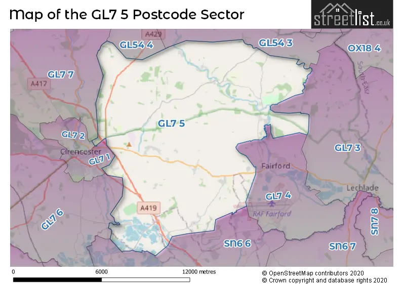
The GL7 5 postcode sector stands on the Gloucestershire and Wiltshire border.
Did you know? According to the 2021 Census, the GL7 5 postcode sector is home to a bustling 7,908 residents!
Given that each sector allows for 400 unique postcode combinations. Letters C, I, K, M, O and V are not allowed in the last two letters of a postcode. With 312 postcodes already in use, this leaves 88 units available.
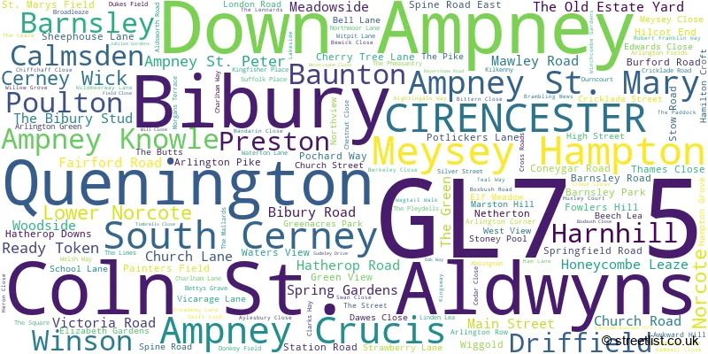
The largest settlement in the GL7 5 postal code is South Cerney followed by Bibury, and Ampney Crucis.
The GL7 5 Postcode shares a border with SN6 6 (Cricklade, Ashton Keynes, Leigh), GL54 3 (Northleach, Naunton, Aldsworth), GL54 4 (Andoversford, Chedworth, Withington), GL7 1 (CIRENCESTER, Love Lane Industrial Estate), GL7 2 (CIRENCESTER, Stratton), GL7 3 (LECHLADE, Filkins, Eastleach), GL7 4 (FAIRFORD, Kempsford, Whelford), GL7 6 (Somerford Keynes, Kemble, Siddington) and GL7 7 (Baunton, Rendcomb, Daglingworth).
The sector is within the post town of CIRENCESTER.
GL7 5 is a postcode sector within the GL7 postcode district which is within the GL Gloucester postcode area.
The Royal Mail delivery office for the GL7 5 postal sector is the Cirencester Delivery Office.
The area of the GL7 5 postcode sector is 55.42 square miles which is 143.53 square kilometres or 35,467.62 square acres.
The GL7 5 postcode sector is crossed by the A417 Major A road.
The GL7 5 postcode sector is crossed by the A419 Major A road.
Waterways within the GL7 5 postcode sector include the River Coln.

Map of the GL7 5 Postcode Sector
Explore the GL7 5 postcode sector by using our free interactive map.
| G | L | 7 | - | 5 | X | X |
| G | L | 7 | Space | 5 | Letter | Letter |
Official List of Streets
Bibury (14 Streets)
South Cerney (54 Streets)
Barnsley (1 Streets)
Ampney Crucis (9 Streets)
Meysey Hampton (14 Streets)
Poulton (11 Streets)
Coln St. Aldwyns (5 Streets)
Down Ampney (11 Streets)
CIRENCESTER (4 Streets)
Quenington (13 Streets)
Preston (4 Streets)
Ampney St. Peter (1 Streets)
Winson (1 Streets)
Unofficial Streets or Alternative Spellings
FAIRFORD
HATHEROP ROAD LEAFIELD ROADSouth Cerney
AARON ROAD TRENCHARD GARDENSAshton Keynes
WHITEFRIARS LANELatton
CIRENCESTER ROADCIRENCESTER
KINGSHILL LANEBagendon
WELSH WAYSchools and Places of Education Within the GL7 5 Postcode Sector
Ampney Crucis Church of England Primary School
Voluntary aided school
School Lane, Cirencester, Gloucestershire, GL7 5SD
Head: Mrs Tana Wood
Ofsted Rating: Outstanding
Inspection: 2014-12-04 (3470 days ago)
Website: Visit Ampney Crucis Church of England Primary School Website
Phone: 01285851440
Number of Pupils: 93
Ann Edwards Church of England Primary School
Voluntary controlled school
Berkeley Close, Cirencester, Gloucestershire, GL7 5UW
Head: Mr Ian Moore
Ofsted Rating: Good
Inspection: 2023-10-11 (237 days ago)
Website: Visit Ann Edwards Church of England Primary School Website
Phone: 01285860335
Number of Pupils: 240
Bibury Church of England Primary School
Academy converter
Church Road, Cirencester, Gloucestershire, GL7 5NR
Head: Mrs Suki Pascoe
Ofsted Rating: Good
Inspection: 2023-05-25 (376 days ago)
Website: Visit Bibury Church of England Primary School Website
Phone: 01285740268
Number of Pupils: 26
Down Ampney Church of England Primary School
Voluntary controlled school
Down Ampney, Cirencester, Gloucestershire, GL7 5QR
Head: Mrs Rebecca Gray
Ofsted Rating: Good
Inspection: 2018-10-18 (2056 days ago)
Website: Visit Down Ampney Church of England Primary School Website
Phone: 01793750294
Number of Pupils: 41
Meysey Hampton Church of England Primary School
Voluntary controlled school
School Lane, Cirencester, Gloucestershire, GL7 5JS
Head: Miss Claire Lewis
Ofsted Rating: Good
Inspection: 2022-11-16 (566 days ago)
Website: Visit Meysey Hampton Church of England Primary School Website
Phone: 01285851441
Number of Pupils: 93
House Prices in the GL7 5 Postcode Sector
| Type of Property | 2018 Average | 2018 Sales | 2017 Average | 2017 Sales | 2016 Average | 2016 Sales | 2015 Average | 2015 Sales |
|---|---|---|---|---|---|---|---|---|
| Detached | £765,227 | 48 | £683,294 | 73 | £586,896 | 78 | £743,979 | 84 |
| Semi-Detached | £410,525 | 43 | £379,851 | 34 | £383,245 | 42 | £388,615 | 39 |
| Terraced | £272,640 | 25 | £255,420 | 25 | £248,728 | 44 | £264,630 | 25 |
| Flats | £186,250 | 5 | £225,000 | 2 | £178,533 | 3 | £115,000 | 1 |
Important Postcodes GL7 5 in the Postcode Sector
GL7 5NR is the postcode for Bibury C of E School, Church Road
GL7 5PU is the postcode for RURAL INNOVATION CENTRE, Manor Farm, Harnhill, Manor Farm, Harnhill, and Farm 491 Harnhill Workshops, Manor Farm
GL7 5SD is the postcode for Ampney Crucis C of E Primary School, School Lane
GL7 5UY is the postcode for Ann Edwards C of E Primary School, Berkley Close, South Cerney, and Ann Edwards C of E Primary School, Berkley Close
| The GL7 5 Sector is within these Local Authorities |
|
|---|---|
| The GL7 5 Sector is within these Counties |
|
| The GL7 5 Sector is within these Water Company Areas |
|