The GU23 6 postcode sector is within the county of Surrey.
Did you know? According to the 2021 Census, the GU23 6 postcode sector is home to a bustling 3,696 residents!
Given that each sector allows for 400 unique postcode combinations. Letters C, I, K, M, O and V are not allowed in the last two letters of a postcode. With 157 postcodes already in use, this leaves 243 units available.
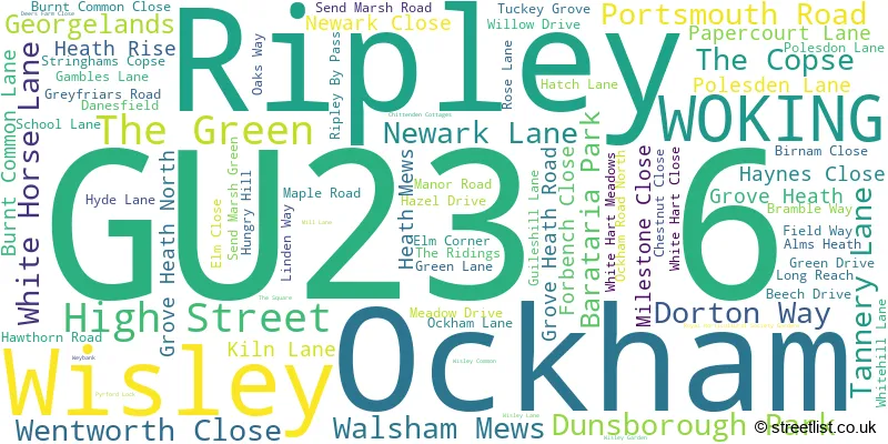
The largest settlement in the GU23 6 postal code is RIPLEY followed by OCKHAM, and WISLEY.
The GU23 6 Postcode shares a border with KT14 7 (BYFLEET ), GU22 8 (WOKING, Pyrford), GU23 7 (Send), KT11 1 (COBHAM ) and KT24 6 (West Horsley, East Horsley).
The sector is within the post town of WOKING.
GU23 6 is a postcode sector within the GU2 postcode district which is within the GU Guildford postcode area.
The Royal Mail delivery office for the GU23 6 postal sector is the unknown.
The area of the GU23 6 postcode sector is 7.43 square miles which is 19.25 square kilometres or 4,756.89 square acres.
The GU23 6 postcode sector is crossed by the A3 Major A road.
The GU23 6 postcode sector is crossed by the M25 motorway.
Waterways within the GU23 6 postcode sector include the Wey Navigation, River Wey, Newark Lock.

Map of the GU23 6 Postcode Sector
Explore the GU23 6 postcode sector by using our free interactive map.
| G | U | 2 | 3 | - | 6 | X | X |
| G | U | 2 | 3 | Space | 6 | Letter | Letter |
Official List of Streets
Ockham (11 Streets)
Ripley (53 Streets)
Wisley (5 Streets)
WOKING (1 Streets)
Unofficial Streets or Alternative Spellings
Ripley
THE RIDINGS AVONMOR MEWS BACHELORS LANE BIRNHAM CLOSE BURNTCOMMON LANE DUNSBOROUGH FARM COTTAGES ELM LANE GROVE HEATH COURT GROVE HEATH LANE HEATHRISE HOLLYBUSH LANE MUDDY LANE PIDGEON HOUSE BRIDGE PORTSMOUTH ROAD CYCLE PATH RIPLEY BY-PASS RIPLEY COMMON RIVER WEY NAVIGATION PATH RYDE CLOSE THE NATIONAL TRUST RIVER WEY NAVIGATIONS WEST END COTTAGES WISLEY INTERCHANGE WOKING 64Byfleet
SANWAY ROADWOKING
LOCK LANEEast Horsley
OCKHAM ROAD NORTHSend
BOUGHTON HALL AVENUE CLANDON ROAD HUNGRY HILL LANEWest Horsley
RIPLEY LANE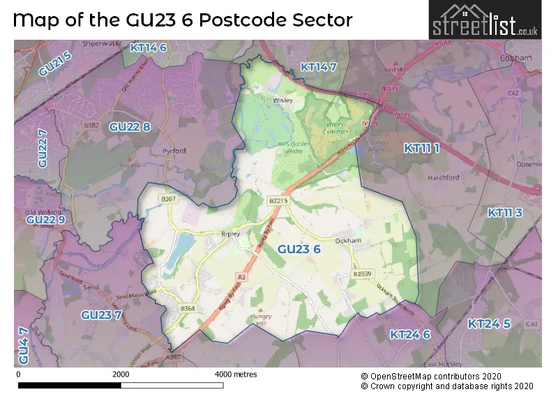
House Prices in the GU23 6 Postcode Sector
| Type of Property | 2018 Average | 2018 Sales | 2017 Average | 2017 Sales | 2016 Average | 2016 Sales | 2015 Average | 2015 Sales |
|---|---|---|---|---|---|---|---|---|
| Detached | £724,644 | 24 | £712,562 | 11 | £699,154 | 13 | £669,588 | 17 |
| Semi-Detached | £660,442 | 12 | £600,209 | 16 | £508,700 | 16 | £519,198 | 20 |
| Terraced | £596,421 | 7 | £467,333 | 12 | £463,322 | 18 | £425,094 | 16 |
| Flats | £255,100 | 5 | £305,188 | 4 | £338,571 | 7 | £321,156 | 16 |
Important Postcodes GU23 6 in the Postcode Sector
GU23 6ED is the postcode for Ripley C of E Primary School, Wentworth Close
| The GU23 6 Sector is within these Local Authorities |
|
|---|---|
| The GU23 6 Sector is within these Counties |
|
| The GU23 6 Sector is within these Water Company Areas |
|
Tourist Attractions within the GU23 6 Postcode Area
We found 1 visitor attractions within the GU2 postcode area
| RHS Garden Wisley |
|---|
| Gardens |
| Garden |
| View RHS Garden Wisley on Google Maps |