The IG8 8 postcode sector stands on the Essex and Greater London border.
Did you know? According to the 2021 Census, the IG8 8 postcode sector is home to a bustling 9,038 residents!
Given that each sector allows for 400 unique postcode combinations. Letters C, I, K, M, O and V are not allowed in the last two letters of a postcode. With 187 postcodes already in use, this leaves 213 units available.
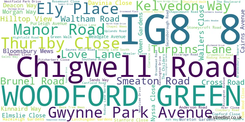
The largest settlements in the IG8 8 postal code are WOODFORD GREEN and CHIGWELL .
The IG8 8 Postcode shares a border with E18 1 (SOUTH WOODFORD , LONDON ), IG6 2 (HAINAULT , BARKINGSIDE , ILFORD ), IG7 5 (CHIGWELL ), IG9 6 (BUCKHURST HILL ), IG4 5 (ILFORD , GANTS HILL , CLAYHALL ), IG5 0 (CLAYHALL , ILFORD ) and IG8 7 (WOODFORD GREEN ).
The sector is within the post town of WOODFORD GREEN.
IG8 8 is a postcode sector within the IG8 postcode district which is within the IG Ilford postcode area.
The Royal Mail delivery office for the IG8 8 postal sector is the Woodford Green Delivery Office.
The area of the IG8 8 postcode sector is 1.25 square miles which is 3.23 square kilometres or 799.31 square acres.
The IG8 8 postcode sector is crossed by the M11 motorway.
Waterways within the IG8 8 postcode sector include the River Roding, Roding.

Map of the IG8 8 Postcode Sector
Explore the IG8 8 postcode sector by using our free interactive map.
| I | G | 8 | - | 8 | X | X |
| I | G | 8 | Space | 8 | Letter | Letter |
Official List of Streets
WOODFORD GREEN (81 Streets)
Unofficial Streets or Alternative Spellings
WOODFORD GREEN
SNAKES LANE EAST WANSFORD ROADCHIGWELL
HIGH ROAD BEAUMARIS DRIVE CHARLIE BROWNS ROUNDABOUT COURTLAND CLOSE ELM COURT FONTEYNE GARDENS HENWOOD SIDE NORTHVIEW DRIVE RODING VALLEY WAY ST JUDES COURT ST MARYS WAY WARLEY ROAD WOODFORD TRADING ESTATECHIGWELL,
MANOR ROADILFORD
HAZEL LANE MARSTON ROAD RAVENSBOURNE GARDENS TOMSWOOD HILL WOODFORD AVENUEILFORD,
RODING LANE SOUTHRedbridge
CHIGWELL ROAD MAYBANK ROAD RAVEN ROAD WAVERLEY ROAD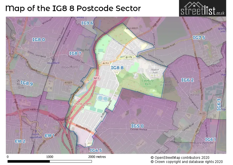
House Prices in the IG8 8 Postcode Sector
| Type of Property | 2018 Average | 2018 Sales | 2017 Average | 2017 Sales | 2016 Average | 2016 Sales | 2015 Average | 2015 Sales |
|---|---|---|---|---|---|---|---|---|
| Detached | £758,545 | 11 | £835,354 | 12 | £729,150 | 10 | £652,837 | 13 |
| Semi-Detached | £476,079 | 19 | £493,368 | 25 | £462,202 | 27 | £421,612 | 35 |
| Terraced | £493,050 | 50 | £512,512 | 47 | £450,393 | 50 | £423,819 | 69 |
| Flats | £415,187 | 27 | £398,662 | 48 | £365,057 | 53 | £334,860 | 57 |
Important Postcodes IG8 8 in the Postcode Sector
IG8 8EU is the postcode for Hatton School & Special Needs Centre, Roding Lane South, and Hatton School, Roding Lane South
IG8 8NP is the postcode for Roding Primary School, Roding Lane North
| The IG8 8 Sector is within these Local Authorities |
|
|---|---|
| The IG8 8 Sector is within these Counties |
|
| The IG8 8 Sector is within these Water Company Areas |
|