The IP17 1 postcode sector is within the county of Suffolk.
Did you know? According to the 2021 Census, the IP17 1 postcode sector is home to a bustling 7,610 residents!
Given that each sector allows for 400 unique postcode combinations. Letters C, I, K, M, O and V are not allowed in the last two letters of a postcode. With 330 postcodes already in use, this leaves 70 units available.
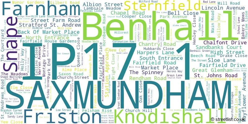
The largest settlement in the IP17 1 postal code is SAXMUNDHAM followed by Snape, and Knodishall.
The IP17 1 Postcode shares a border with IP12 2 (Rendlesham, Orford, Sudbourne), IP13 0 (Wickham Market, Campsea Ashe, Easton), IP13 9 (Framlingham, Parham, Saxtead), IP15 5 (ALDEBURGH), IP16 4 (LEISTON, Thorpeness, Aldringham) and IP17 2 (Kelsale, Peasenhall, Sibton).
The sector is within the post town of SAXMUNDHAM.
IP17 1 is a postcode sector within the IP17 postcode district which is within the IP Ipswich postcode area.
The Royal Mail delivery office for the IP17 1 postal sector is the Saxmundham Delivery Office.
The area of the IP17 1 postcode sector is 20.22 square miles which is 52.36 square kilometres or 12,938.11 square acres.
Waterways within the IP17 1 postcode sector include the River Fromus, Alde.

Map of the IP17 1 Postcode Sector
Explore the IP17 1 postcode sector by using our free interactive map.
| I | P | 1 | 7 | - | 1 | X | X |
| I | P | 1 | 7 | Space | 1 | Letter | Letter |
Official List of Streets
SAXMUNDHAM (83 Streets)
Friston (15 Streets)
Benhall (19 Streets)
Knodishall (21 Streets)
Snape (23 Streets)
Stratford St. Andrew (4 Streets)
Sternfield (6 Streets)
Farnham (2 Streets)
Unofficial Streets or Alternative Spellings
ALDEBURGH
SAXMUNDHAM ROADAldringham
ALDRINGHAM LANE FITCHES LANE BOTANY LANE CHEQUERS ROW DOVE COURT FITZGERALD MEWS GREAT GREMHAM ROAD HARROW LANE KILN LANE NEW ROAD NUTTERY LANE PARK ROAD REDBARN LANE SAINT ANDREWS ROAD SAINT JOHNS ROAD SAWMILL CLOSE SHELLEY MEWS SHOTTS MEADOW SOUTHWOLD CLOSE THE BEECHES THE GROVE THE SAILORS PATH TINKER BROOK TWO VILLAGE BYPASS WATERING LANETheberton
SAXMUNDHAM ROADBlaxhall
LANGHAM ROADCarlton
MAIN ROAD RENDHAM ROAD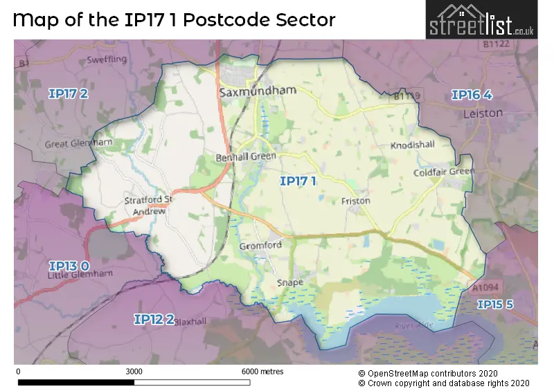
House Prices in the IP17 1 Postcode Sector
| Type of Property | 2018 Average | 2018 Sales | 2017 Average | 2017 Sales | 2016 Average | 2016 Sales | 2015 Average | 2015 Sales |
|---|---|---|---|---|---|---|---|---|
| Detached | £392,148 | 61 | £363,916 | 72 | £355,034 | 86 | £324,944 | 106 |
| Semi-Detached | £241,885 | 37 | £250,465 | 53 | £212,503 | 36 | £213,198 | 45 |
| Terraced | £219,226 | 48 | £231,327 | 51 | £194,992 | 65 | £195,100 | 66 |
| Flats | £151,367 | 19 | £192,000 | 9 | £207,000 | 5 | £134,953 | 12 |
Important Postcodes IP17 1 in the Postcode Sector
IP17 1AL is the postcode for Suffolk County Council, County Buildings, Street Farm Road
IP17 1AS is the postcode for SAXMUNDHAM HEALTH THE SURGERY, 7, North Entrance
IP17 1DZ is the postcode for Saxmundham School, Seaman Avenue, Suffolk County Council, The Saxmundham Centre, Seaman Avenue, and Saxmundham Free School, Seaman Avenue
IP17 1HE is the postcode for Benhall St. Marys C of E VC Primary School, School Lane
IP17 1QG is the postcode for Snape County Primary School, Church Road
IP17 1SP is the postcode for Snape Maltings, Snape Maltings Concert Hall, Snape Bridge, and Britten Pears School For Advanced Musical Studies, Snape Maltings Concert Hall, Snape Bridge
IP17 1UY is the postcode for Knodishall Primary School, Judith Avenue
IP17 1XQ is the postcode for Saxmundham Primary School, Brook Farm Road
| The IP17 1 Sector is within these Local Authorities |
|
|---|---|
| The IP17 1 Sector is within these Counties |
|
| The IP17 1 Sector is within these Water Company Areas |
|