The KT13 0 postcode sector is within the county of Surrey.
Did you know? According to the 2021 Census, the KT13 0 postcode sector is home to a bustling 7,048 residents!
Given that each sector allows for 400 unique postcode combinations. Letters C, I, K, M, O and V are not allowed in the last two letters of a postcode. With 254 postcodes already in use, this leaves 146 units available.
The largest settlements in the KT13 0 postal code are WEYBRIDGE and BROOKLANDS INDUSTRIAL PARK .
The KT13 0 Postcode shares a border with KT13 8 (WEYBRIDGE , ADDLESTONE ), KT13 9 (WEYBRIDGE ), KT14 7 (BYFLEET ), KT15 2 (ADDLESTONE , MEADOWLANDS PARK , MEADOWLANDS ), KT15 3 (ADDLESTONE , NEW HAW , WOODHAM ), KT11 1 (COBHAM ), KT12 4 (HERSHAM , WHITELEY VILLAGE HERSHAM , WALTON-ON-THAMES ), KT12 5 (HERSHAM , WALTON-ON-THAMES ) and KT14 6 (WEST BYFLEET , BYFLEET ).
The sector is within the post town of WEYBRIDGE.
KT13 0 is a postcode sector within the KT13 postcode district which is within the KT Kingston upon Thames postcode area.
The Royal Mail delivery office for the KT13 0 postal sector is the Weybridge Delivery Office.
The area of the KT13 0 postcode sector is 2.62 square miles which is 6.79 square kilometres or 1,679.00 square acres.
Waterways within the KT13 0 postcode sector include the River Wey.

Map of the KT13 0 Postcode Sector
Explore the KT13 0 postcode sector by using our free interactive map.
| K | T | 1 | 3 | - | 0 | X | X |
| K | T | 1 | 3 | Space | 0 | Letter | Letter |
Official List of Streets
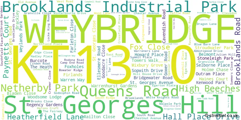
WEYBRIDGE (112 Streets)
Brooklands Industrial Park (2 Streets)
St. Georges Hill (2 Streets)
Unofficial Streets or Alternative Spellings
WALTON-ON-THAMES
SEVEN HILLS ROADHersham
BURWOOD ROAD QUEENS ROADByfleet
GREEN LANE CLOSE PARVIS ROADWEST BYFLEET
DUNFEE WAY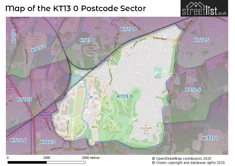
House Prices in the KT13 0 Postcode Sector
| Type of Property | 2018 Average | 2018 Sales | 2017 Average | 2017 Sales | 2016 Average | 2016 Sales | 2015 Average | 2015 Sales |
|---|---|---|---|---|---|---|---|---|
| Detached | £1,760,563 | 40 | £2,013,399 | 44 | £1,665,659 | 49 | £1,853,135 | 54 |
| Semi-Detached | £809,485 | 22 | £734,765 | 13 | £793,083 | 12 | £656,833 | 15 |
| Terraced | £600,789 | 18 | £664,740 | 25 | £671,567 | 29 | £637,801 | 35 |
| Flats | £405,219 | 50 | £450,417 | 39 | £564,792 | 59 | £418,951 | 48 |
Important Postcodes KT13 0 in the Postcode Sector
KT13 0RH is the postcode for 241 Brooklands Road
KT13 0XG is the postcode for Royal Mail, West Byfleet Delivery Office, The Circuit Centre, Avro Way
KT13 0YP is the postcode for Dakota Weybridge, 11 De Havilland Drive, Brooklands Business Park
| The KT13 0 Sector is within these Local Authorities |
|
|---|---|
| The KT13 0 Sector is within these Counties |
|
| The KT13 0 Sector is within these Water Company Areas |
|
Tourist Attractions within the KT13 0 Postcode Area
We found 1 visitor attractions within the KT13 postcode area
| Brooklands Museum |
|---|
| Museums & Art Galleries |
| Museum and / or Art Gallery |
| View Brooklands Museum on Google Maps |