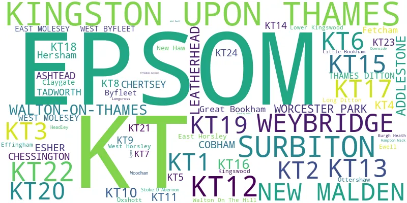
This section of the site is all about the KT Postcode area, also known as the Kingston upon Thames Postal Area. Explore links to the next level to learn more about specific postcode districts such as KT1.
Map of the KT Postcode Area
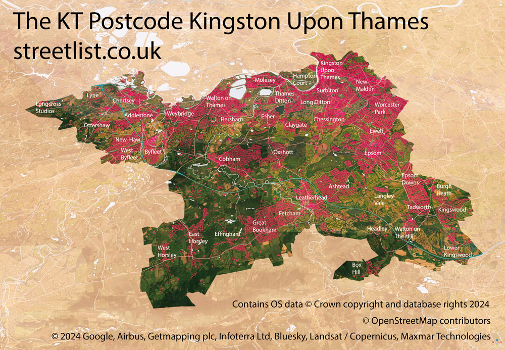
The KT postcode area represents a group of postal districts in the Kingston upon Thames area of the United Kingdom. The area code KT stands for the letters k and t in Kingston upon Thames. KT has a population of 531,664 and covers an area of 345,046 hectares. Fun fact: 0.82% of the population of Great Britain lives in this area.
The postcode area falls within the following counties: Surrey (70.89%), Greater London (29.11%).
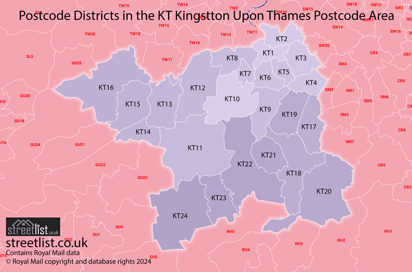
Post Towns and Postcode Districts for the KT Postcode
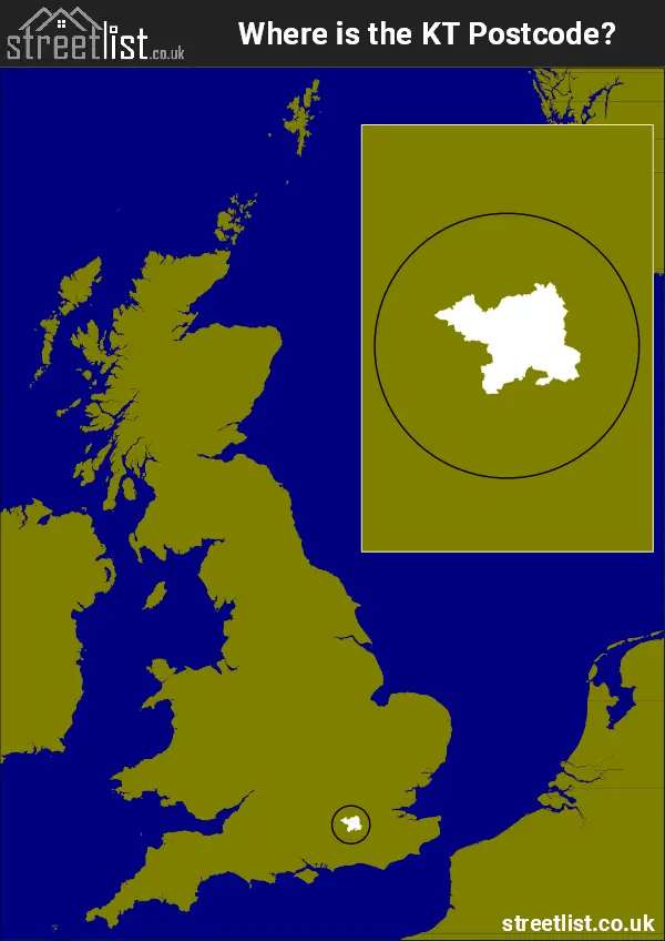
Where is the KT Postcode Area?
The Kingston upon Thames KT Postcode is in the South East of England. The postal area borders the following neighbouring postal areas: CR - Croydon, SW - London - SW, GU - Guildford, SM - Sutton, RH - Redhill and TW - Twickenham, and is located inland.
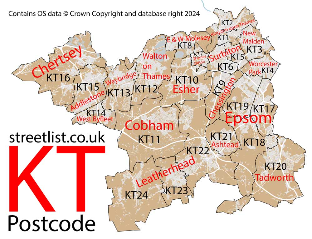
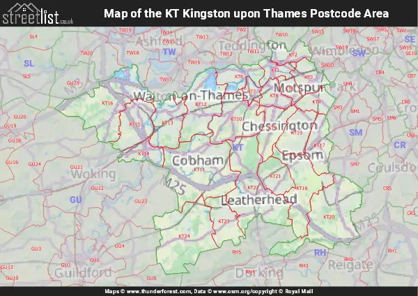
Map of the KT Kingston upon Thames Postcode Area
Explore the KT Kingston upon Thames postcode area by using our interactive map.
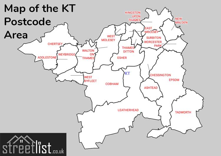
Postcode Districts within the KT Kingston upon Thames Postcode Area
There are 24 postcode districts within the Kingston upon Thames postcode area
A map showing the boundary of in relation to other areas
There are 6 towns within the Kingston upon Thames postcode area.
| Unit | Area² |
|---|---|
| Hectares | 345,046² |
| Miles | 1,332² |
| Feet | 37,140,406,394² |
| Kilometres | 3,450² |
Postal Delivery Offices serving the KT Kingston upon Thames Postcode Area
- Addlestone Delivery Office
- Ashtead Delivery Office
- Chertsey Delivery Office
- Chessington Delivery Office
- Cobham Delivery Office
- East Horsley Delivery Office
- East Molesey Delivery Office
- Epsom Delivery Office
- Esher Delivery Office
- Kingston Upon Thames & Surbiton Delivery Office
- Leatherhead Delivery Office
- New Malden Delivery Office
- Tadworth Delivery Office
- Walton On Thames Delivery Office
- West Byfleet Delivery Office
- Weybridge Delivery Office
- Worcester Park Delivery Office
Councils with Postcodes in KT
Towns and Villages within the KT Kingston upon Thames Postcode Area
- Addlestone - town
- Ashtead - Settlement
- Banstead - Urban Area
- Box Hill - village
- Brooklands - Urban Area
- Burgh Heath - village
- Burwood Park - village
- Byfleet - village
- Cheam - Urban Area
- Chertsey - town
- Chessington - Urban Area
- Claygate - village
- Cobham - Urban Area
- Downside - village
- East Horsley - village
- East Molesey - village
- Effingham - village
- Epsom - Urban Area
- Epsom Downs - village
- Esher - town
- Ewell - Urban Area
- Fetcham - Settlement
- Great Bookham - Settlement
- Great Burgh - village
- Ham - Urban Area
- Hampton Wick - Urban Area
- Hatchford - village
- Headley - village
- Hersham - village
- Hinchley Wood - village
- Hook - Urban Area
- Kingston on Thames - Urban Area
- Kingswood - village
- Laleham - village
- Langley Vale - village
- Leatherhead - town
- Little Bookham - village
- Long Ditton - Urban Area
- Longcross - village
- Lower Kingswood - village
- Lyne - village
- Malden - Urban Area
- Malden Rushett - village
- Margery - village
- Martyr's Green - otherSettlement
- Mogador - village
- Morden - Urban Area
- Motspur Park - Urban Area
- New Haw - village
- Norbiton - Urban Area
- Nork - village
- North Cheam - Urban Area
- Old Malden - Urban Area
- Ottershaw - village
- Oxshott - Urban Area
- Pachesham Park - village
- Penton Hook - village
- Putney - Urban Area
- Pyrford - village
- Raynes Park - Urban Area
- Row Town - village
- Shepperton - village
- St George's Hill - Settlement
- Stoke D'Abernon - village
- Stoneleigh - Urban Area
- Surbiton - Urban Area
- Tadworth - village
- Teddington - Urban Area
- Thames Ditton - Urban Area
- Tolworth - Urban Area
- Walton on the Hill - village
- Walton-on-Thames - town
- West Byfleet - village
- West Horsley - village
- West Molesey - village
- Weston Green - village
- Weybridge - town
- Whiteley Village - village
- Wimbledon - Urban Area
- Woodham - village
- Worcester Park - Urban Area