This section of the site is all about the TW Postcode area, also known as the Twickenham Postal Area. Explore links to the next level to learn more about specific postcode districts such as TW1.
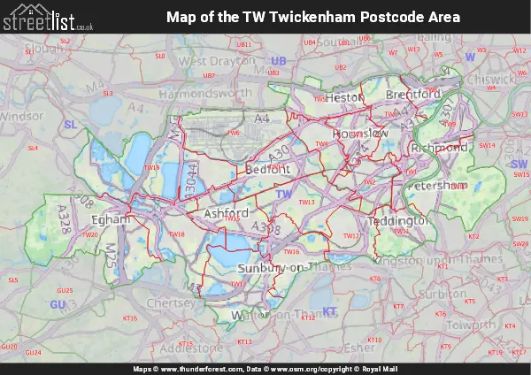
Map of the TW Postcode Area
The TW postcode area represents a group of postal districts in the Twickenham area of the United Kingdom. The area code TW stands for the letters t and w in TWickenham. TW has a population of 490,472 and covers an area of 187,269 hectares. Fun fact: 0.75% of the population of Great Britain lives in this area.
The postcode area falls within the following counties: Greater London (72.46%), Surrey (26.76%), Berkshire (0.78%).
Post Towns and Postcode Districts for the TW Postcode
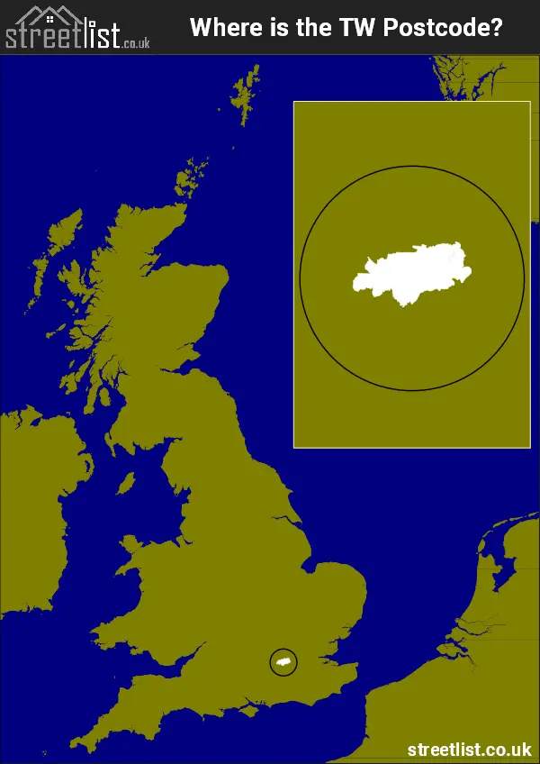
Where is the TW Postcode Area?
The TW Twickenham Postcode has it's West is in the South East of England and it's East is in the London Region. The postal area borders the following neighbouring postal areas: SW - London - SW, GU - Guildford, SL - Slough, KT - Kingston upon Thames, W - London - W and UB - Uxbridge, It also borders The Tidal Thames,
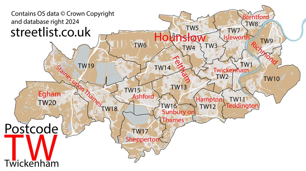
Map of the TW Twickenham Postcode Area
Explore the TW Twickenham postcode area by using our interactive map.
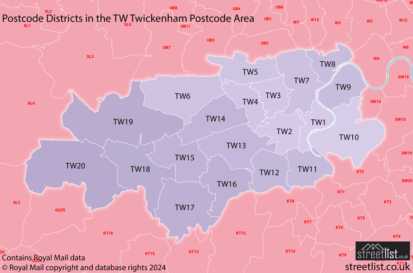
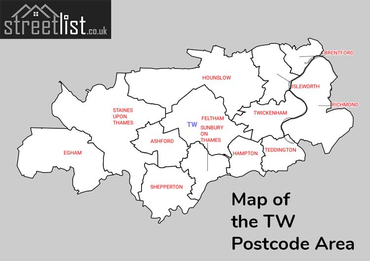
Postcode Districts within the TW Twickenham Postcode Area
There are 20 postcode districts within the Twickenham postcode area
A map showing the boundary of in relation to other areas
There are 5 towns within the Twickenham postcode area.
| Unit | Area² |
|---|---|
| Hectares | 187,269² |
| Miles | 723² |
| Feet | 20,157,447,891² |
| Kilometres | 1,873² |
Postal Delivery Offices serving the TW Twickenham Postcode Area
- Ashford (tw) Delivery Office
- Brentford & Isleworth Delivery Office
- Egham & Staines Delivery Office
- Egham Delivery Office
- Feltham Delivery Office
- Hampton Delivery Office
- Hounslow Delivery Office
- Isleworth Delivery Office
- Richmond (tw)
- Shepperton Delivery Office
- Sunbury On Thames Delivery Office
- Teddington Delivery Office
- Twickenham Delivery Office
Councils with Postcodes in TW
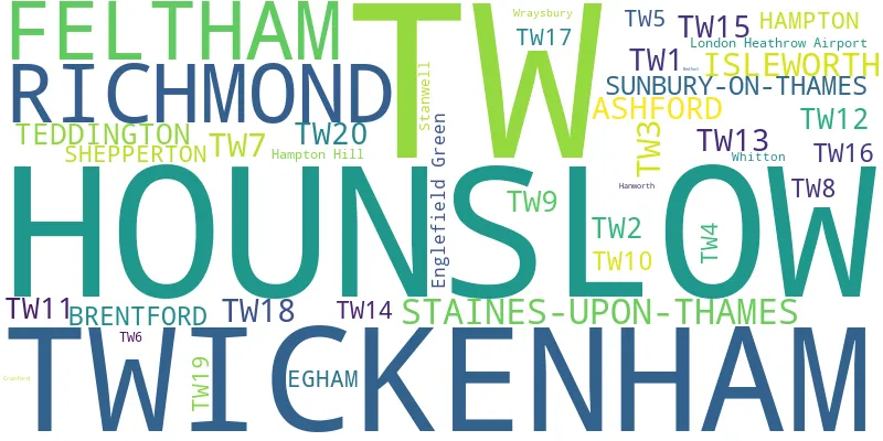
Towns and Villages within the TW Twickenham Postcode Area
- Acton - Urban Area
- Ashford - town
- Ashford Common - village
- Bishopsgate - village
- Brentford - Urban Area
- Charlton - village
- Chiswick - Urban Area
- Cranford - Urban Area
- Ealing - Urban Area
- East Bedfont - Urban Area
- Egham - town
- Feltham - Urban Area
- Ham - Urban Area
- Hamondsworth - Urban Area
- Hampton - Urban Area
- Hampton Wick - Urban Area
- Hanwell - Urban Area
- Harlington - Urban Area
- Hayes - Urban Area
- Heathrow - Urban Area
- Heston - Urban Area
- Horton - village
- Hounslow - Urban Area
- Hythe End - village
- Isleworth - Urban Area
- Kew - Urban Area
- Kingston on Thames - Urban Area
- Laleham - village
- Littleton - village
- Littleton Common - village
- Longford - Urban Area
- Mortlake - Urban Area
- Norwood Green - Urban Area
- Old Windsor - village
- Osterley - Urban Area
- Penton Hook - village
- Petersham - Urban Area
- Putney - Urban Area
- Richmond - Urban Area
- Runnymede - village
- Shepperton - village
- Shepperton Green - village
- Sipson - Urban Area
- Southall - Urban Area
- Spring Grove - Urban Area
- Staines-upon-Thames - town
- Stanwell - village
- Stanwell Moor - village
- Stroude - village
- Sunbury-on-Thames - town
- Teddington - Urban Area
- Thorpe - village
- Thorpe Green - village
- Twickenham - Urban Area
- Upper Halliford - village
- Virginia Water - village
- West Bedfont - village
- Weybridge - town
- Whitton - Urban Area
- Wraysbury - village