This section of the site is all about the SL Postcode area, also known as the Slough Postal Area. Explore links to the next level to learn more about specific postcode districts such as SL0.
The SL postcode area represents a group of postal districts in the Slough area of the United Kingdom. The area code SL stands for the letters s and l in SLough. SL has a population of 373,607 and covers an area of 400,686 hectares. Fun fact: 0.57% of the population of Great Britain lives in this area.
The postcode area falls within the following counties: Berkshire (70.94%), Buckinghamshire (28.94%), Surrey (0.10%), Hertfordshire (0.02%).
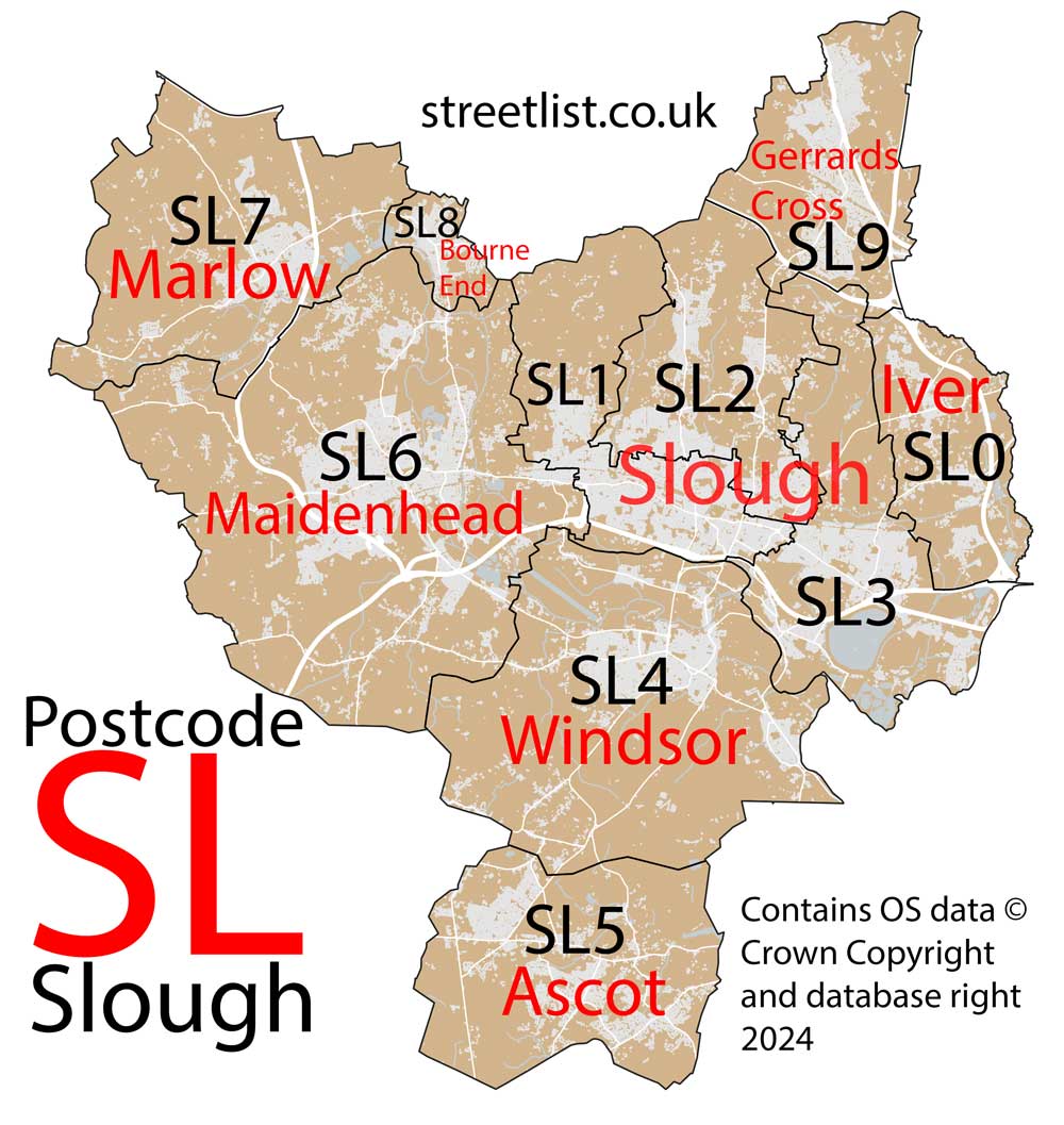
Post Towns and Postcode Districts for the SL Postcode
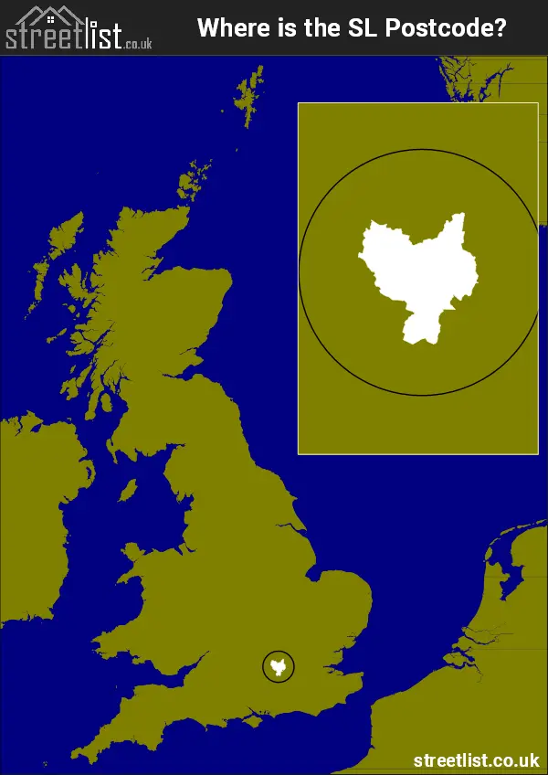
Where is the SL Postcode Area?
The Slough SL Postcode is in the South East of England. The postal area borders the following neighbouring postal areas: GU - Guildford, WD - Watford, RG - Reading, UB - Uxbridge, TW - Twickenham and HP - Hemel Hempstead, and is located inland.
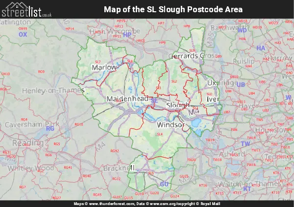
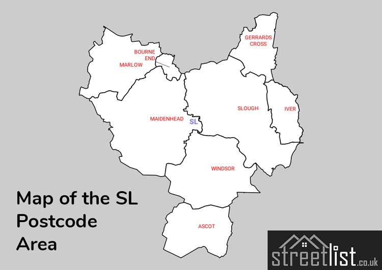
Map of the SL Slough Postcode Area
Explore the SL Slough postcode area by using our interactive map.
Postcode Districts within the SL Slough Postcode Area
There are 10 postcode districts within the Slough postcode area
A map showing the boundary of in relation to other areas
There are 6 towns within the Slough postcode area.
| Unit | Area² |
|---|---|
| Hectares | 400,686² |
| Miles | 1,547² |
| Feet | 43,129,440,354² |
| Kilometres | 4,007² |
Postal Delivery Offices serving the SL Slough Postcode Area
- Ascot Delivery Office
- Bourne End Scale Payment Delivery Office
- Gerrards Cross Delivery Office
- Iver Delivery Office
- Maidenhead Delivery Office
- Marlow Delivery Office
- Slough Delivery Office
- Windsor Delivery Office
Councils with Postcodes in SL
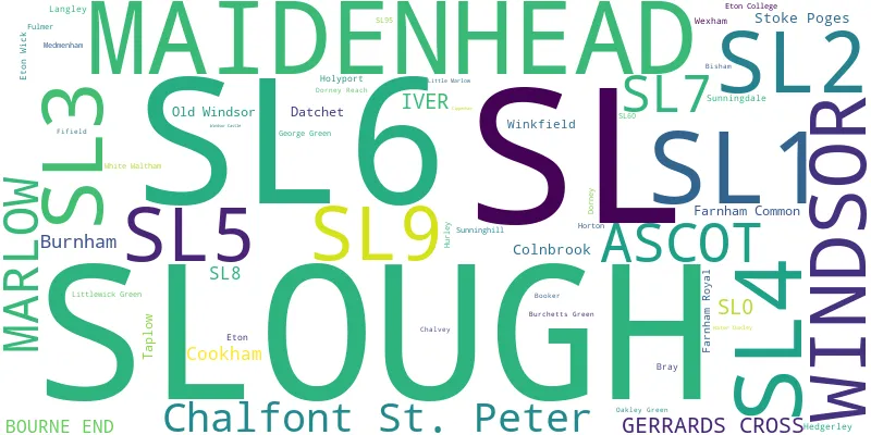
Towns and Villages within the SL Slough Postcode Area
- Ascot - village
- Bisham - village
- Bourne End - village
- Bovingdon Green - village
- Bray - village
- Broomhall - Settlement
- Burchett's Green - village
- Chalfont St Peter - village
- Chavey Down - village
- Cheapside - village
- Clayhill - village
- Colnbrook - village
- Cookham - otherSettlement
- Cores End - village
- Cranbourne - village
- Datchet - village
- Dorney - village
- Dorney Reach - village
- East Burnham - village
- Egypt - village
- Eton - town
- Eton Wick - village
- Farnham Common - village
- Farnham Royal - village
- Fifield - village
- Frogmill - village
- Fulmer - village
- George Green - village
- Gerrards Cross - town
- Hedgerley - village
- Hedsor - village
- Hitchambury - village
- Holloway - village
- Holyport - village
- Horn Hill - village
- Horton - village
- Hurley - village
- Iver - village
- Iver Heath - otherSettlement
- Little Marlow - village
- Littlewick Green - village
- Maiden's Green - village
- Maidenhead - town
- Marlow - town
- Marlow Bottom - village
- Marlow Common - otherSettlement
- Medmenham - village
- Moneyrow Green - village
- North Ascot - village
- Oakley Green - village
- Old Windsor - village
- Paley Street - village
- Plaistow Green - village
- Poyle - village
- Richings Park - village
- Shreding Green - village
- Slough - town
- South Ascot - village
- Stoke Poges - otherSettlement
- Stud Green - village
- Sunningdale - village
- Sunninghill - village
- Taplow - village
- Tatling End - village
- Temple - village
- The Village - village
- Thorney - village
- Touchen-end - village
- Uxbridge - Urban Area
- Water Oakley - otherSettlement
- Well End - village
- West Drayton - Urban Area
- Wexham Street - village
- White Waltham - village
- Windsor - town
- Winkfield - village
- Winkfield Row - village
- Winkfield Street - village
- Woodside - village
- Woolley Green - village
- Wraysbury - village
- Yiewsley - Urban Area