The SL1 postcode district is a postal district located in the SL Slough postcode area with a population of 78,212 residents according to the 2021 England and Wales Census.
The area of the SL1 postcode district is 11.60 square miles which is 30.04 square kilometres or 7,424.16 acres.
Currently, the SL1 district has about 1630 postcode units spread across 9 geographic postcode sectors.
Given that each sector allows for 400 unique postcode combinations, the district has a capacity of 3,600 postcodes. With 1630 postcodes already in use, this leaves 1970 units available.
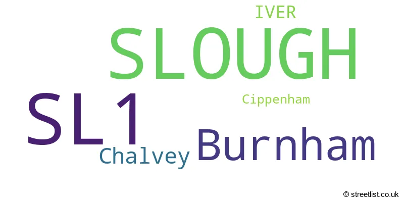
The largest settlements in the SL1 postal code are SLOUGH and Burnham.
The SL1 Postcode shares a border with HP10 (Wooburn Green, Flackwell Heath, Penn), HP9 (BEACONSFIELD, Seer Green, Knotty Green), SL6 (MAIDENHEAD, Cookham, Taplow), SL2 (SLOUGH, Stoke Poges, Farnham Common), SL3 (SLOUGH, DATCHET, POYLE) and SL4 (WINDSOR, Old Windsor, Winkfield).
In the SL1 postcode district, the primary settlement is Slough, which is located in the county of Berkshire. The most significant post town in this district is Slough as well. Other significant settlements in the area include Chalvey, Burnham, and Cippenham. Chalvey is also part of Berkshire county, while Burnham is found in both Berkshire and Buckinghamshire counties.
For the district SL1, we have data on 10 postcode sectors. Here's a breakdown: The sector SL1 0 is non-geographic. It's often designated for PO Boxes, large organisations, or special services. The sector SL1 1, covers Slough in Berkshire. The sector SL1 2, covers Slough in Berkshire. The sector SL1 3, covers Slough in Berkshire. The sector SL1 4, covers Slough in Berkshire. The sector SL1 5, covers Slough in Berkshire. The sector SL1 6, covers Slough in Berkshire. The sector SL1 7, covers Burnham in Buckinghamshire. The sector SL1 8, covers Burnham in Buckinghamshire. The sector SL1 9, covers Slough in Berkshire.

Map of the SL1 Postcode District
Explore the SL1 postcode district by using our free interactive map.

When it comes to local government, postal geography often disregards political borders. However, for a breakdown in the SL1 District: the district mostly encompasses the Slough (B) (1351 postcodes), and finally, the Buckinghamshire area (289 postcodes).
Recent House Sales in SL1
| Date | Price | Address |
|---|---|---|
| 27/09/2023 | £380,000 | Eltham Avenue, Slough, SL1 5AF |
| 19/09/2023 | £430,000 | Kings Road, Slough, SL1 2PS |
| 13/09/2023 | £504,000 | Lent Rise Road, Burnham, Slough, SL1 7BN |
| 08/09/2023 | £335,000 | Windsor Road, Slough, SL1 2NE |
| 08/09/2023 | £305,000 | Alpha Street South, Slough, SL1 1QZ |
| 31/08/2023 | £340,000 | Alice Lane, Burnham, Slough, SL1 7AY |
| 30/08/2023 | £218,000 | Arborfield Close, Slough, SL1 2JW |
| 29/08/2023 | £363,500 | Ragstone Road, Slough, SL1 2PU |
| 29/08/2023 | £450,000 | King Edward Street, Slough, SL1 2QT |
| 25/08/2023 | £265,000 | Sandringham Court, Slough, SL1 6JU |
Weather Forecast for SL1
Press Button to Show Forecast for Cliveden
| Time Period | Icon | Description | Temperature | Rain Probability | Wind |
|---|---|---|---|---|---|
| 09:00 to 12:00 | Light rain | 7.0°C (feels like 4.0°C) | 47.00% | NE 11 mph | |
| 12:00 to 15:00 | Overcast | 10.0°C (feels like 7.0°C) | 13.00% | ENE 9 mph | |
| 15:00 to 18:00 | Cloudy | 11.0°C (feels like 9.0°C) | 12.00% | NE 9 mph | |
| 18:00 to 21:00 | Cloudy | 10.0°C (feels like 8.0°C) | 24.00% | NE 11 mph | |
| 21:00 to 00:00 | Light rain | 9.0°C (feels like 6.0°C) | 58.00% | NE 11 mph |
Press Button to Show Forecast for Cliveden
| Time Period | Icon | Description | Temperature | Rain Probability | Wind |
|---|---|---|---|---|---|
| 00:00 to 03:00 | Heavy rain | 8.0°C (feels like 5.0°C) | 85.00% | NNE 11 mph | |
| 03:00 to 06:00 | Heavy rain | 8.0°C (feels like 5.0°C) | 88.00% | NNE 11 mph | |
| 06:00 to 09:00 | Heavy rain | 7.0°C (feels like 5.0°C) | 81.00% | N 9 mph | |
| 09:00 to 12:00 | Heavy rain | 8.0°C (feels like 5.0°C) | 84.00% | NW 9 mph | |
| 12:00 to 15:00 | Light rain | 9.0°C (feels like 6.0°C) | 56.00% | WNW 11 mph | |
| 15:00 to 18:00 | Cloudy | 10.0°C (feels like 8.0°C) | 18.00% | WNW 9 mph | |
| 18:00 to 21:00 | Cloudy | 10.0°C (feels like 9.0°C) | 8.00% | WSW 7 mph | |
| 21:00 to 00:00 | Cloudy | 8.0°C (feels like 7.0°C) | 6.00% | SW 7 mph |
Press Button to Show Forecast for Cliveden
| Time Period | Icon | Description | Temperature | Rain Probability | Wind |
|---|---|---|---|---|---|
| 00:00 to 03:00 | Partly cloudy (night) | 7.0°C (feels like 5.0°C) | 2.00% | SW 4 mph | |
| 03:00 to 06:00 | Clear night | 5.0°C (feels like 4.0°C) | 2.00% | SSW 4 mph | |
| 06:00 to 09:00 | Sunny day | 6.0°C (feels like 5.0°C) | 1.00% | S 4 mph | |
| 09:00 to 12:00 | Partly cloudy (day) | 11.0°C (feels like 10.0°C) | 1.00% | S 9 mph | |
| 12:00 to 15:00 | Cloudy | 14.0°C (feels like 11.0°C) | 5.00% | S 11 mph | |
| 15:00 to 18:00 | Partly cloudy (day) | 15.0°C (feels like 12.0°C) | 4.00% | S 11 mph | |
| 18:00 to 21:00 | Sunny day | 13.0°C (feels like 11.0°C) | 1.00% | S 9 mph | |
| 21:00 to 00:00 | Clear night | 10.0°C (feels like 9.0°C) | 1.00% | SSE 7 mph |
Press Button to Show Forecast for Cliveden
| Time Period | Icon | Description | Temperature | Rain Probability | Wind |
|---|---|---|---|---|---|
| 00:00 to 03:00 | Clear night | 9.0°C (feels like 7.0°C) | 1.00% | SE 7 mph | |
| 03:00 to 06:00 | Clear night | 8.0°C (feels like 7.0°C) | 2.00% | ESE 7 mph | |
| 06:00 to 09:00 | Sunny day | 9.0°C (feels like 8.0°C) | 3.00% | ESE 7 mph | |
| 09:00 to 12:00 | Partly cloudy (day) | 13.0°C (feels like 11.0°C) | 5.00% | ESE 9 mph | |
| 12:00 to 15:00 | Cloudy | 16.0°C (feels like 14.0°C) | 13.00% | SE 9 mph | |
| 15:00 to 18:00 | Cloudy | 16.0°C (feels like 14.0°C) | 10.00% | SE 9 mph | |
| 18:00 to 21:00 | Cloudy | 15.0°C (feels like 14.0°C) | 8.00% | SE 7 mph | |
| 21:00 to 00:00 | Partly cloudy (night) | 12.0°C (feels like 11.0°C) | 5.00% | SE 7 mph |
Where is the SL1 Postcode District?
The postcode district SL1 is located in Slough. Slough is situated near several nearby towns. To the North West, there is Bourne End which is approximately 3.87 miles away. To the East, there is Wexham, which is about 3.99 miles away. Beaconsfield is situated to the North, approximately 4.27 miles away. Orchards Residential Park is located to the South East, approximately 4.39 miles away. Maidenhead is situated to the South West, approximately 4.51 miles away. Finally, Gerrards Cross is located to the North East, approximately 4.70 miles away. The distance between Slough and the center of London is approximately 22.25 miles.
The district covers the post towns of IVER, SLOUGH.
The sector has postcodes within the nation of England.
The SL1 Postcode District is in the Berkshire region of Berkshire, Buckinghamshire and Oxfordshire within the South East (England).
| Postcode Sector | Delivery Office |
|---|---|
| SL1 1 | Slough Delivery Office |
| SL1 2 | Slough Delivery Office |
| SL1 3 | Slough Delivery Office |
| SL1 4 | Slough Delivery Office |
| SL1 5 | Slough Delivery Office |
| SL1 6 | Slough Delivery Office |
| SL1 7 | Slough Delivery Office |
| SL1 8 | Slough Delivery Office |
| SL1 9 | Slough Delivery Office |
| S | L | 1 | - | X | X | X |
| S | L | 1 | Space | Numeric | Letter | Letter |
Current Monthly Rental Prices
| # Bedrooms | Min Price | Max Price | Avg Price |
|---|---|---|---|
| £450 | £1,250 | £818 | |
| 1 | £925 | £3,150 | £1,408 |
| 2 | £1,190 | £3,600 | £1,733 |
| 3 | £1,600 | £2,500 | £1,950 |
| 4 | £2,000 | £4,750 | £2,900 |
Current House Prices
| # Bedrooms | Min Price | Max Price | Avg Price |
|---|---|---|---|
| £25,000 | £1,450,000 | £426,382 | |
| 1 | £35,000 | £357,950 | £197,411 |
| 2 | £81,250 | £575,000 | £291,028 |
| 3 | £92,500 | £1,000,000 | £464,937 |
| 4 | £390,000 | £1,499,950 | £676,783 |
| 5 | £350,000 | £1,600,000 | £844,217 |
| 6 | £700,000 | £1,100,000 | £837,500 |
| 7 | £750,000 | £750,000 | £750,000 |
Estate Agents who Operate in the SL1 District
| Logo | Name | Brand Name | Address | Contact Number | Total Properties |
|---|---|---|---|---|---|
 | Slough | Chancellors | 92 High Street, Slough, SL1 1EL | 01753 251931 | 67 |
 | Slough | Connells | 111 High Street, Slough, Berkshire, SL1 1DH | 01753 387402 | 58 |
 | Cippenham | Jackson O'Rourke | 144 Lower Cippenham Lane, Cippenham, Slough, SL1 5EA | 01628 965436 | 34 |
 | Cippenham | Staples & King | 33, Elmshott Lane, Cippenham, Slough, SL1 5QS | 01628 564714 | 21 |
 | Slough | The Frost Partnership | 7 Mackenzie Street, Slough, SL1 1XQ | 01753 387937 | 20 |
| Type of Property | 2018 Average | 2018 Sales | 2017 Average | 2017 Sales | 2016 Average | 2016 Sales | 2015 Average | 2015 Sales |
|---|---|---|---|---|---|---|---|---|
| Detached | £598,352 | 87 | £656,637 | 73 | £683,000 | 92 | £520,487 | 90 |
| Semi-Detached | £393,576 | 184 | £400,614 | 185 | £387,890 | 183 | £331,006 | 202 |
| Terraced | £342,917 | 182 | £338,981 | 236 | £324,606 | 223 | £276,226 | 275 |
| Flats | £238,782 | 513 | £248,685 | 594 | £222,561 | 677 | £190,591 | 466 |