The SL7 postcode district is a postal district located in the SL Slough postcode area with a population of 21,318 residents according to the 2021 England and Wales Census.
The area of the SL7 postcode district is 17.85 square miles which is 46.23 square kilometres or 11,423.60 acres.
Currently, the SL7 district has about 697 postcode units spread across 3 geographic postcode sectors.
Given that each sector allows for 400 unique postcode combinations, the district has a capacity of 1,200 postcodes. With 697 postcodes already in use, this leaves 503 units available.
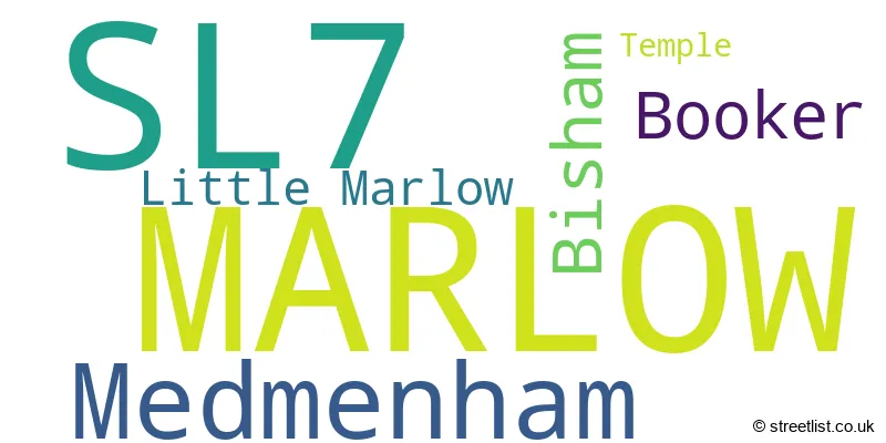
The largest settlement in the SL7 postal code is MARLOW followed by Medmenham, and Booker.
The SL7 Postcode shares a border with HP10 (Wooburn Green, Flackwell Heath, Penn), HP11 (HIGH WYCOMBE), HP12 (HIGH WYCOMBE, Cressex Business Park, Sands Industrial Estate), HP14 (Stokenchurch, Lane End, Walters Ash), RG9 (HENLEY-ON-THAMES, Hambleden, Shiplake) and SL6 (MAIDENHEAD, Cookham, Taplow).
The primary settlement in the SL7 postcode district is Marlow, located in the county of Buckinghamshire. This is also the main post town for the area. Other significant settlements in the district include Bisham, Temple, Medmenham, Booker, and Little Marlow, all of which are also in Buckinghamshire.
For the district SL7, we have data on 4 postcode sectors. Here's a breakdown: The sector SL7 1, covers Marlow in Buckinghamshire. The sector SL7 2, covers Marlow and Medmenham in Buckinghamshire. The sector SL7 3, covers Marlow in Buckinghamshire. The sector SL7 9 is non-geographic. It's often designated for PO Boxes, large organisations, or special services.

Map of the SL7 Postcode District
Explore the SL7 postcode district by using our free interactive map.

When it comes to local government, postal geography often disregards political borders. However, for a breakdown in the SL7 District: the district mostly encompasses the Buckinghamshire (674 postcodes), and finally, the Windsor and Maidenhead (B) area (23 postcodes).
Recent House Sales in SL7
| Date | Price | Address |
|---|---|---|
| 06/10/2023 | £610,000 | Newtown Road, Marlow, SL7 1JY |
| 04/10/2023 | £450,000 | Harleyford, Marlow, SL7 2SN |
| 03/10/2023 | £690,000 | The Orchard, Marlow, SL7 3EF |
| 29/09/2023 | £910,000 | Fishermans Retreat, Marlow, SL7 1NH |
| 28/09/2023 | £630,000 | Little Marlow Road, Marlow, SL7 1HG |
| 26/09/2023 | £685,000 | Portland Crescent, Marlow, SL7 2FS |
| 15/09/2023 | £950,000 | Claremont Road, Marlow, SL7 1BH |
| 11/09/2023 | £470,000 | Sandygate Close, Marlow, SL7 3BA |
| 07/09/2023 | £725,000 | Newtown Road, Marlow, SL7 1LA |
| 06/09/2023 | £784,500 | Goodwood Rise, Marlow, SL7 3QE |
Weather Forecast for SL7
Press Button to Show Forecast for Marlow
| Time Period | Icon | Description | Temperature | Rain Probability | Wind |
|---|---|---|---|---|---|
| 18:00 to 21:00 | Overcast | 10.0°C (feels like 9.0°C) | 14.00% | E 7 mph | |
| 21:00 to 00:00 | Cloudy | 9.0°C (feels like 7.0°C) | 12.00% | E 7 mph |
Press Button to Show Forecast for Marlow
| Time Period | Icon | Description | Temperature | Rain Probability | Wind |
|---|---|---|---|---|---|
| 00:00 to 03:00 | Cloudy | 7.0°C (feels like 5.0°C) | 17.00% | ENE 9 mph | |
| 03:00 to 06:00 | Light rain | 7.0°C (feels like 4.0°C) | 50.00% | NE 9 mph | |
| 06:00 to 09:00 | Light rain | 6.0°C (feels like 3.0°C) | 53.00% | NE 9 mph | |
| 09:00 to 12:00 | Overcast | 7.0°C (feels like 5.0°C) | 47.00% | NE 11 mph | |
| 12:00 to 15:00 | Overcast | 10.0°C (feels like 8.0°C) | 12.00% | ENE 9 mph | |
| 15:00 to 18:00 | Cloudy | 12.0°C (feels like 10.0°C) | 12.00% | NE 9 mph | |
| 18:00 to 21:00 | Cloudy | 10.0°C (feels like 8.0°C) | 17.00% | NE 11 mph | |
| 21:00 to 00:00 | Light rain | 9.0°C (feels like 6.0°C) | 59.00% | NNE 11 mph |
Press Button to Show Forecast for Marlow
| Time Period | Icon | Description | Temperature | Rain Probability | Wind |
|---|---|---|---|---|---|
| 00:00 to 03:00 | Heavy rain | 8.0°C (feels like 5.0°C) | 82.00% | NNE 11 mph | |
| 03:00 to 06:00 | Heavy rain | 8.0°C (feels like 5.0°C) | 90.00% | NNE 11 mph | |
| 06:00 to 09:00 | Heavy rain | 8.0°C (feels like 5.0°C) | 86.00% | NNE 11 mph | |
| 09:00 to 12:00 | Heavy rain | 8.0°C (feels like 5.0°C) | 84.00% | NW 9 mph | |
| 12:00 to 15:00 | Heavy rain | 9.0°C (feels like 6.0°C) | 79.00% | WNW 11 mph | |
| 15:00 to 18:00 | Cloudy | 10.0°C (feels like 8.0°C) | 17.00% | W 9 mph | |
| 18:00 to 21:00 | Cloudy | 11.0°C (feels like 9.0°C) | 9.00% | W 7 mph | |
| 21:00 to 00:00 | Cloudy | 8.0°C (feels like 7.0°C) | 6.00% | SW 7 mph |
Press Button to Show Forecast for Marlow
| Time Period | Icon | Description | Temperature | Rain Probability | Wind |
|---|---|---|---|---|---|
| 00:00 to 03:00 | Clear night | 7.0°C (feels like 5.0°C) | 2.00% | SW 4 mph | |
| 03:00 to 06:00 | Clear night | 5.0°C (feels like 3.0°C) | 1.00% | SSW 4 mph | |
| 06:00 to 09:00 | Sunny day | 7.0°C (feels like 5.0°C) | 1.00% | SSE 4 mph | |
| 09:00 to 12:00 | Partly cloudy (day) | 12.0°C (feels like 10.0°C) | 1.00% | S 9 mph | |
| 12:00 to 15:00 | Cloudy | 14.0°C (feels like 12.0°C) | 6.00% | S 11 mph | |
| 15:00 to 18:00 | Partly cloudy (day) | 15.0°C (feels like 12.0°C) | 3.00% | S 11 mph | |
| 18:00 to 21:00 | Sunny day | 13.0°C (feels like 11.0°C) | 1.00% | S 9 mph | |
| 21:00 to 00:00 | Clear night | 10.0°C (feels like 8.0°C) | 1.00% | SSE 7 mph |
Press Button to Show Forecast for Marlow
| Time Period | Icon | Description | Temperature | Rain Probability | Wind |
|---|---|---|---|---|---|
| 00:00 to 03:00 | Clear night | 9.0°C (feels like 7.0°C) | 1.00% | SE 7 mph | |
| 03:00 to 06:00 | Clear night | 8.0°C (feels like 7.0°C) | 2.00% | ESE 7 mph | |
| 06:00 to 09:00 | Sunny day | 9.0°C (feels like 8.0°C) | 3.00% | ESE 7 mph | |
| 09:00 to 12:00 | Partly cloudy (day) | 13.0°C (feels like 11.0°C) | 4.00% | ESE 9 mph | |
| 12:00 to 15:00 | Cloudy | 16.0°C (feels like 14.0°C) | 11.00% | SE 11 mph | |
| 15:00 to 18:00 | Cloudy | 17.0°C (feels like 14.0°C) | 9.00% | SE 9 mph | |
| 18:00 to 21:00 | Cloudy | 15.0°C (feels like 14.0°C) | 9.00% | SE 9 mph | |
| 21:00 to 00:00 | Partly cloudy (night) | 12.0°C (feels like 11.0°C) | 4.00% | ESE 7 mph |
Where is the SL7 Postcode District?
The postcode district SL7 is located in the town of Marlow, which is in close proximity to several nearby towns. To the east of Marlow is Bourne End, which is approximately 3.7 miles away. To the north, there is High Wycombe, located about 3.9 miles from Marlow. In the southeast direction, one can find Maidenhead, which is around 5.3 miles away. To the southwest is Henley-on-Thames, located at a distance of about 5.8 miles. Finally, in the northwest direction, Chinnor is located approximately 9.7 miles from Marlow. Additionally, the distance between Marlow and the center of London is approximately 29.1 miles.
The district is within the post town of MARLOW.
The sector has postcodes within the nation of England.
The SL7 Postcode District is in the Berkshire region of Berkshire, Buckinghamshire and Oxfordshire within the South East (England).
| Postcode Sector | Delivery Office |
|---|---|
| SL7 1 | Marlow Delivery Office |
| SL7 2 | Marlow Delivery Office |
| SL7 3 | Marlow Delivery Office |
| S | L | 7 | - | X | X | X |
| S | L | 7 | Space | Numeric | Letter | Letter |
Tourist Attractions within the Postcode Area
We found 1 visitor attractions within the SL7 postcode area
| Marlow Museum |
|---|
| Museums & Art Galleries |
| Museum and / or Art Gallery |
| View Marlow Museum on Google Maps |
Current Monthly Rental Prices
| # Bedrooms | Min Price | Max Price | Avg Price |
|---|---|---|---|
| £2,000 | £2,000 | £2,000 | |
| 1 | £2,426 | £3,467 | £2,773 |
| 2 | £1,600 | £3,857 | £2,875 |
| 3 | £1,875 | £3,800 | £2,655 |
| 4 | £2,500 | £3,300 | £2,900 |
Current House Prices
| # Bedrooms | Min Price | Max Price | Avg Price |
|---|---|---|---|
| £80,000 | £2,900,000 | £1,820,833 | |
| 1 | £195,000 | £533,950 | £300,584 |
| 2 | £245,000 | £999,000 | £475,794 |
| 3 | £345,000 | £1,200,000 | £717,564 |
| 4 | £600,000 | £2,995,000 | £1,242,725 |
| 5 | £699,950 | £3,675,000 | £2,063,569 |
| 6 | £2,500,000 | £6,000,000 | £4,250,000 |
| 7 | £1,875,000 | £9,500,000 | £5,250,000 |
| 8 | £6,950,000 | £6,950,000 | £6,950,000 |
Estate Agents who Operate in the SL7 District
| Logo | Name | Brand Name | Address | Contact Number | Total Properties |
|---|---|---|---|---|---|
 | Marlow | Andrew Milsom | 35 High Street, Marlow, SL7 1AU | 01628 965452 | 40 |
 | Marlow | Ballards Estate Agents | 45 High Street, Marlow, SL7 1BA | 01628 965504 | 27 |
 | Marlow | Simmons & Sons | 1 High Street, Marlow, SL7 1AX | 01628 562764 | 25 |
 | Marlow | Savills | 36 West Street, Marlow, SL7 2NB | 01628 965510 | 22 |
 | Marlow | Bonners & Babingtons | 3 Anglers Court, Spittal Street, Marlow, SL7 3HJ | 01628 333800 | 17 |
| Type of Property | 2018 Average | 2018 Sales | 2017 Average | 2017 Sales | 2016 Average | 2016 Sales | 2015 Average | 2015 Sales |
|---|---|---|---|---|---|---|---|---|
| Detached | £1,067,388 | 104 | £953,350 | 108 | £826,317 | 124 | £868,403 | 108 |
| Semi-Detached | £607,095 | 54 | £621,482 | 81 | £584,528 | 64 | £528,459 | 68 |
| Terraced | £542,711 | 61 | £529,701 | 98 | £485,202 | 106 | £452,835 | 99 |
| Flats | £446,746 | 66 | £443,797 | 69 | £370,910 | 59 | £314,946 | 53 |