This section of the site is all about the W Postcode area, also known as the West London Postal Area. Explore links to the next level to learn more about specific postcode districts such as W10.
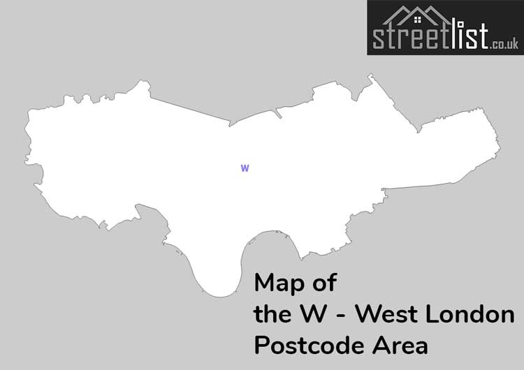
Map of the W Postcode for West London
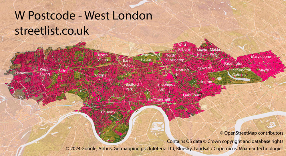
The W postcode area represents a group of postal districts in the West London area of the United Kingdom. The area code W stands for the letters w in West London. W has a population of 533,706 and covers an area of 57,746 hectares. Fun fact: 0.82% of the population of Great Britain lives in this area.
The postcode area falls within the following counties: Greater London (100.00%).
Post Towns and Postcode Districts for the W Postcode
-
W1A W1B Greater LondonW1C Greater LondonW1D Greater LondonW1F Greater LondonW1G Greater LondonW1H Greater LondonW1J Greater LondonW1K Greater LondonW1S Greater LondonW1T Greater LondonW1U Greater LondonW1W Greater LondonW2 Greater LondonW3 Greater LondonW4 Greater LondonW5 Greater LondonW6 Greater LondonW7 Greater LondonW8 Greater LondonW9 Greater LondonW10 Greater LondonW11 Greater LondonW12 Greater LondonW13 Greater LondonW14 Greater London
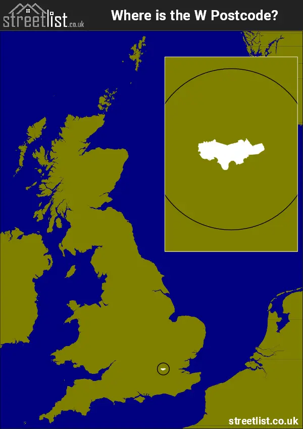
Where is the W Postcode Area?
Unknown area The postal area borders the following neighbouring postal areas: HA - Harrow, SW - London - SW, WC - London - WC, NW - London - NW, UB - Uxbridge and TW - Twickenham, It also borders The Tidal Thames,
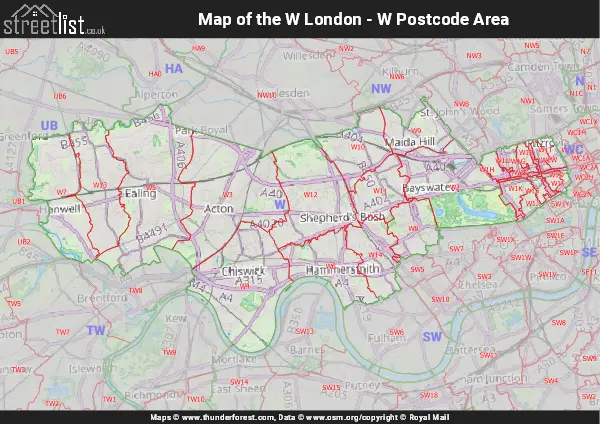
Map of the W West London Postcode Area
Explore the W West London postcode area by using our interactive map.
Postcode Districts within the W West London Postcode Area
There are 25 postcode districts within the West London postcode area
A map showing the boundary of in relation to other areas
| Unit | Area² |
|---|---|
| Hectares | 57,746² |
| Miles | 223² |
| Feet | 6,215,721,694² |
| Kilometres | 577² |
Postal Delivery Offices serving the W West London Postcode Area
- Acton S Delivery Office
- Chiswick S Delivery Office
- Ealing S Delivery Office
- Hammersmith S Delivery Office
- Hanwell S Delivery Office
- Kensington S Delivery Office
- Maida Hill S Delivery Office
- North Kensington S Delivery Office
- Notting Hill S Delivery Office
- Paddington S Delivery Office
- Shepherds Bush S Delivery Office
- W Delivery Office
- West Ealing S Delivery Office
- West Kensington S Delivery Office
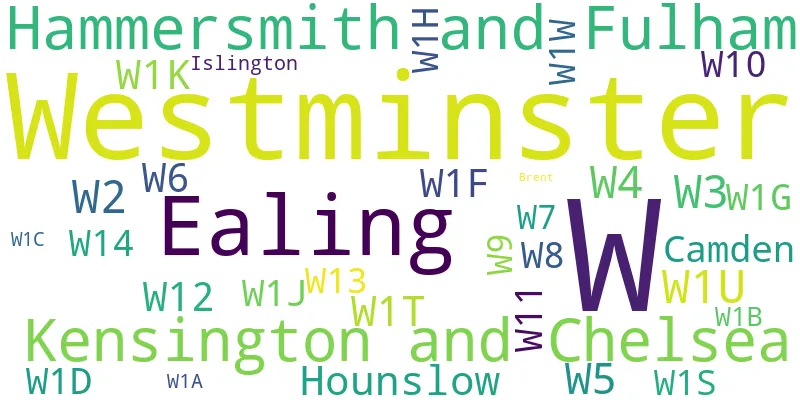
Councils with Postcodes in W
Towns and Villages within the W West London Postcode Area
- Acton - Urban Area
- Alperton - Urban Area
- Bayswater - Urban Area
- Brentford - Urban Area
- China Town - Urban Area
- Chiswick - Urban Area
- Ealing - Urban Area
- Fitzrovia - Urban Area
- Fulham - Urban Area
- Green Park - Urban Area
- Greenford - Urban Area
- Hammersmith - Urban Area
- Hanwell - Urban Area
- Hyde Park - Urban Area
- Hyde Park Corner - Urban Area
- Kensal Green - Urban Area
- Kensal Town - Urban Area
- Kensington - Urban Area
- Kensington Gardens - Urban Area
- Kew - Urban Area
- Kilburn - Urban Area
- Leicester Square - Urban Area
- Little Venice - Urban Area
- Maida Hill - Urban Area
- Maida Vale - Urban Area
- Marylebone - Urban Area
- Mayfair - Urban Area
- Mortlake - Urban Area
- North Kensington - Urban Area
- Norwood Green - Urban Area
- Notting Hill - Urban Area
- Paddington - Urban Area
- Perivale - Urban Area
- Regents Park - Urban Area
- Shepherds Bush - Urban Area
- Soho - Urban Area
- Southall - Urban Area
- St Giles - Urban Area
- St James - Urban Area
- St Johns Wood - Urban Area
- West Ealing - Urban Area
- White City - Urban Area
- Willesden - Urban Area