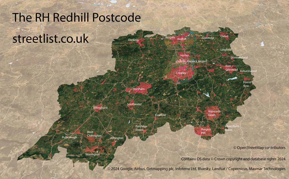
This section of the site is all about the RH Postcode area, also known as the Redhill Postal Area. Explore links to the next level to learn more about specific postcode districts such as RH1.
Map of RH Redhill Postcode/p>
The RH postcode area represents a group of postal districts in the Redhill area of the United Kingdom. The area code RH stands for the letters r and h in RedHill. RH has a population of 532,536 and covers an area of 1,380,227 hectares. Fun fact: 0.82% of the population of Great Britain lives in this area.
The postcode area falls within the following counties: West Sussex (64.79%), Surrey (33.60%), East Sussex (1.61%).
Post Towns and Postcode Districts for the RH Postcode
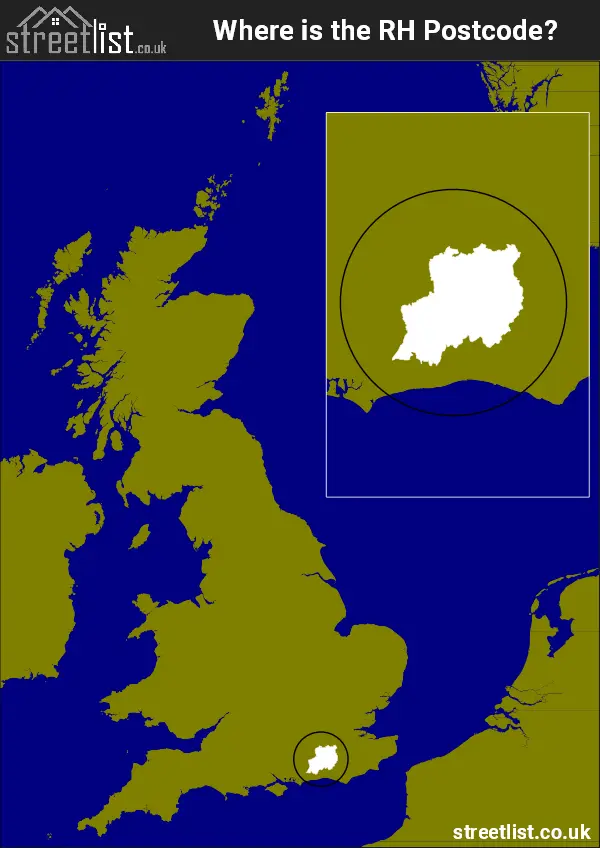
Where is the RH Postcode Area?
The RH Redhill Postcode is in the South East of England. The postal area borders the following neighbouring postal areas: CR - Croydon, GU - Guildford, KT - Kingston upon Thames, BN - Brighton and TN - Tonbridge, and is located inland.
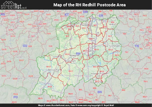
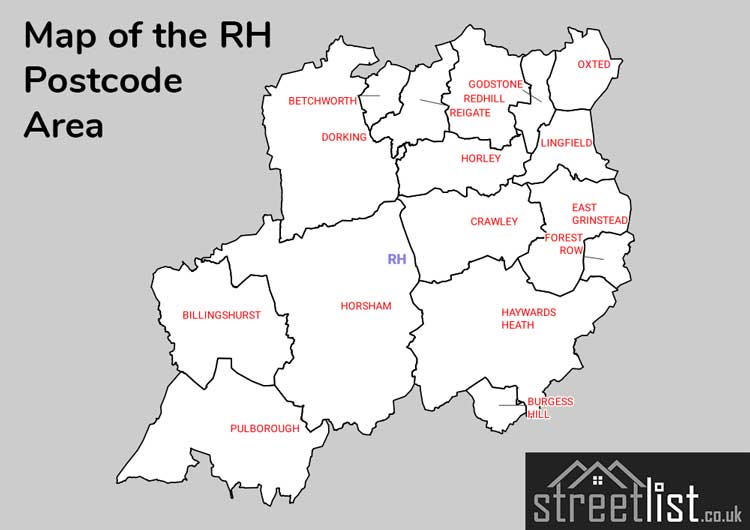
Map of the RH Redhill Postcode Area
Explore the RH Redhill postcode area by using our interactive map.
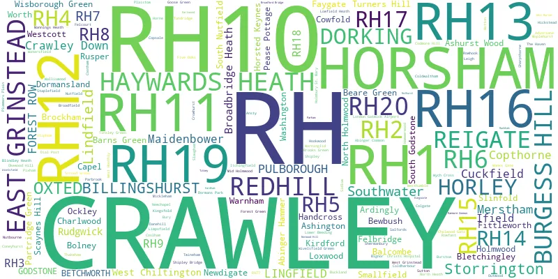
Postcode Districts within the RH Redhill Postcode Area
There are 20 postcode districts within the Redhill postcode area
A map showing the boundary of in relation to other areas
There are 11 towns within the Redhill postcode area.
| Unit | Area² |
|---|---|
| Hectares | 1,380,227² |
| Miles | 5,329² |
| Feet | 148,566,254,053² |
| Kilometres | 13,802² |
Postal Delivery Offices serving the RH Redhill Postcode Area
- Billingshurst Delivery Office
- Burgess Hill Delivery Office
- Crawley Delivery Office
- Dorking Delivery Office
- East Grinstead Delivery Office
- Haywards Heath Delivery Office
- Horley Delivery Office
- Horsham Delivery Office
- Lingfield Delivery Office
- Oxted Delivery Office
- Pulborough Delivery Office
- Redhill Delivery Office
- Reigate Delivery Office
- Storrington Delivery Office
Councils with Postcodes in RH
Towns and Villages within the RH Redhill Postcode Area
- Abinger Common - village
- Abinger Hammer - village
- Adversane - village
- Alfold Bars - village
- Anglefield Corner - village
- Ansty - village
- Ardingly - village
- Ashington - village
- Ashurst Wood - village
- Balcombe - village
- Barns Green - village
- Beare Green - village
- Betchworth - village
- Billingshurst - village
- Bletchingley - village
- Blindley Heath - village
- Bolney - village
- Broadbridge Heath - village
- Brockham - village
- Brooks Green - village
- Buckland - village
- Bunce Common - village
- Burgess Hill - town
- Burstow - village
- Bury - village
- Capel - village
- Caterham - Urban Area
- Charlwood - village
- Chelwood Common - village
- Chelwood Gate - village
- Church Town - village
- Codmore Hill - village
- Coldharbour - village
- Coldwaltham - village
- Colgate - village
- Coolham - village
- Cootham - village
- Copthorne - village
- Cowfold - village
- Crabtree - village
- Crawley - town
- Crawley Down - village
- Crosspost - village
- Cuckfield - town
- Cudworth - village
- Danehill - village
- Dial Post - village
- Domewood - village
- Dorking - town
- Dormans Park - village
- Dragon's Green - village
- Durfold Wood - village
- East Grinstead - town
- Ellen's Green - village
- Faygate - village
- Felbridge - village
- Felcourt - village
- Fernhill - village
- Fittleworth - village
- Five Oaks - village
- Forest Green - village
- Forest Row - village
- Furnace Wood - village
- Gatton - village
- Godstone - village
- Hammerwood - village
- Handcross - village
- Haywards Heath - town
- Hickstead - otherSettlement
- Holmbury St Mary - village
- Holmwood Corner - village
- Hookwood - village
- Hooley - village
- Horley - town
- Horsham - town
- Horsted Keynes - village
- Ifold - village
- Itchingfield - village
- Keeper's Corner - village
- Kingsfold - village
- Kirdford - village
- Leigh - village
- Limpsfield - village
- Lingfield - village
- Lingfield Common - village
- Littleworth - village
- Lower Beeding - village
- Lowfield Heath - otherSettlement
- Loxwood - village
- Mannings Heath - village
- Maplehurst - village
- Marehill - village
- Merstham - village
- Mickleham - village
- Mid Holmwood - village
- Monk's Gate - village
- Newchapel - village
- Newdigate - village
- Newpound Common - village
- Nutbourne - village
- Nutfield - village
- Ockley - village
- Okewood Hill - village
- Outwood - village
- Oxted - town
- Pains-Hill - village
- Parkgate - village
- Partridge Green - village
- Pease Pottage - village
- Pitland Street - village
- Plaistow - village
- Plummers Plain - village
- Pulborough - village
- Redhill - town
- Reigate - town
- Rock - village
- Rudgwick - village
- Rusper - village
- Salfords - village
- Scayne's Hill - village
- Sharpthorne - village
- Shermanbury - village
- Shipley - village
- Shipley Bridge - village
- Skimmington - village
- Slinfold - village
- Smallfield - village
- South Godstone - village
- South Holmwood - village
- South Merstham - village
- South Nutfield - village
- Southwater - village
- Staplefield - village
- Stopham - village
- Storrington - village
- Strood Green - village
- Sutton - village
- Sutton Abinger - village
- Tandridge - village
- Thakeham - village
- The Chart - village
- Tinsley Green - village
- Tisman's Common - village
- Tower Hill - village
- Turners Hill - village
- Tyler's Green - village
- Walliswood - village
- Warnham - village
- Warninglid - village
- Washington - village
- Watersfield - village
- West Chiltington - village
- West Chiltington Common - village
- West Grinstead - village
- West Hoathly - village
- Westcott - village
- Westhumble - village
- Whitewood - village
- Wisborough Green - village
- Wivelsfield - village
- Wivelsfield Green - village
- Worth Abbey - village
- Wotton - village
- Wych Cross - otherSettlement