Given that each sector allows for 400 unique postcode combinations. Letters C, I, K, M, O and V are not allowed in the last two letters of a postcode. With 268 postcodes already in use, this leaves 132 units available.
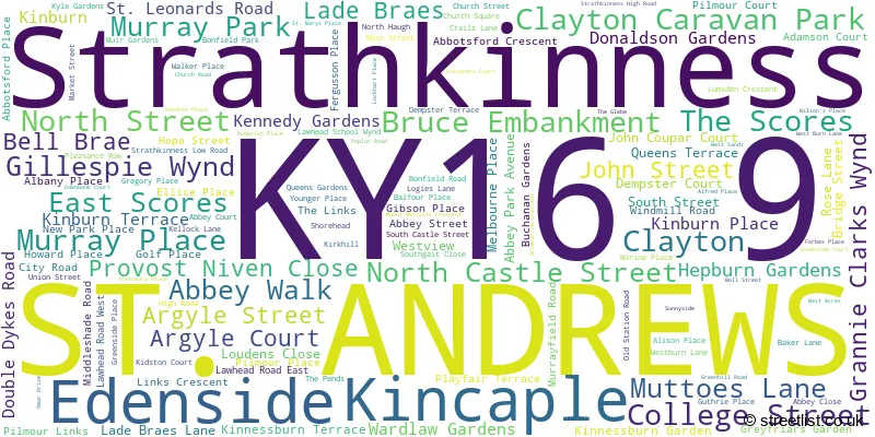
The largest settlement in the KY16 9 postal code is ST. ANDREWS followed by Strathkinness, and Clayton Caravan Park.
The KY16 9 Postcode shares a border with KY15 4 (CUPAR, Dairsie, Kilmany), KY15 5 (CUPAR, Ceres, Springfield), KY16 0 (Leuchars, Guardbridge, Balmullo) and KY16 8 (ST. ANDREWS, Kingsbarns, Boarhills).
The sector is within the post town of ST. ANDREWS.
KY16 9 is a postcode sector within the KY16 postcode district which is within the KY Kirkcaldy postcode area.
The Royal Mail delivery office for the KY16 9 postal sector is the St Andrews Delivery Office.
The area of the KY16 9 postcode sector is 9.96 square miles which is 25.79 square kilometres or 6,371.69 square acres.

Map of the KY16 9 Postcode Sector
Explore the KY16 9 postcode sector by using our free interactive map.
| K | Y | 1 | 6 | - | 9 | X | X |
| K | Y | 1 | 6 | Space | 9 | Letter | Letter |
Official List of Streets
ST. ANDREWS (110 Streets)
Strathkinness (16 Streets)
Clayton Caravan Park (4 Streets)
Unofficial Streets or Alternative Spellings
ST. ANDREWS
KINNESSBURN ROAD PIPELAND ROAD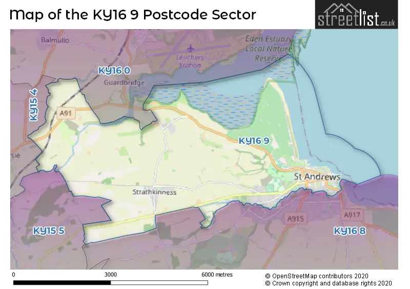
| The KY16 9 Sector is within these Local Authorities | |
|---|---|
| The KY16 9 Sector is within these Counties | |
| The KY16 9 Sector is within these Water Company Areas |