The L10 1 postcode sector is within the county of Merseyside.
Did you know? According to the 2021 Census, the L10 1 postcode sector is home to a bustling 1,748 residents!
Given that each sector allows for 400 unique postcode combinations. Letters C, I, K, M, O and V are not allowed in the last two letters of a postcode. With 27 postcodes already in use, this leaves 373 units available.
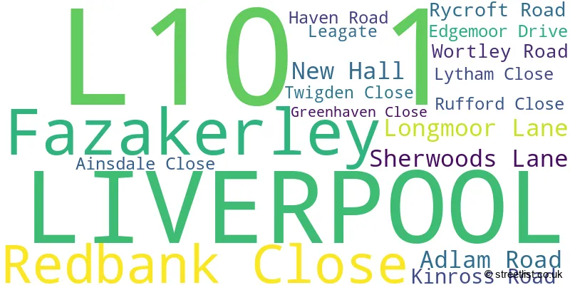
The largest settlements in the L10 1 postal code are LIVERPOOL and Fazakerley.
The L10 1 Postcode shares a border with L10 9 (LIVERPOOL, Fazakerley), L9 7 (LIVERPOOL, Walton), L9 9 (LIVERPOOL, Fazakerley, Walton), L10 0 (LIVERPOOL, Fazakerley, Walton), L10 7 (LIVERPOOL) and L10 8 (LIVERPOOL, Aintree).
The sector is within the post town of LIVERPOOL.
L10 1 is a postcode sector within the L10 postcode district which is within the L Liverpool postcode area.
The Royal Mail delivery office for the L10 1 postal sector is the Walton (l) Delivery Office.
The area of the L10 1 postcode sector is 0.24 square miles which is 0.62 square kilometres or 153.05 square acres.

Map of the L10 1 Postcode Sector
Explore the L10 1 postcode sector by using our free interactive map.
| L | 1 | 0 | - | 1 | X | X |
| L | 1 | 0 | Space | 1 | Letter | Letter |
Official List of Streets
LIVERPOOL (14 Streets)
Fazakerley (2 Streets)
Unofficial Streets or Alternative Spellings
LIVERPOOL
AINTREE LANE DEREHAM CRESCENT LOWER LANE CLOCK TOWER PARK COPPLE HOUSE LANE NEWHALLKirkby
VALLEY ROAD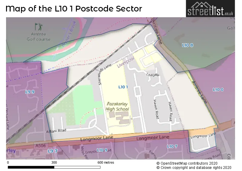
House Prices in the L10 1 Postcode Sector
| Type of Property | 2018 Average | 2018 Sales | 2017 Average | 2017 Sales | 2016 Average | 2016 Sales | 2015 Average | 2015 Sales |
|---|---|---|---|---|---|---|---|---|
| Detached | £239,607 | 18 | £241,275 | 25 | £159,200 | 10 | £162,500 | 1 |
| Semi-Detached | £166,407 | 11 | £149,998 | 19 | £135,800 | 10 | £95,530 | 5 |
| Terraced | £98,238 | 4 | £90,604 | 8 | £82,563 | 8 | £87,100 | 5 |
| Flats | £99,728 | 35 | £0 | 0 | £0 | 0 | £0 | 0 |
Important Postcodes L10 1 in the Postcode Sector
L10 1LW is the postcode for Fazakerley High School, Sherwoods Lane, Bank View High School, Sherwoods Lane, and Redbridge High School, Sherwoods Lane
| The L10 1 Sector is within these Local Authorities |
|
|---|---|
| The L10 1 Sector is within these Counties |
|
| The L10 1 Sector is within these Water Company Areas |
|