This section of the site is all about the L Postcode area, also known as the Liverpool Postal Area. Explore links to the next level to learn more about specific postcode districts such as L1.
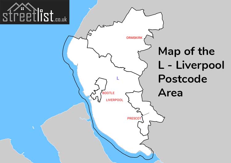
Map of the L Postcode for Livepool

The L postcode area represents a group of postal districts in the Liverpool area of the United Kingdom. The area code L stands for the letters l in Liverpool. L has a population of 857,079 and covers an area of 513,986 hectares. Fun fact: 1.32% of the population of Great Britain lives in this area.
The postcode area falls within the following counties: Merseyside (93.38%), Lancashire (6.39%), Cheshire (0.23%).
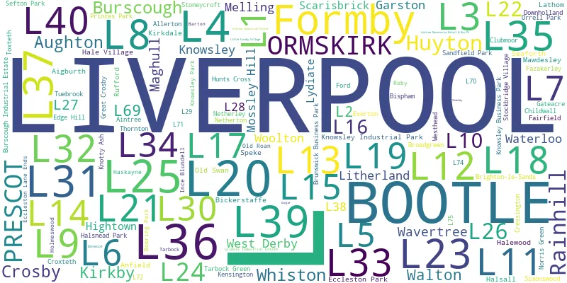
Post Towns and Postcode Districts for the L Postcode
-
L1 MerseysideL2 MerseysideL3 MerseysideL4 MerseysideL5 MerseysideL6 MerseysideL7 MerseysideL8 MerseysideL9 MerseysideL10 MerseysideL11 MerseysideL12 MerseysideL13 MerseysideL14 MerseysideL15 MerseysideL16 MerseysideL17 MerseysideL18 MerseysideL19 MerseysideL20 MerseysideL21 MerseysideL22 MerseysideL23 MerseysideL24 Cheshire (11%), Merseyside (88%)L25 MerseysideL26 MerseysideL27 MerseysideL28 MerseysideL29 MerseysideL31 Lancashire (1%), Merseyside (98%)L32 MerseysideL33 Lancashire (2%), Merseyside (97%)L36 MerseysideL37 Lancashire (1%), Merseyside (98%)L38 MerseysideL67 L68 L69 MerseysideL70 L71 L72 L74 L75
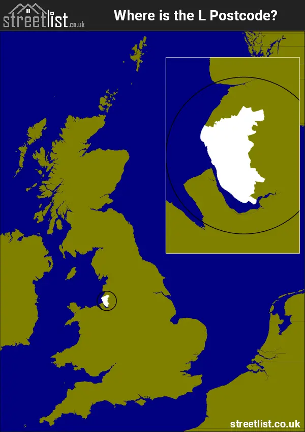
Where is the L Postcode Area?
The Liverpool L Postcode is in the North West of England. The postal area borders the following neighbouring postal areas: PR - Preston, WN - Wigan, CH - Chester and WA - Warrington, It also borders The Irish Sea and The Mersey.
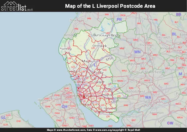
Map of the L Liverpool Postcode Area
Explore the L Liverpool postcode area by using our interactive map.
Postcode Districts within the L Liverpool Postcode Area
There are 41 postcode districts within the Liverpool postcode area
A map showing the boundary of in relation to other areas
There are 10 towns within the Liverpool postcode area.
| Unit | Area² |
|---|---|
| Hectares | 513,986² |
| Miles | 1,985² |
| Feet | 55,324,939,054² |
| Kilometres | 5,140² |
Postal Delivery Offices serving the L Liverpool Postcode Area
- Bootle Delivery Office
- Crosby Delivery Office
- Formby Delivery Office
- Garston Delivery Office
- Huyton Delivery Office
- Kirkby Delivery Office
- Lark Lane Delivery Office
- Liverpool 1-3
- Liverpool 4-5
- Liverpool 6-7
- Liverpool 8
- Maghull Delivery Office
- Mossley Hill Delivery Office
- Ormskirk Delivery Office
- Prescot Delivery Office
- Seaforth Delivery Office
- South Eastern (l) Delivery Office
- Speke Delivery Office
- Walton (l) Delivery Office
- West Derby Delivery Office
- Woolton Delivery Office